Fish Passage Site 20501430
Coordinates (dec. deg.): 61.58418°, -149.74304°
Legal Description: S017N003W12
Region: South Central
Road Name: PARKS HIGHWAY
Datum: NAD83
Quad Name / ITM: Anchorage C-8
AWC Stream #: 247-50-10330-2050-3025
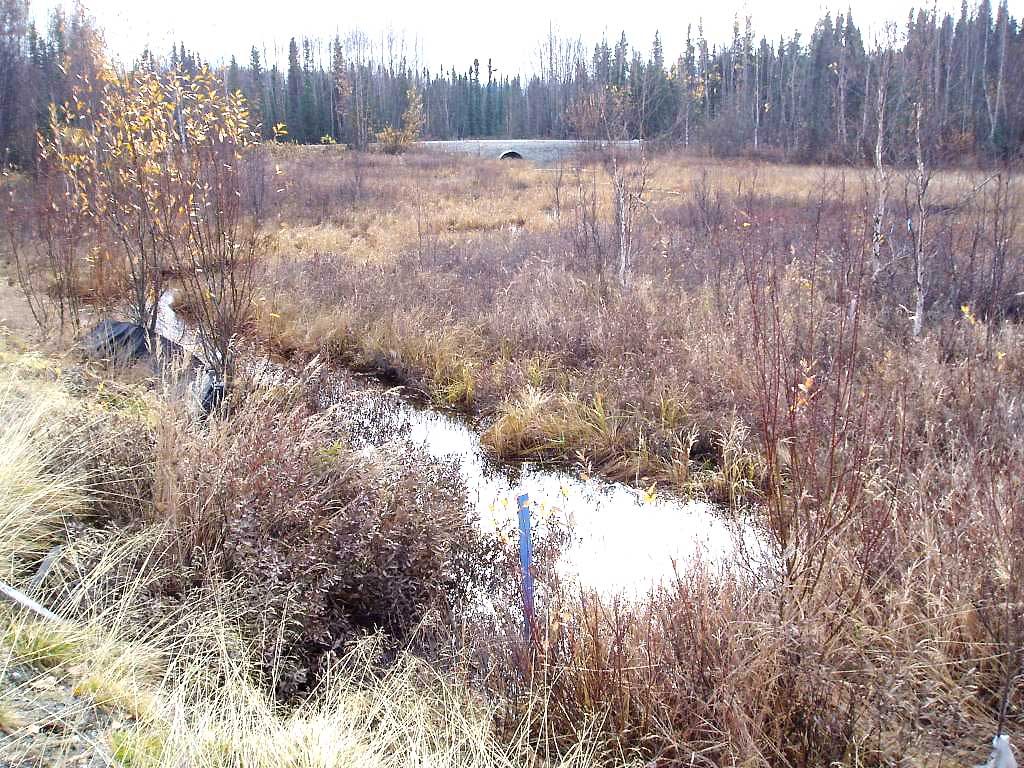
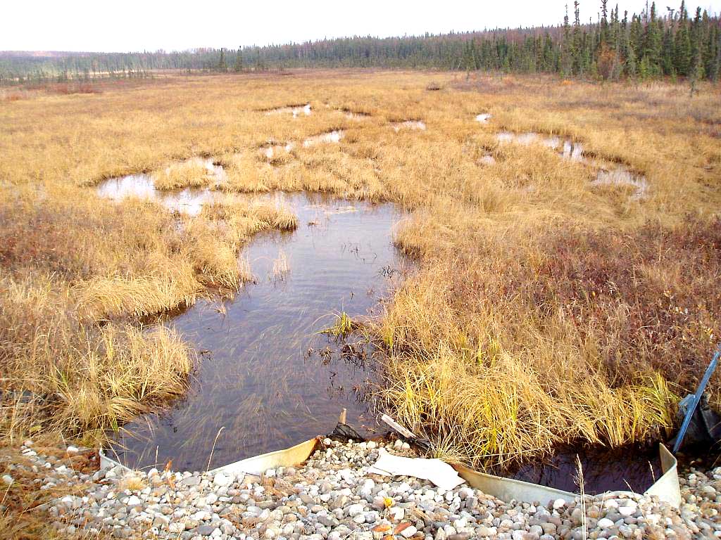
Stream Name: Meadow Creek tributary
Elevation:
Site Comments: None
arrow to the right of the survey date below to choose a different report for this site.
Survey MSB04-ML062
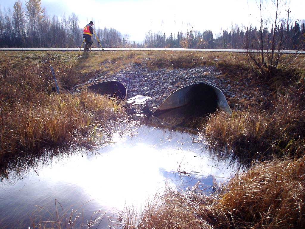
Observers: Gary Greenberg, I S
Overall Fish Passage Rating:
Tidal: No
Backwatered: No
Step Pools:
Construction Year:
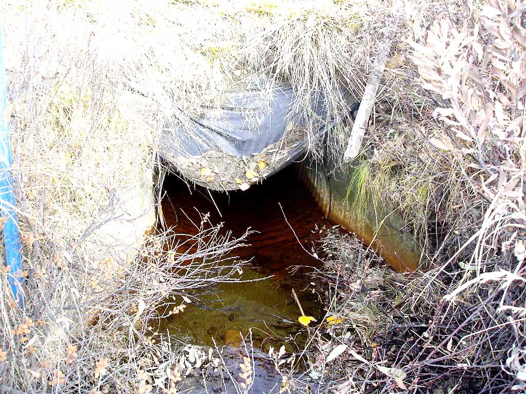
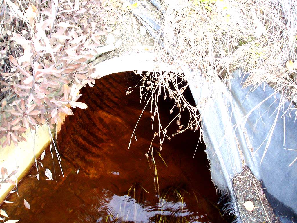
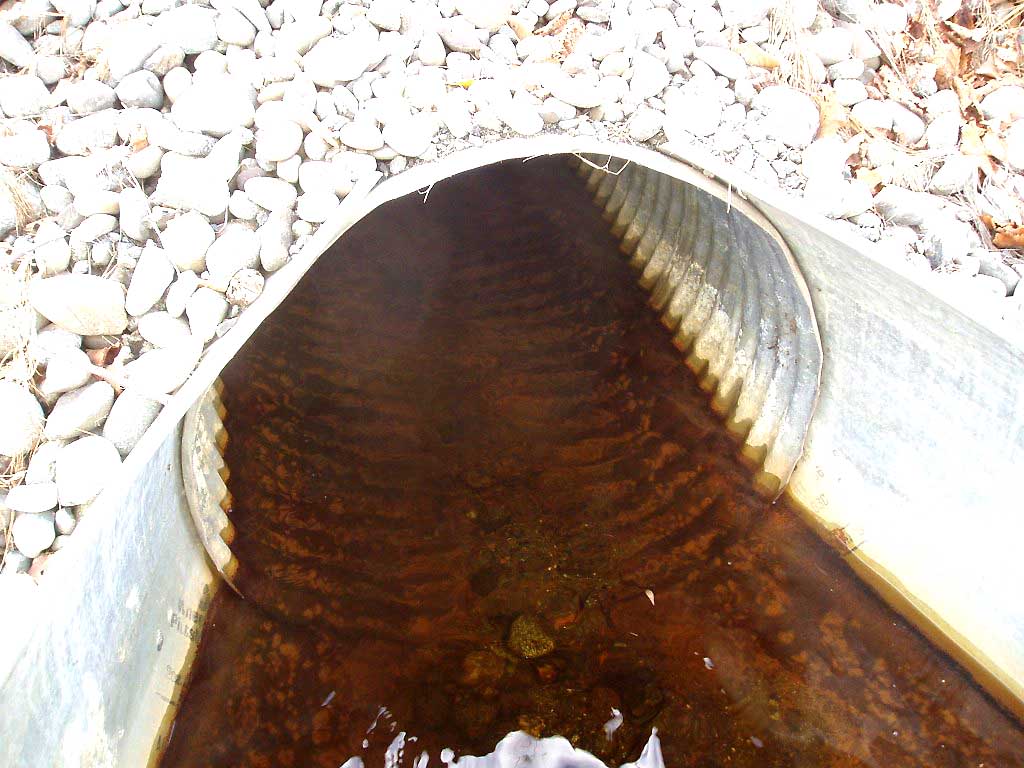
Comments: COHO JUV BELOW OUTLET, NO THALWEG AT OUTLET. ** This site has been resurvyed. This old survey should be used for historical purposes only.**
Culvert Measurements
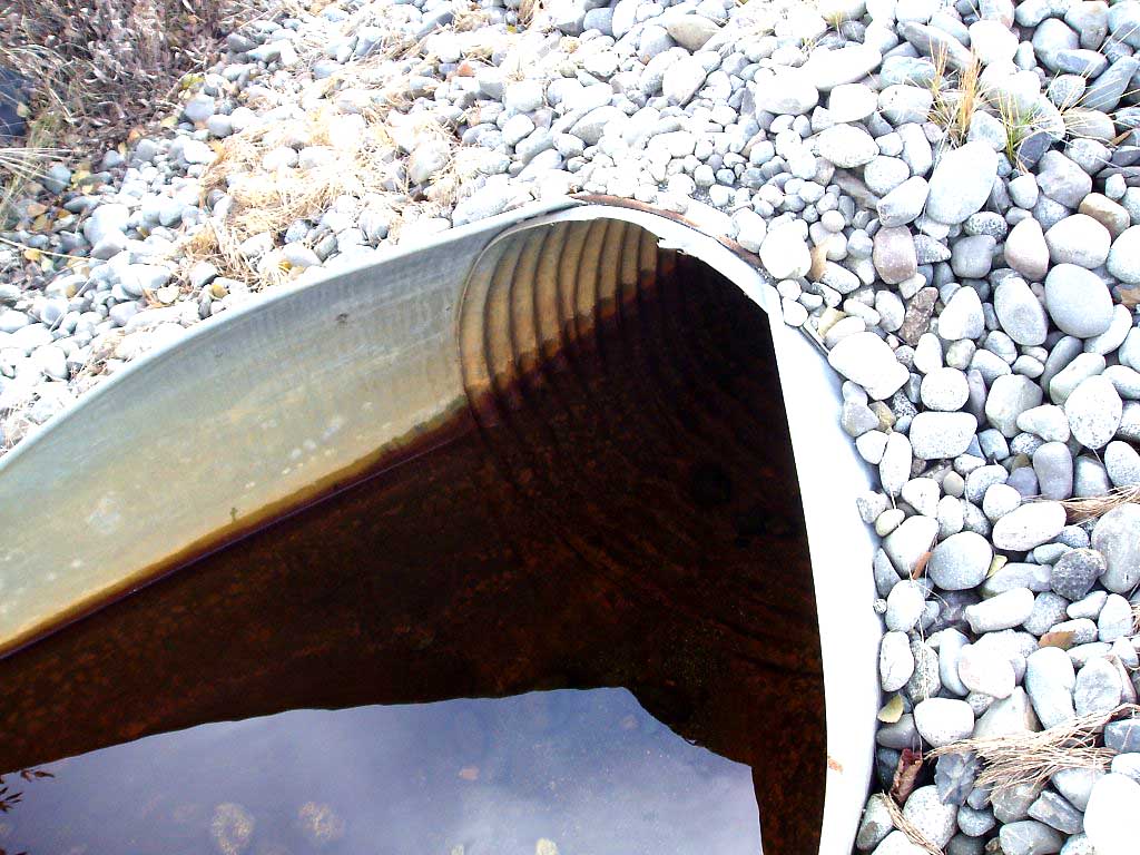
| ID: 1 | Structure Type: Circular pipe (Corrugated Metal) | Fish Passage Rating: | |||||||||||||||||||||||||||||||||||||||||
|
|
|
|||||||||||||||||||||||||||||||||||||||||
| ID: 2 | Structure Type: Circular pipe (Corrugated Metal) | Fish Passage Rating: | |||||||||||||||||||||||||||||||||||||||||
|
|
|
|||||||||||||||||||||||||||||||||||||||||
Stream Measurements
|
|
No stream width data available.
Elevations
| Locator ID | Culvert Number |
River Distance (ft)1 |
Distance From Crossing (ft)2 |
Relative Elevation (ft) |
|---|---|---|---|---|
| OHW Left Bank | 97.77 | |||
| OHW Left Bank | 97.78 | |||
| D/S Tailcrest or 1st Thalweg | 0.00 | 6.0 | 97.35 | |
| Max Pool Depth | 6.00 | 0.0 | 96.49 | |
| D/S Thalweg | 6.00 | 0.0 | 96.49 | |
| Outlet Invert | 1 | 6.00 | 0.0 | 96.49 |
| Outlet Invert | 2 | 6.00 | 0.0 | 96.87 |
| Road Elev | 55.00 | 104.06 | ||
| Inlet Culvert Invert | 2 | 104.00 | 0.0 | 97.00 |
| Inlet Culvert Invert | 1 | 104.00 | 0.0 | 96.73 |
| U/S Thalweg | 1 | 110.00 | 6.0 | 96.12 |
| U/S Thalweg | 2 | 110.00 | 6.0 | 96.27 |
Notes:
- River distance is measured continuously throughout the survey reach along the thalweg of the stream.
- Measured from each end of the crossing along the thalweg of the stream.
Fish Sampling Efforts
| Gear Type: Visual Observation, Ground (A) | ||
| Comments: Coho fry observed below outlet. | ||
Fish Observations
No fish observations occurred during this survey.
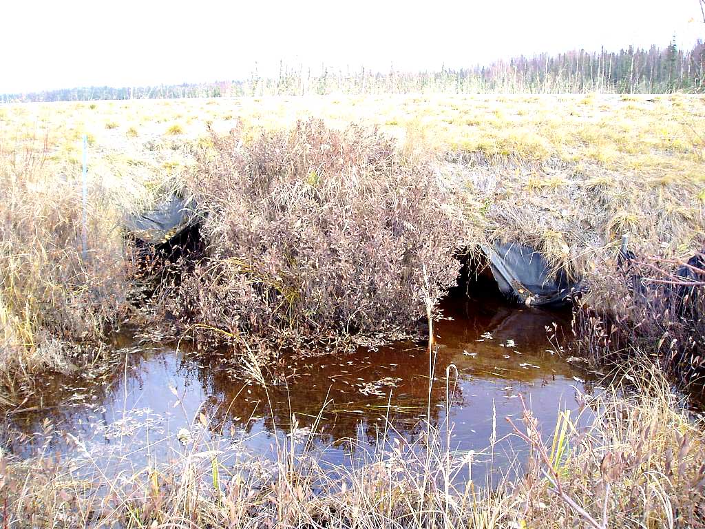
Photos
Questions or comments about this report can be directed to dfg.dsf.webmaster@alaska.gov