Fish Passage Site 20400151
Coordinates (dec. deg.): 61.09417°, -149.79006°
Legal Description: S012N003W27
Region: South Central
Road Name: East 140th Street
Datum: NAD83
Quad Name / ITM: Anchorage A-8
AWC Stream #: 247-60-10320
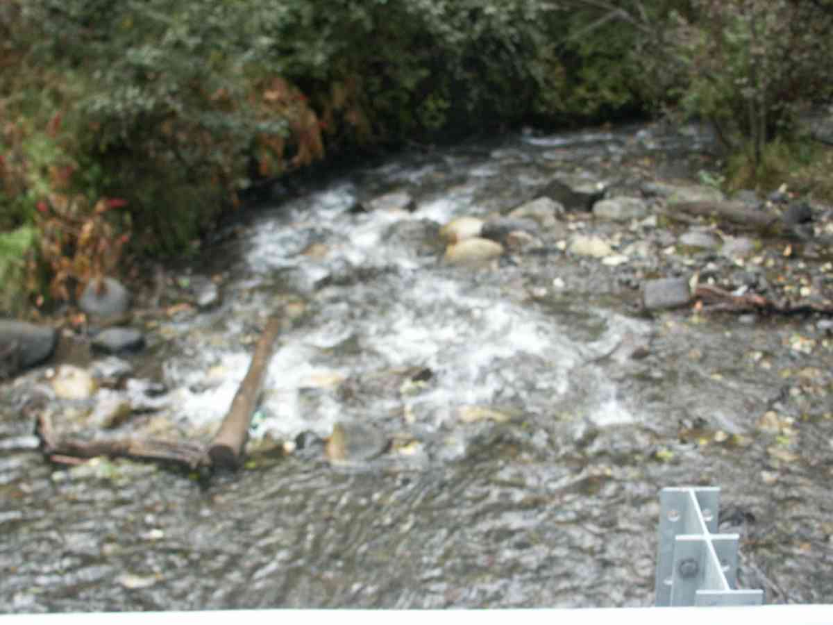
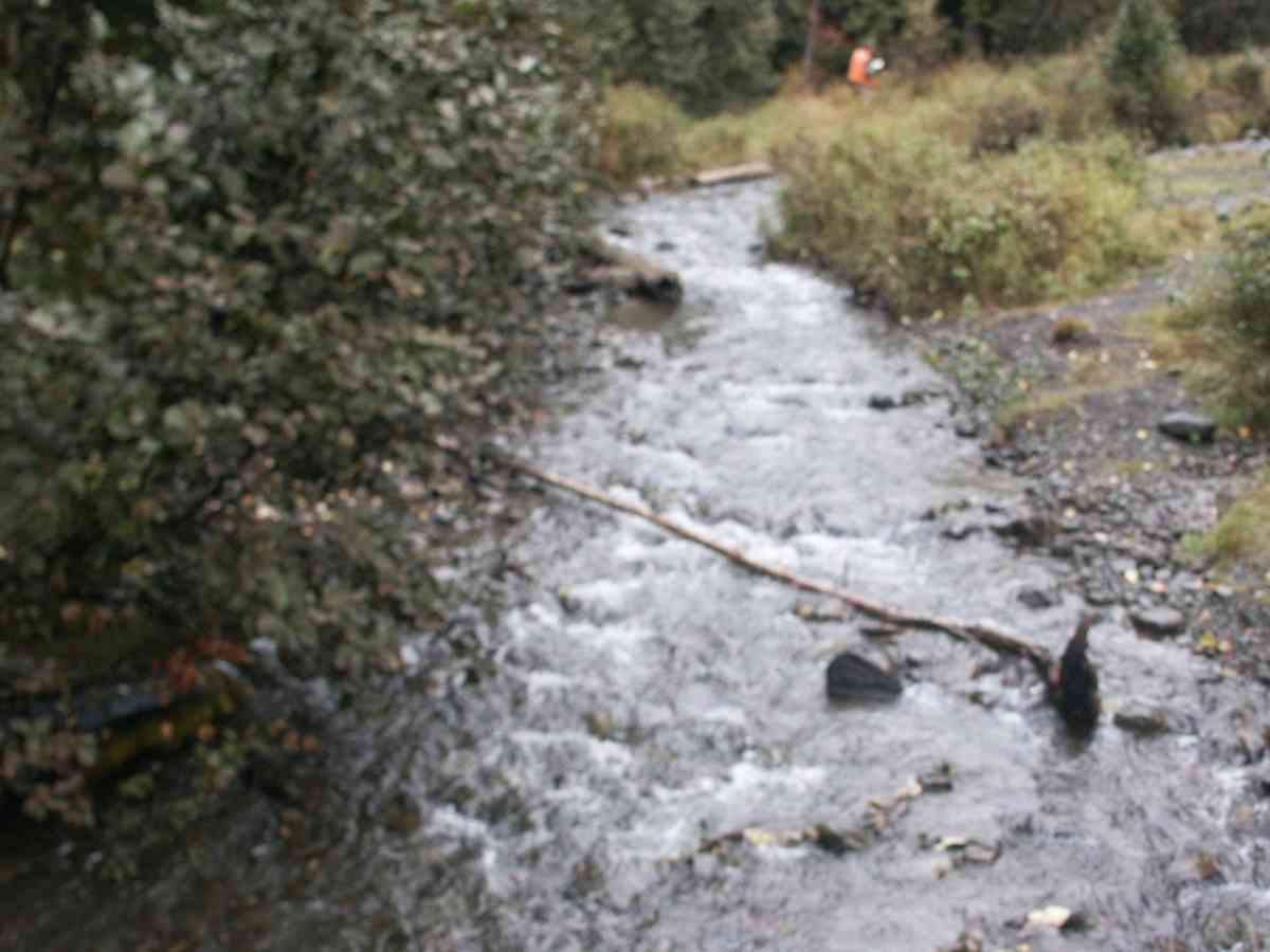
Stream Name: Rabbit Creek
Elevation:
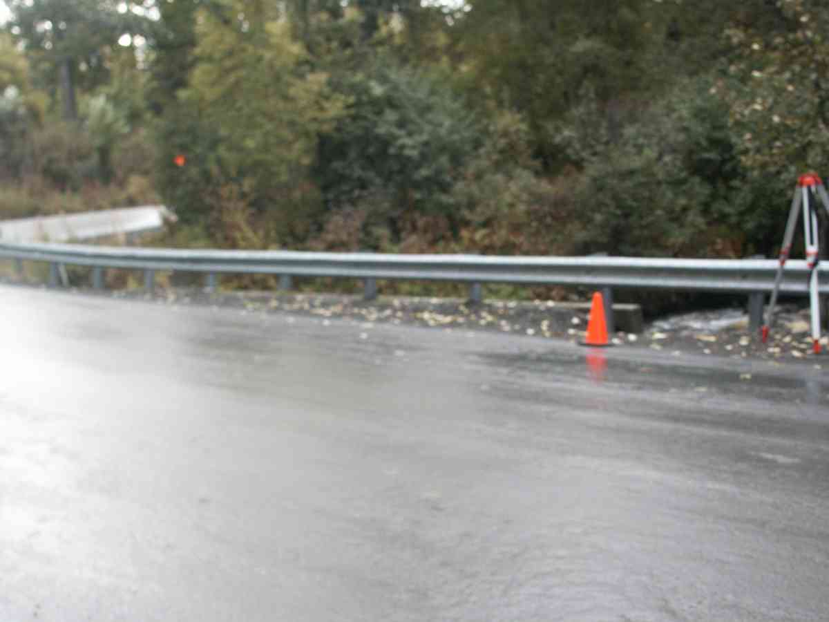
Site Comments: EAST 140TH (CORNER OF BUFFALO. RABBIT CREEK WATERSHED,
Survey ANC04-3A151
Observers: Dean Beers, Vic Stanculescu
Overall Fish Passage Rating:
Tidal: No
Backwatered: No
Step Pools:
Construction Year:
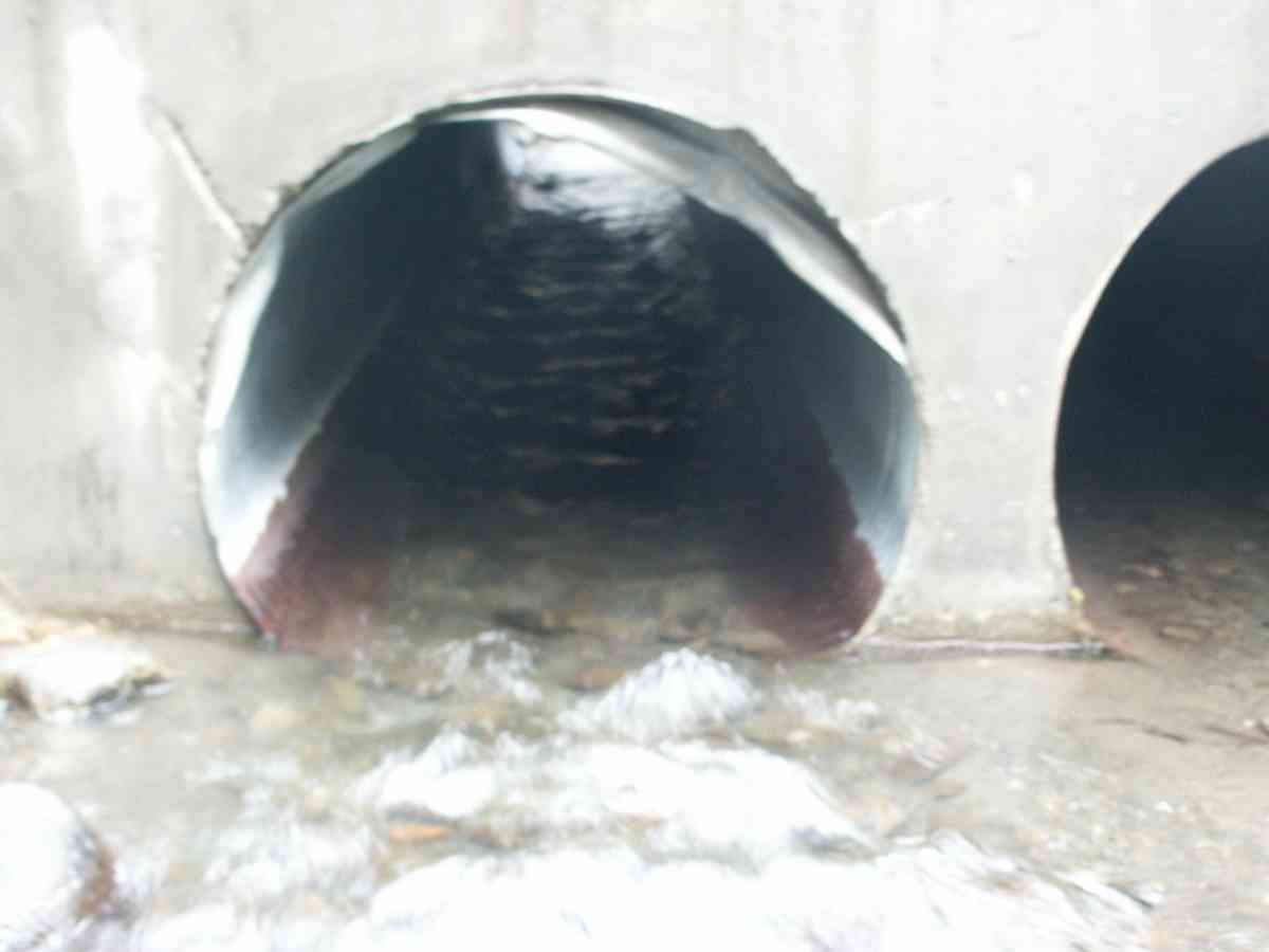
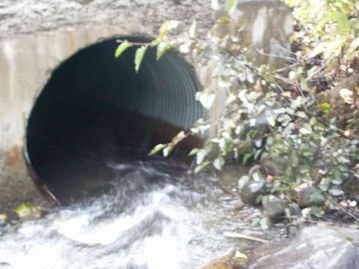
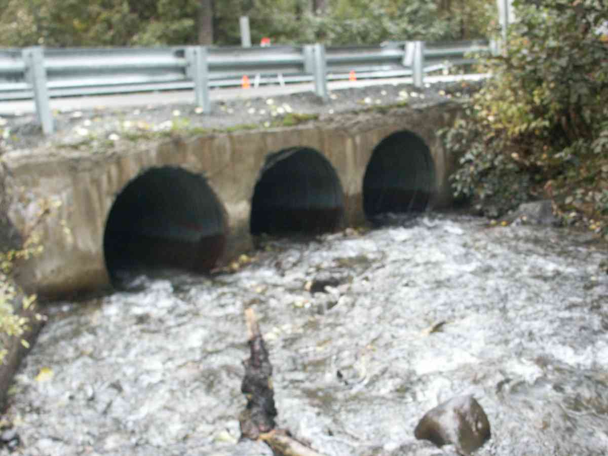
Comments: RABBIT CREEK WATERSHED, ADULT COHO SALMON (SPAWNING PHASE) AND DOLLY VARDEN CHAR PRESENT BELOW CULVERT OUTLET
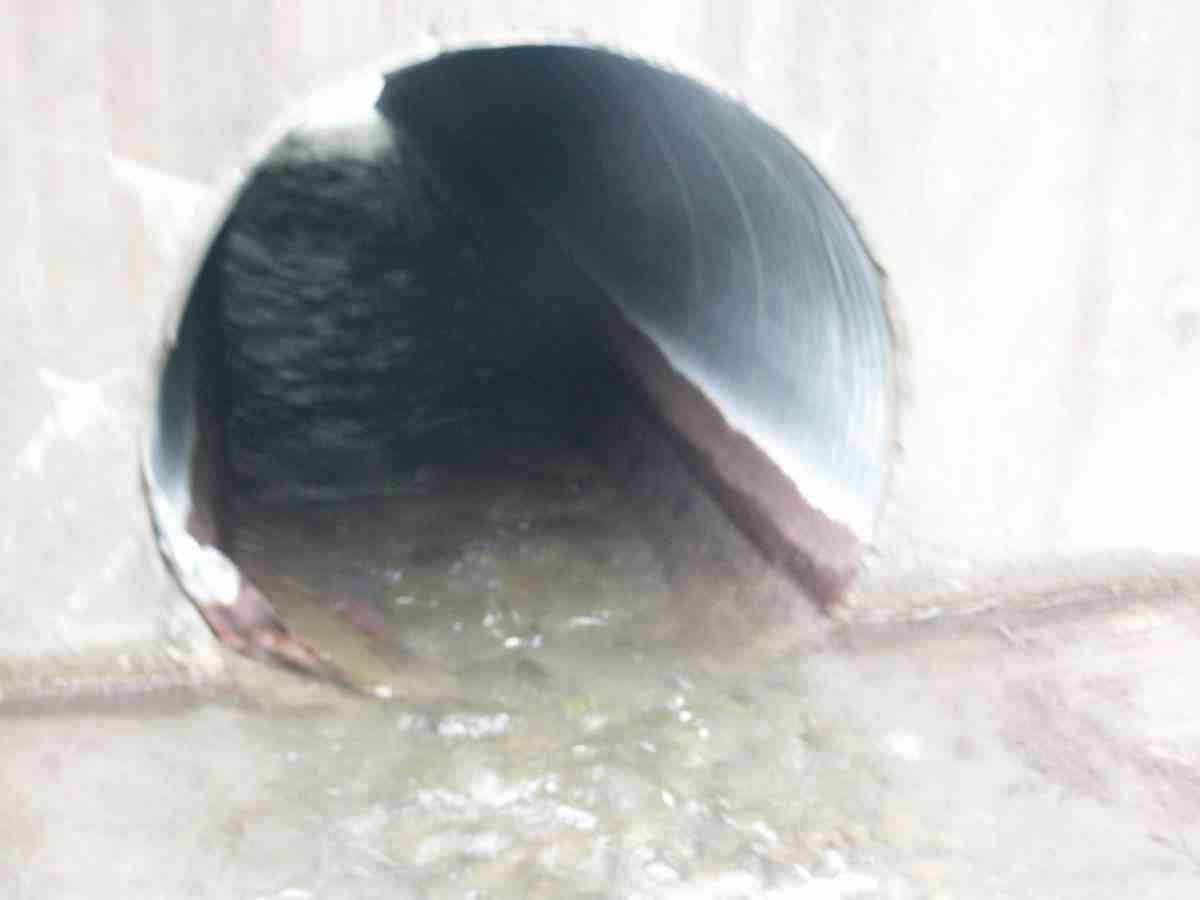
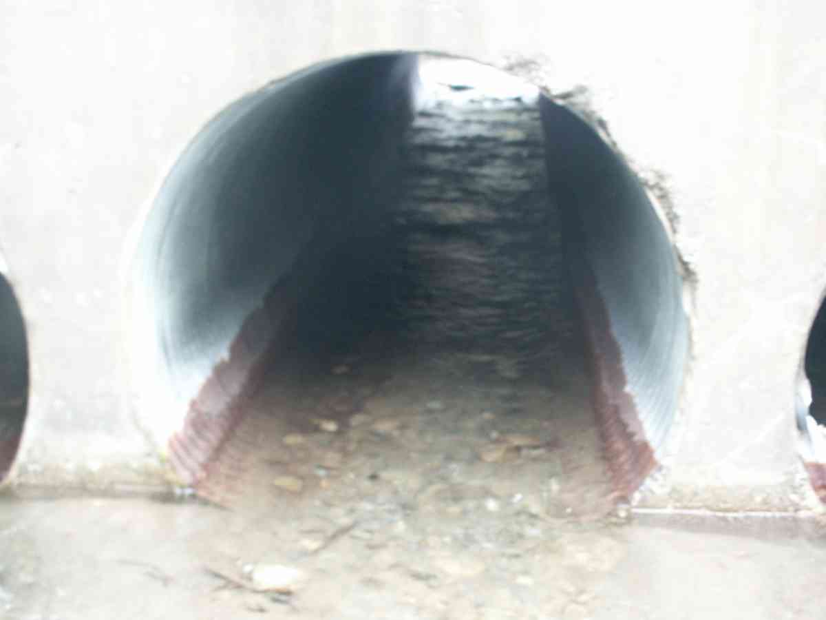
Culvert Measurements
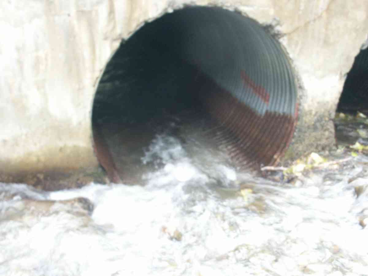
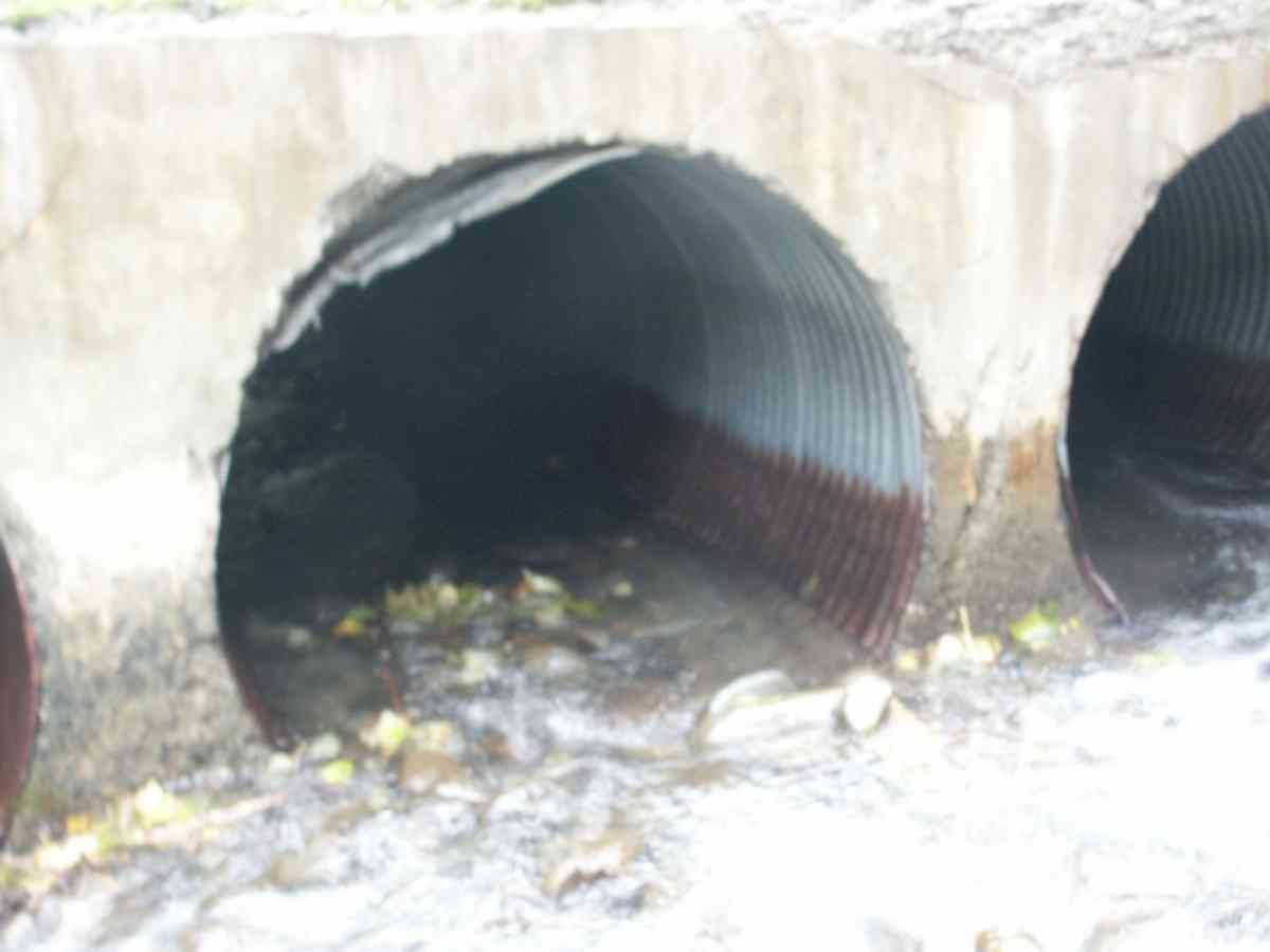
| ID: 1 | Structure Type: Circular pipe (Corrugated Metal) | Fish Passage Rating: | |||||||||||||||||||||||||||||||||||||||||
|
|
|
|||||||||||||||||||||||||||||||||||||||||
| ID: 2 | Structure Type: Circular pipe (Corrugated Metal) | Fish Passage Rating: | |||||||||||||||||||||||||||||||||||||||||
|
|
|
|||||||||||||||||||||||||||||||||||||||||
| ID: 3 | Structure Type: Circular pipe (Corrugated Metal) | Fish Passage Rating: | |||||||||||||||||||||||||||||||||||||||||
|
|
|
|||||||||||||||||||||||||||||||||||||||||
Stream Measurements
|
|
| Stream Width Type | Distance From Crossing (ft) |
Stream Width (ft) |
|---|---|---|
| Upstream bank full | 75.0 | 47.60 |
| Upstream bank full | 100.0 | 66.20 |
| Upstream bank full | 125.0 | 61.50 |
| Upstream bank full | 150.0 | 56.90 |
| Upstream bed width | 75.0 | 25.00 |
| Upstream bed width | 100.0 | 27.10 |
| Upstream bed width | 125.0 | 13.90 |
| Upstream bed width | 150.0 | 20.60 |
| Upstream ordinary high water | 75.0 | 26.10 |
| Upstream ordinary high water | 100.0 | 27.90 |
| Upstream ordinary high water | 125.0 | 15.20 |
| Upstream ordinary high water | 150.0 | 21.90 |
Elevations
| Locator ID | Culvert Number |
River Distance (ft)1 |
Distance From Crossing (ft)2 |
Relative Elevation (ft) |
|---|---|---|---|---|
| D/S Thalweg | 97.87 | |||
| Max Pool Depth | 97.93 | |||
| D/S Tailcrest or 1st Thalweg | 98.02 | |||
| OHW Left Bank | 98.60 | |||
| U/S Thalweg | 3 | 98.99 | ||
| OHW Left Bank | 99.04 | |||
| U/S Thalweg | 2 | 99.16 | ||
| U/S Thalweg | 1 | 99.33 | ||
| Outlet Invert | 1 | 0.00 | 0.0 | 97.61 |
| Outlet Invert | 2 | 0.00 | 0.0 | 97.95 |
| Outlet Invert | 3 | 0.00 | 0.0 | 97.97 |
| Road Elev | 18.00 | 104.03 | ||
| Inlet Culvert Invert | 3 | 36.00 | 0.0 | 98.87 |
| Inlet Culvert Invert | 1 | 36.00 | 0.0 | 98.04 |
| Inlet Culvert Invert | 2 | 36.00 | 0.0 | 98.23 |
Notes:
- River distance is measured continuously throughout the survey reach along the thalweg of the stream.
- Measured from each end of the crossing along the thalweg of the stream.
Fish Sampling Efforts
| Gear Type: Visual Observation, Ground (A) | ||
Fish Observations
No fish observations occurred during this survey.
Photos

Questions or comments about this report can be directed to dfg.dsf.webmaster@alaska.gov