Fish Passage Site 20400069
Coordinates (dec. deg.): 61.30761°, -149.81891°
Legal Description: S014N003W16
Region: South Central
Road Name: Unknown
Datum: NAD83
Quad Name / ITM: Anchorage B-8
AWC Stream #: 247-50-10095
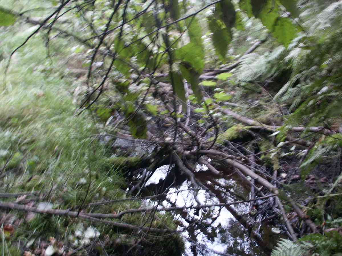
Stream Name: EOD Creek
Elevation:
Site Comments: ELMENDORF AIR FORCE BASE, E.O.D. CREEK WATERSHED,
Survey ANC04-3A069
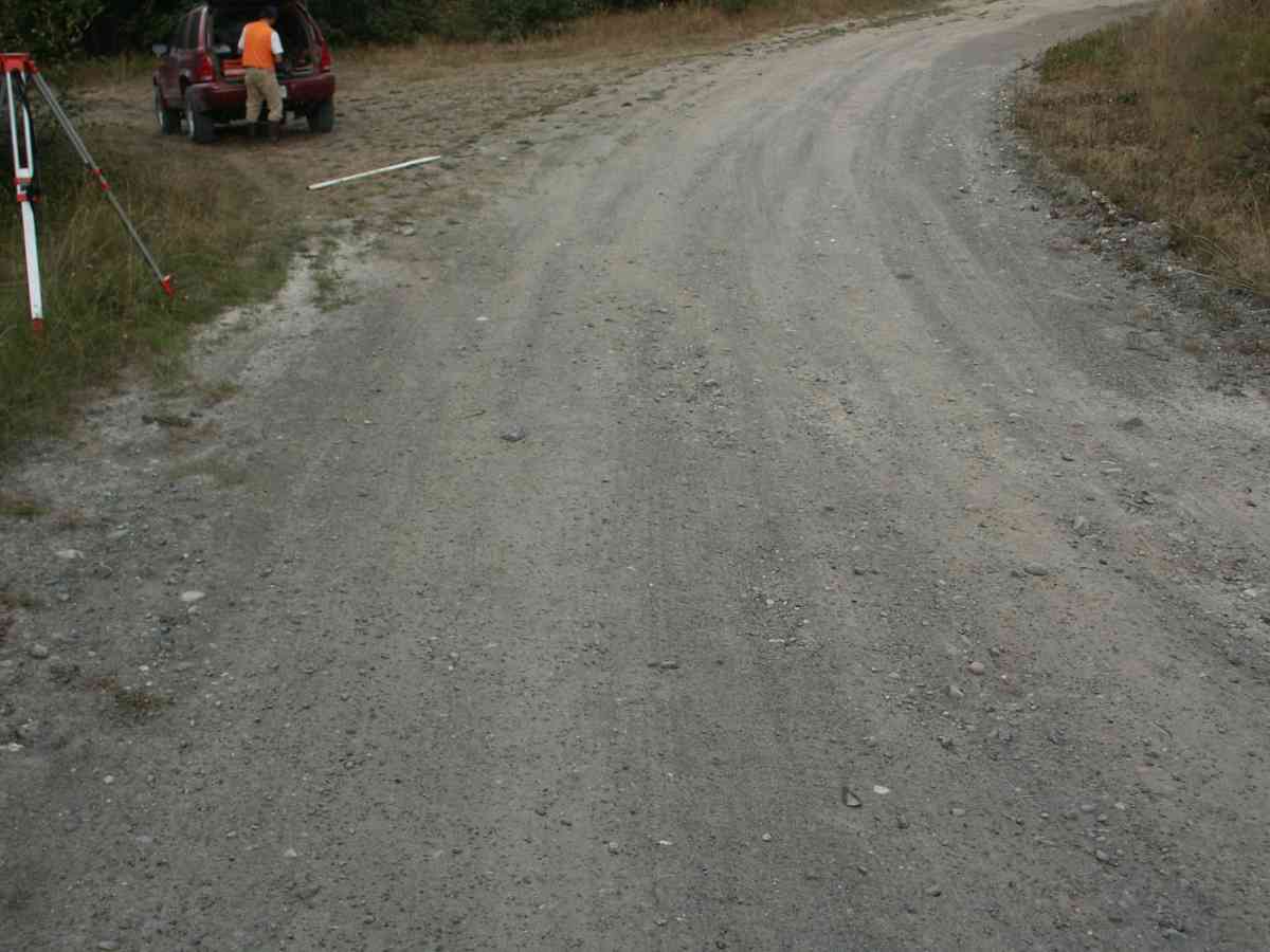
Observers: Dean Beers, Vic Stanculescu
Overall Fish Passage Rating:
Tidal: No
Backwatered: No
Step Pools:
Construction Year:
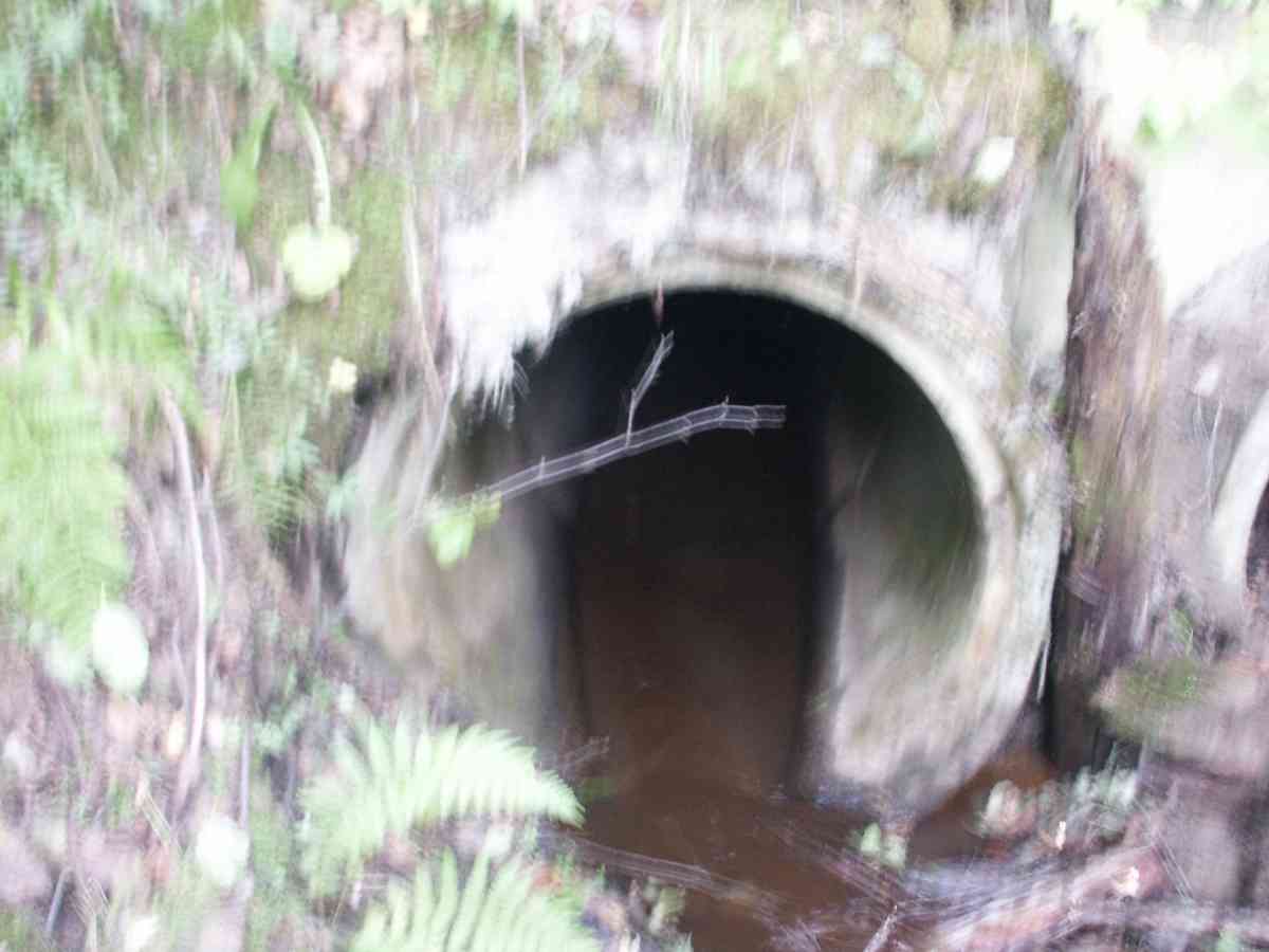
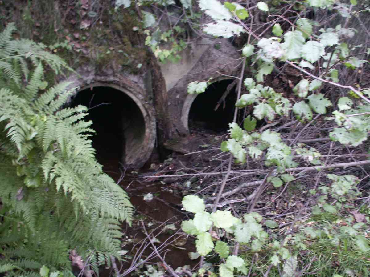
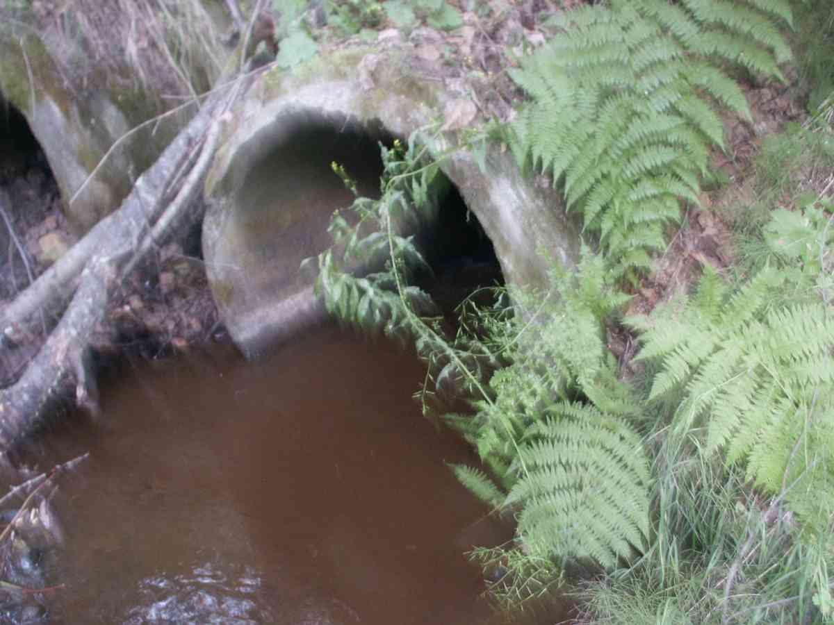
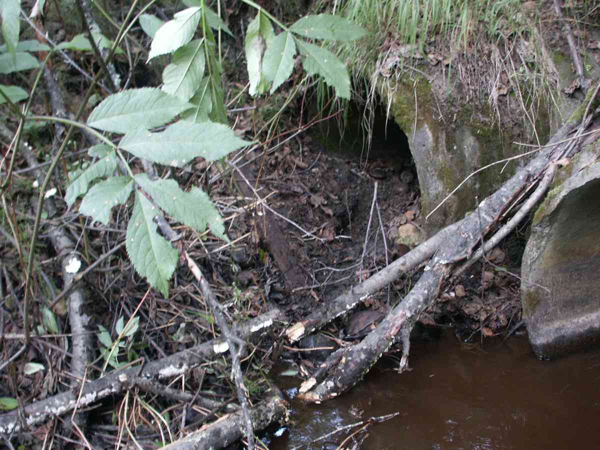
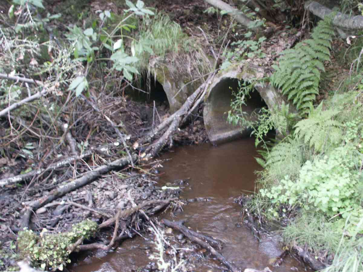
Comments: ELMENDORF AIR FORCE BASE, E.O.D. CREEK WATERSHED, OBSERVED COHO FRY ABOVE INLET, CEMENT CULVERTS WITH NO CORRUGATIONS, RIGHT CULVERT COLLAPSED AT OUTLET.
Culvert Measurements
| ID: 1 | Structure Type: Other (Unknown) | Fish Passage Rating: | |||||||||||||||||||||||||||||||||||||||||
|
|
|
|||||||||||||||||||||||||||||||||||||||||
| ID: 2 | Structure Type: Other (Unknown) | Fish Passage Rating: | |||||||||||||||||||||||||||||||||||||||||
|
|
|
|||||||||||||||||||||||||||||||||||||||||
Stream Measurements
|
|
| Stream Width Type | Distance From Crossing (ft) |
Stream Width (ft) |
|---|---|---|
| Upstream bank full | 75.0 | 14.00 |
| Upstream bank full | 100.0 | 12.00 |
| Upstream bank full | 125.0 | 16.00 |
| Upstream bank full | 150.0 | 14.00 |
| Upstream bed width | 75.0 | 3.00 |
| Upstream bed width | 100.0 | 2.50 |
| Upstream bed width | 125.0 | 3.00 |
| Upstream bed width | 150.0 | 3.50 |
| Upstream ordinary high water | 75.0 | 3.50 |
| Upstream ordinary high water | 100.0 | 2.50 |
| Upstream ordinary high water | 125.0 | 3.00 |
| Upstream ordinary high water | 150.0 | 2.50 |
Elevations
| Locator ID | Culvert Number |
River Distance (ft)1 |
Distance From Crossing (ft)2 |
Relative Elevation (ft) |
|---|---|---|---|---|
| D/S Thalweg | 85.51 | |||
| Max Pool Depth | 85.62 | |||
| D/S Tailcrest or 1st Thalweg | 85.63 | |||
| OHW Left Bank | 85.71 | |||
| OHW Left Bank | 85.76 | |||
| U/S Thalweg | 1 | 87.32 | ||
| U/S Thalweg | 2 | 87.32 | ||
| Outlet Invert | 2 | 0.00 | 0.0 | 85.94 |
| Outlet Invert | 1 | 0.00 | 0.0 | 85.41 |
| Road Elev | 41.50 | 99.90 | ||
| Inlet Culvert Invert | 2 | 83.00 | 0.0 | 87.77 |
| Inlet Culvert Invert | 1 | 83.00 | 0.0 | 87.92 |
Notes:
- River distance is measured continuously throughout the survey reach along the thalweg of the stream.
- Measured from each end of the crossing along the thalweg of the stream.
Fish Sampling Efforts
| Gear Type: Visual Observation, Ground (A) | ||
Fish Observations
No fish observations occurred during this survey.
Photos

Questions or comments about this report can be directed to dfg.dsf.webmaster@alaska.gov