Fish Passage Site 20400049
Coordinates (dec. deg.): 61.22357°, -149.89320°
Legal Description: S013N003W18
Region: South Central
Road Name: Ship Creek Boat Launch
Datum: NAD83
Quad Name / ITM: Anchorage A-8
AWC Stream #: 247-50-10060
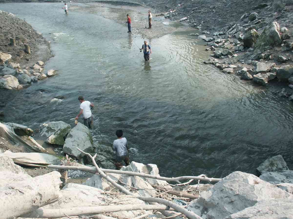
Stream Name: Ship Creek
Elevation:
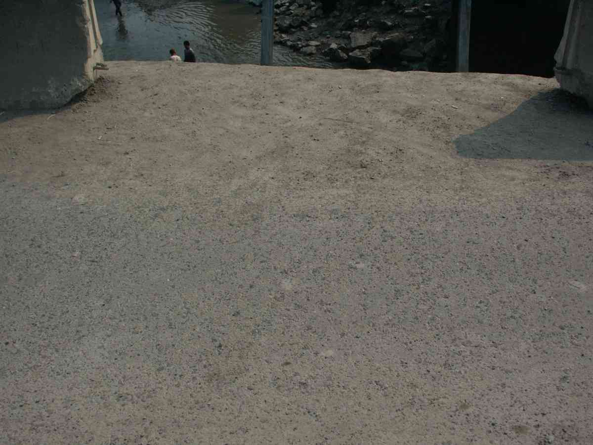
Site Comments: SHIP CREEK WATERSHED
arrow to the right of the survey date below to choose a different report for this site.
Survey ANC04-2A049
Observers: Dean Beers, Vic Stanculescu
Overall Fish Passage Rating:
Tidal: No
Backwatered: No
Step Pools:
Construction Year:
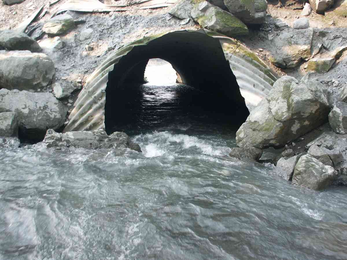
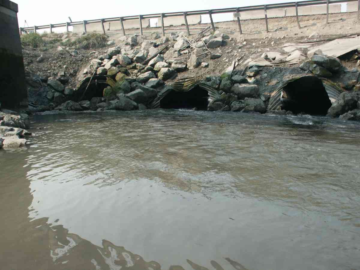
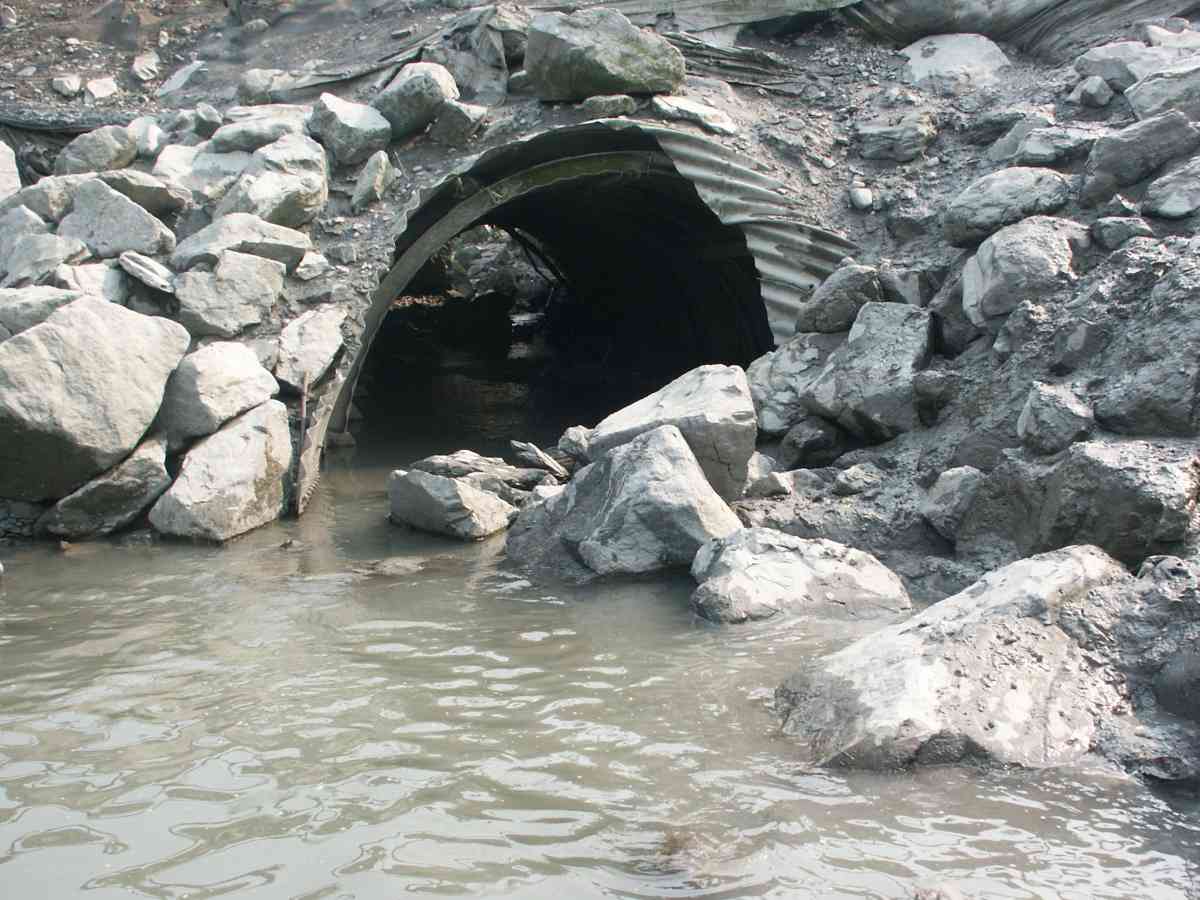
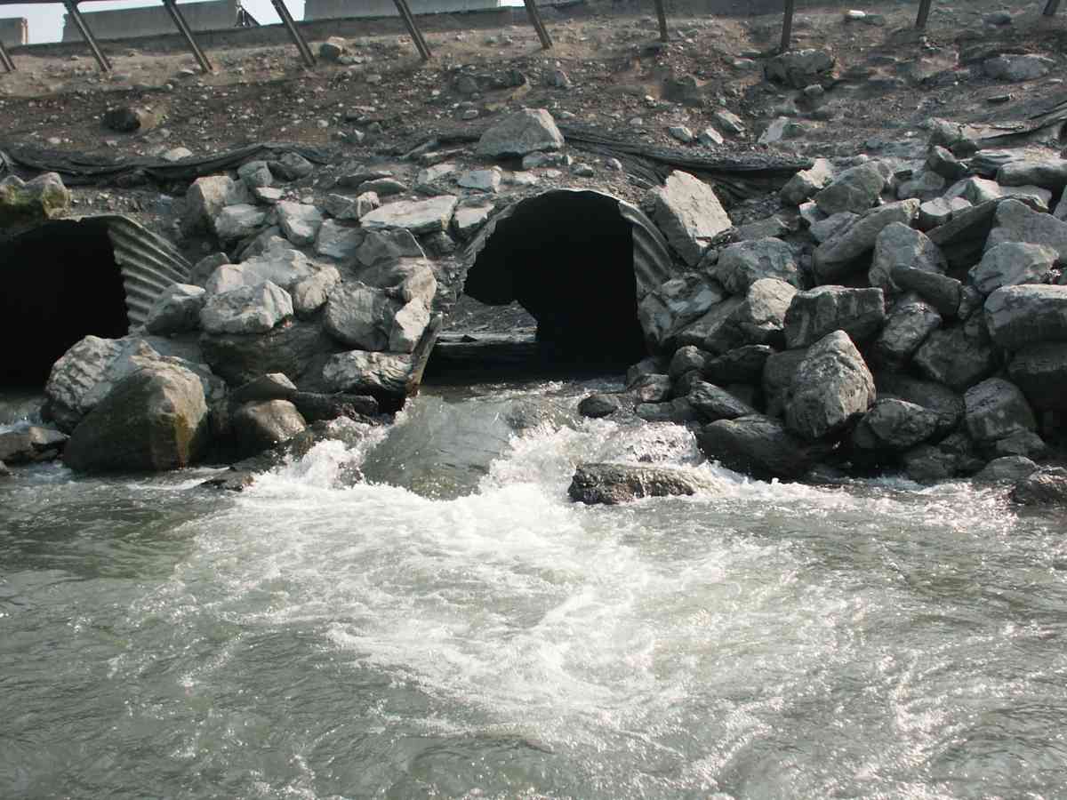
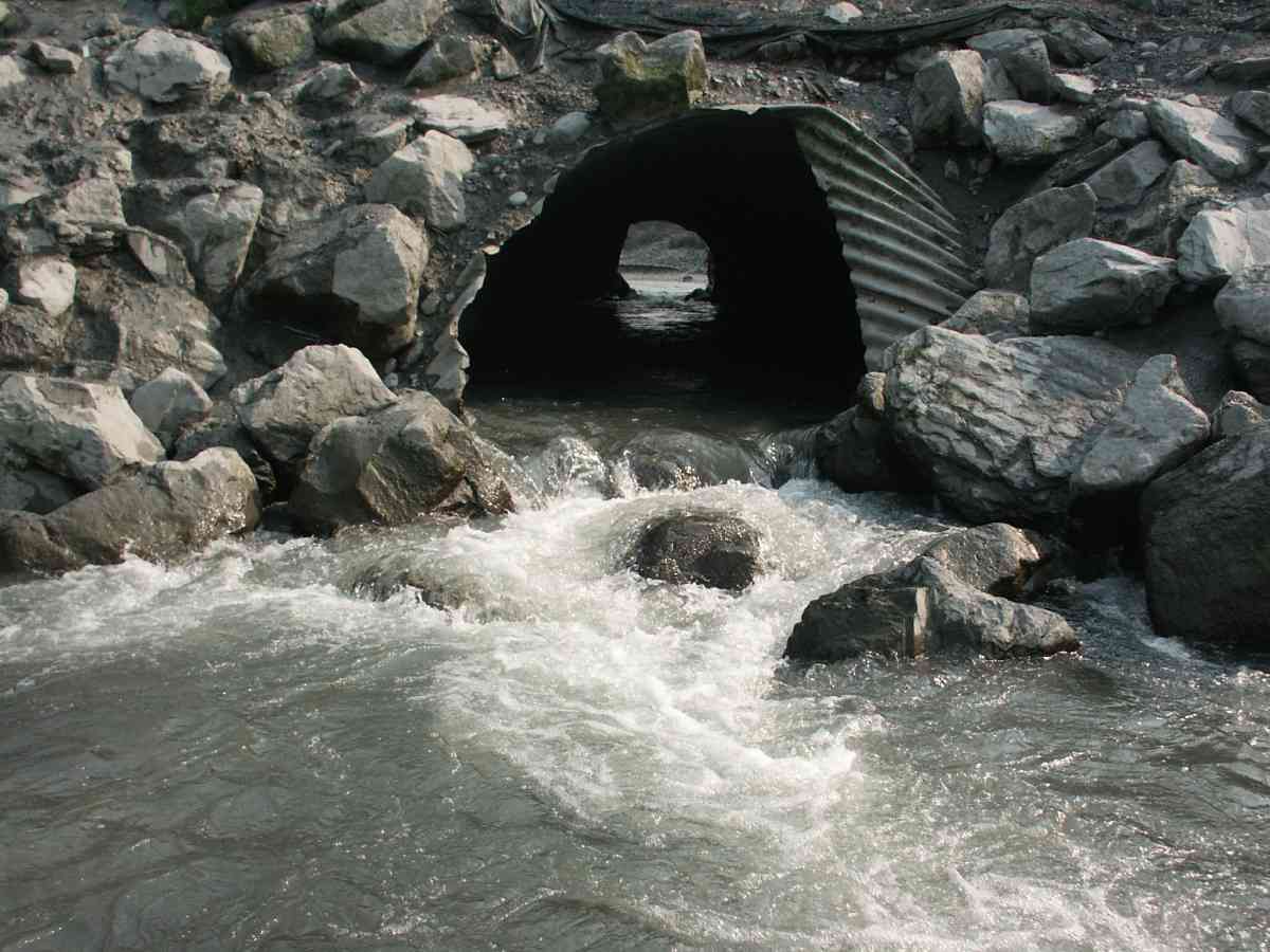
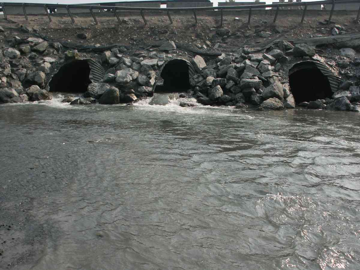
Comments: SHIP CREEK WATERSHED, ADULT COHO SALMON PRESENT UPSTREAM AND DOWNSTREAM OF THE CULVERTS, NO UPSTREAM MEASUREMENTS DUE TO WIDE ERODED BANKS
Culvert Measurements
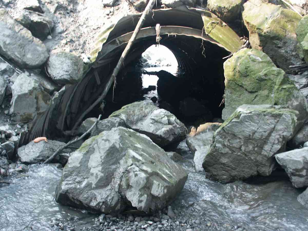
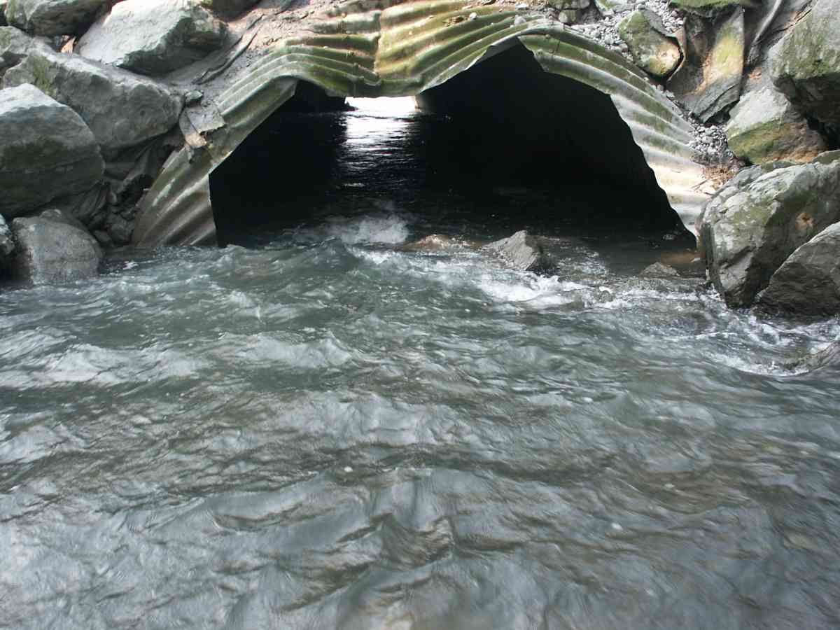
| ID: 1 | Structure Type: Pipe-arch (Corrugated Metal) | Fish Passage Rating: | |||||||||||||||||||||||||||||||||||||||||
|
|
|
|||||||||||||||||||||||||||||||||||||||||
| ID: 2 | Structure Type: Pipe-arch (Corrugated Metal) | Fish Passage Rating: | |||||||||||||||||||||||||||||||||||||||||
|
|
|
|||||||||||||||||||||||||||||||||||||||||
| ID: 3 | Structure Type: Pipe-arch (Corrugated Metal) | Fish Passage Rating: | |||||||||||||||||||||||||||||||||||||||||
|
|
|
|||||||||||||||||||||||||||||||||||||||||
Stream Measurements
|
|
No stream width data available.
Elevations
| Locator ID | Culvert Number |
River Distance (ft)1 |
Distance From Crossing (ft)2 |
Relative Elevation (ft) |
|---|---|---|---|---|
| D/S Thalweg | 73.50 | |||
| Max Pool Depth | 78.86 | |||
| D/S Tailcrest or 1st Thalweg | 79.13 | |||
| OHW Left Bank | 80.80 | |||
| U/S Thalweg | 2 | 82.76 | ||
| U/S Thalweg | 1 | 82.77 | ||
| U/S Thalweg | 3 | 82.92 | ||
| Outlet Invert (TAKEN OFF SUBSTRATE) | 2 | 0.00 | 0.0 | 81.54 |
| Outlet Invert (TAKEN OFF SUBSTRATE) | 1 | 0.00 | 0.0 | 80.18 |
| Outlet Invert (TAKEN OFF SUBSTRATE) | 3 | 0.00 | 0.0 | 80.34 |
| Road Elev | 38.50 | 103.25 | ||
| Inlet Culvert Invert (TAKEN OFF SUBSTRATE) | 1 | 77.00 | 0.0 | 80.71 |
| Inlet Culvert Invert (TAKEN OFF SUBSTRATE) | 3 | 77.00 | 0.0 | 81.64 |
| Inlet Culvert Invert (TAKEN OFF SUBSTRATE) | 2 | 77.00 | 0.0 | 80.84 |
Notes:
- River distance is measured continuously throughout the survey reach along the thalweg of the stream.
- Measured from each end of the crossing along the thalweg of the stream.
Fish Sampling Efforts
| Gear Type: Visual Observation, Ground (A) | ||
Fish Observations
No fish observations occurred during this survey.
Photos
Questions or comments about this report can be directed to dfg.dsf.webmaster@alaska.gov