Fish Passage Site 20400022
Coordinates (dec. deg.): 61.31187°, -149.57526°
Legal Description: S014N002W11
Region: South Central
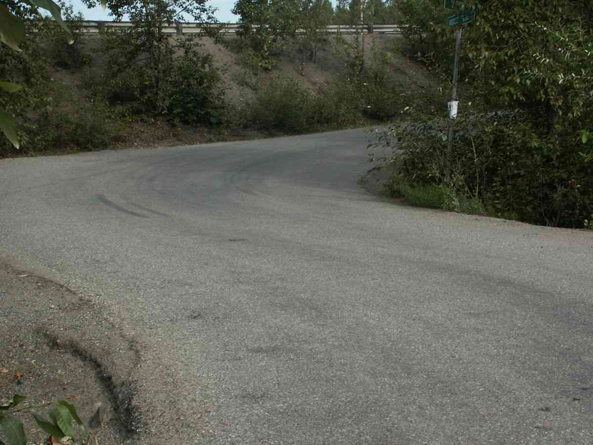
Road Name: Hidden Haven Drive
Datum: NAD83
Quad Name / ITM: Anchorage B-7
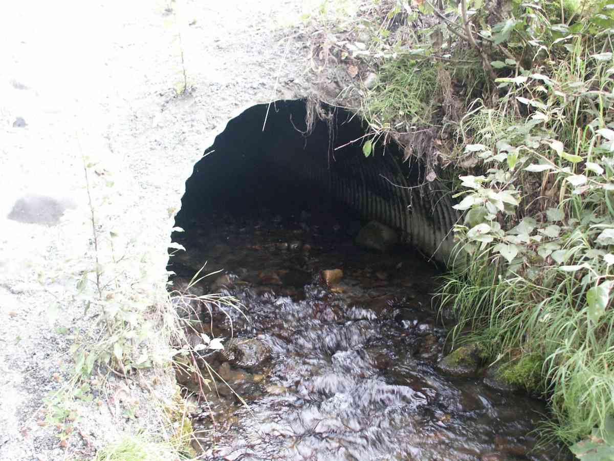
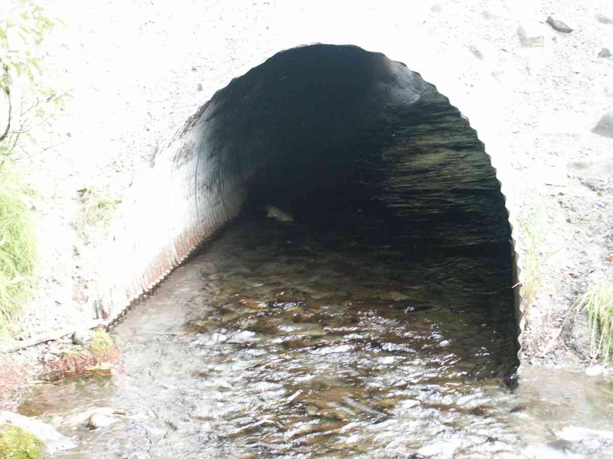
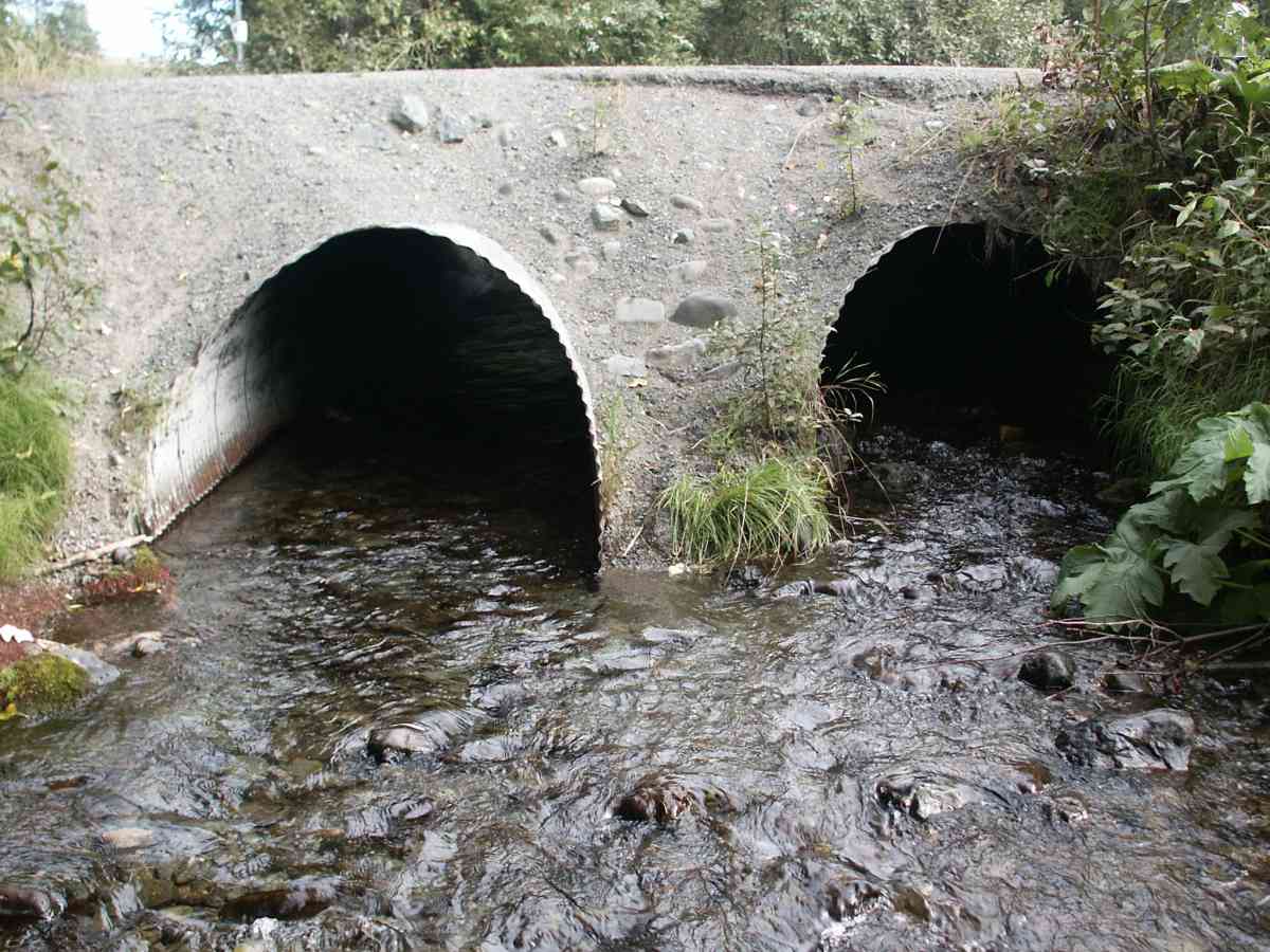
AWC Stream #: 247-50-10110-2053
Stream Name: Meadow Creek
Elevation:
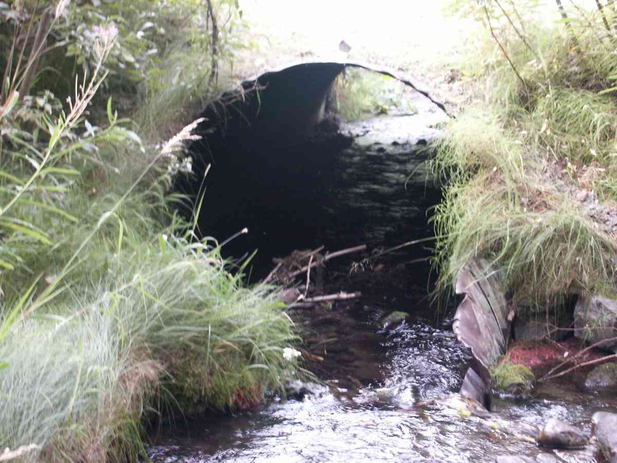
Site Comments: Culvert outlet is 800-1000 feet upstream from confluence with Eagle River. Another culvert upstream 20400023 on VFW Drive.
arrow to the right of the survey date below to choose a different report for this site.
Survey ANC04-1A022
Observers: Dean Beers, Joe Miller
Overall Fish Passage Rating:
Tidal: No
Backwatered: No
Step Pools:
Construction Year:
Comments: Dead adult chinook above and below culvert. Eagle River watershed.
Culvert Measurements
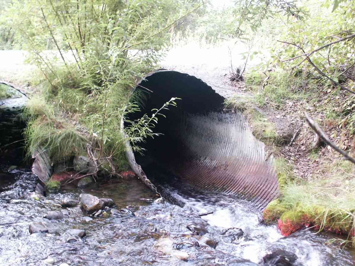
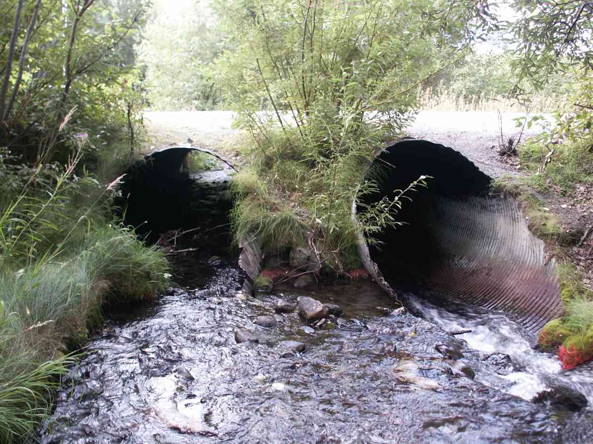
| ID: 1 | Structure Type: Circular pipe (Corrugated Metal) | Fish Passage Rating: | |||||||||||||||||||||||||||||||||||||||||
|
|
|
|||||||||||||||||||||||||||||||||||||||||
| ID: 2 | Structure Type: Circular pipe (Corrugated Metal) | Fish Passage Rating: | |||||||||||||||||||||||||||||||||||||||||
|
|
|
|||||||||||||||||||||||||||||||||||||||||
Stream Measurements
|
|
| Stream Width Type | Distance From Crossing (ft) |
Stream Width (ft) |
|---|---|---|
| Upstream bank full | 75.0 | 16.60 |
| Upstream bank full | 100.0 | 19.30 |
| Upstream bank full | 125.0 | 12.20 |
| Upstream bank full | 150.0 | 14.30 |
| Upstream bed width | 75.0 | 6.10 |
| Upstream bed width | 100.0 | 6.20 |
| Upstream bed width | 125.0 | 6.70 |
| Upstream bed width | 150.0 | 8.10 |
| Upstream ordinary high water | 75.0 | 10.90 |
| Upstream ordinary high water | 100.0 | 10.50 |
| Upstream ordinary high water | 125.0 | 8.50 |
| Upstream ordinary high water | 150.0 | 8.40 |
Elevations
| Locator ID | Culvert Number |
River Distance (ft)1 |
Distance From Crossing (ft)2 |
Relative Elevation (ft) |
|---|---|---|---|---|
| D/S Thalweg | 95.14 | |||
| Max Pool Depth | 95.26 | |||
| D/S Tailcrest or 1st Thalweg | 95.38 | |||
| OHW Left Bank | 95.66 | |||
| OHW Left Bank | 95.74 | |||
| U/S Thalweg | 1 | 97.60 | ||
| U/S Thalweg | 2 | 97.60 | ||
| Outlet Invert | 1 | 0.00 | 0.0 | 93.45 |
| Outlet Invert | 2 | 0.00 | 0.0 | 93.73 |
| Road Elev | 25.50 | 102.55 | ||
| Inlet Culvert Invert | 2 | 51.00 | 0.0 | 96.08 |
| Inlet Culvert Invert | 1 | 51.00 | 0.0 | 95.58 |
Notes:
- River distance is measured continuously throughout the survey reach along the thalweg of the stream.
- Measured from each end of the crossing along the thalweg of the stream.
Fish Sampling Efforts
| Gear Type: Visual Observation, Ground (A) | ||
Fish Observations
No fish observations occurred during this survey.
Photos

Questions or comments about this report can be directed to dfg.dsf.webmaster@alaska.gov