Fish Passage Site 20400013
Coordinates (dec. deg.): 61.35958°, -149.57481°
Legal Description: S015N002W26
Region: South Central
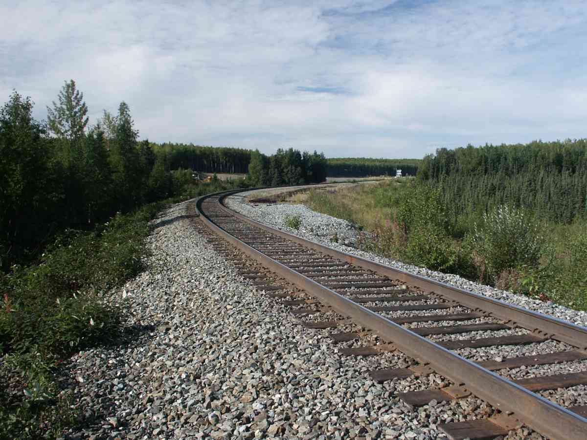
Road Name: Alaska Railroad
Datum: NAD83
Quad Name / ITM: Anchorage B-7
AWC Stream #: 247-50-10150
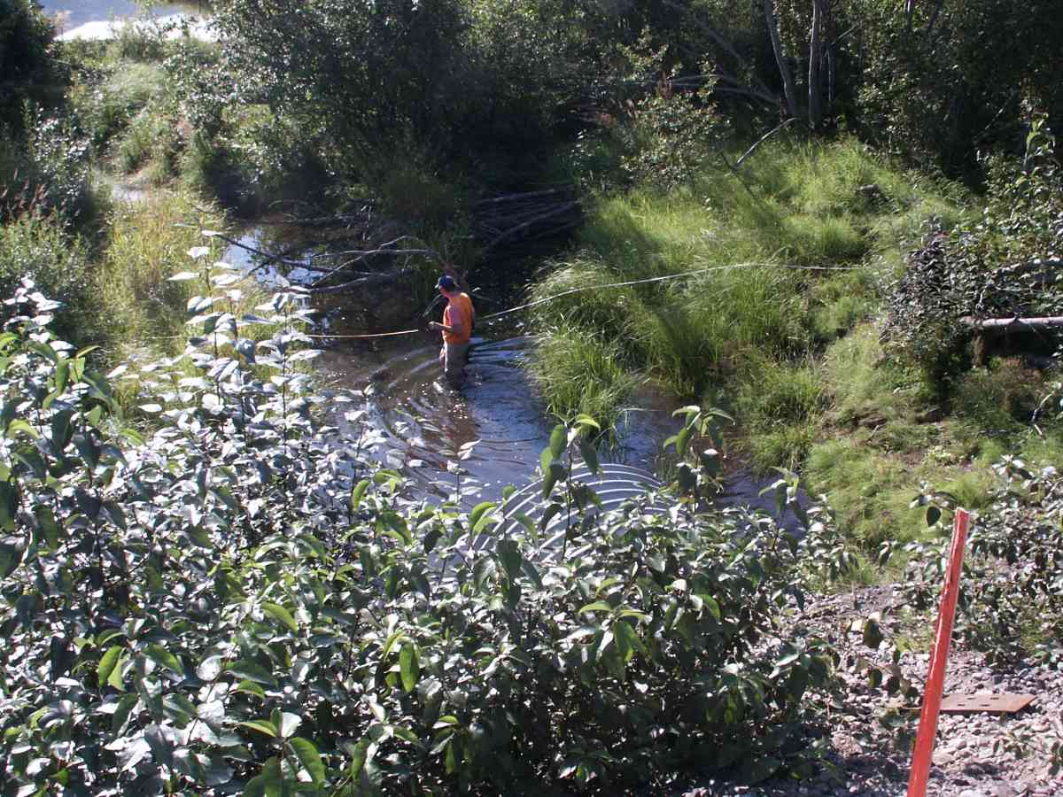
Stream Name: Fire Creek
Elevation:
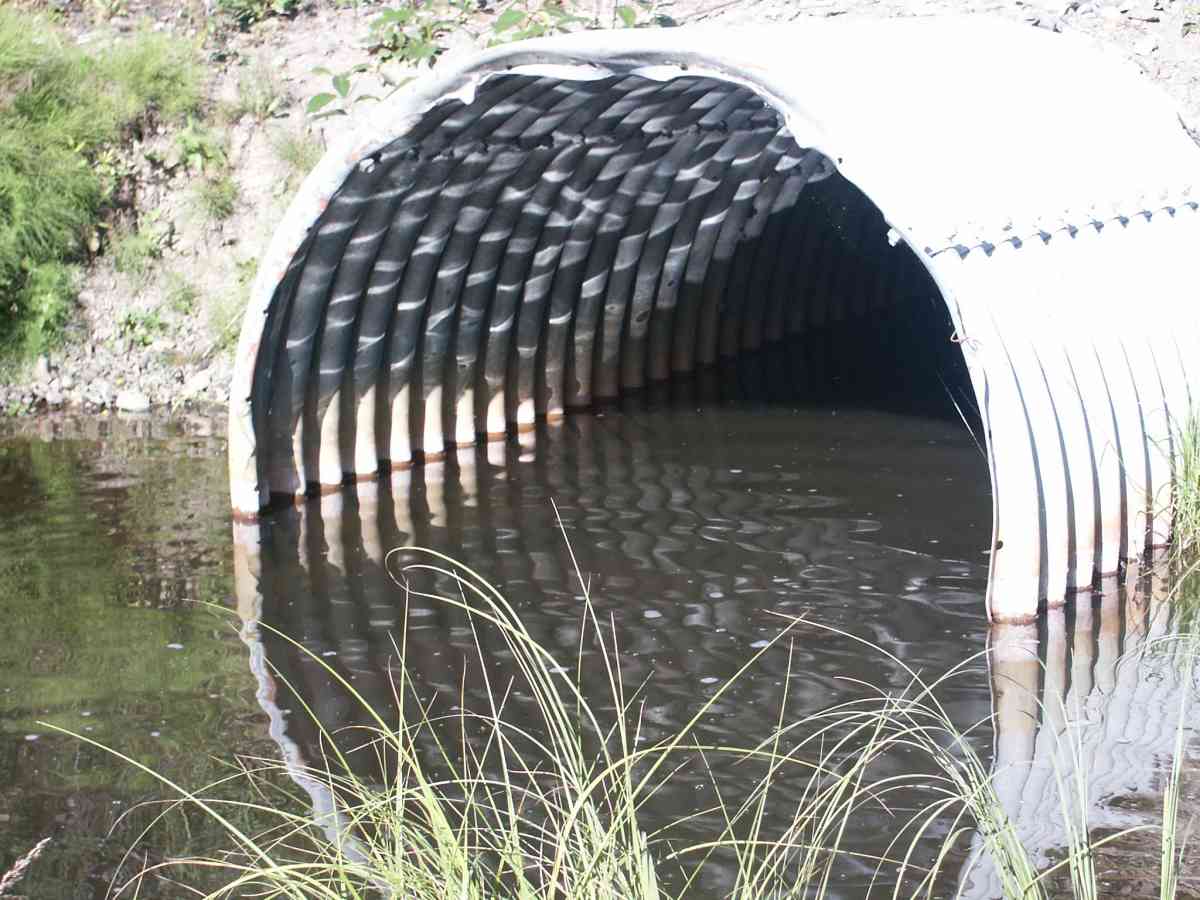
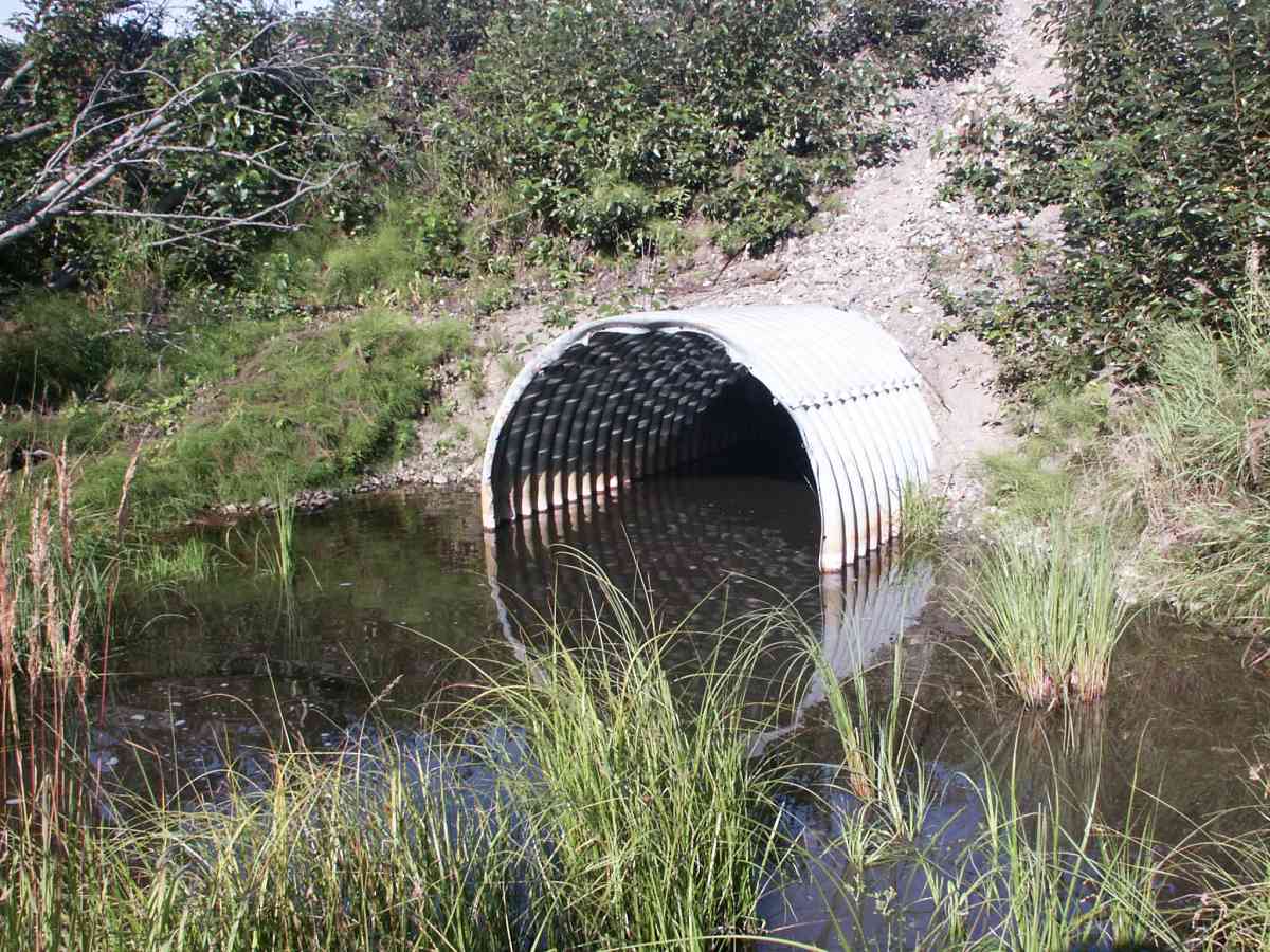
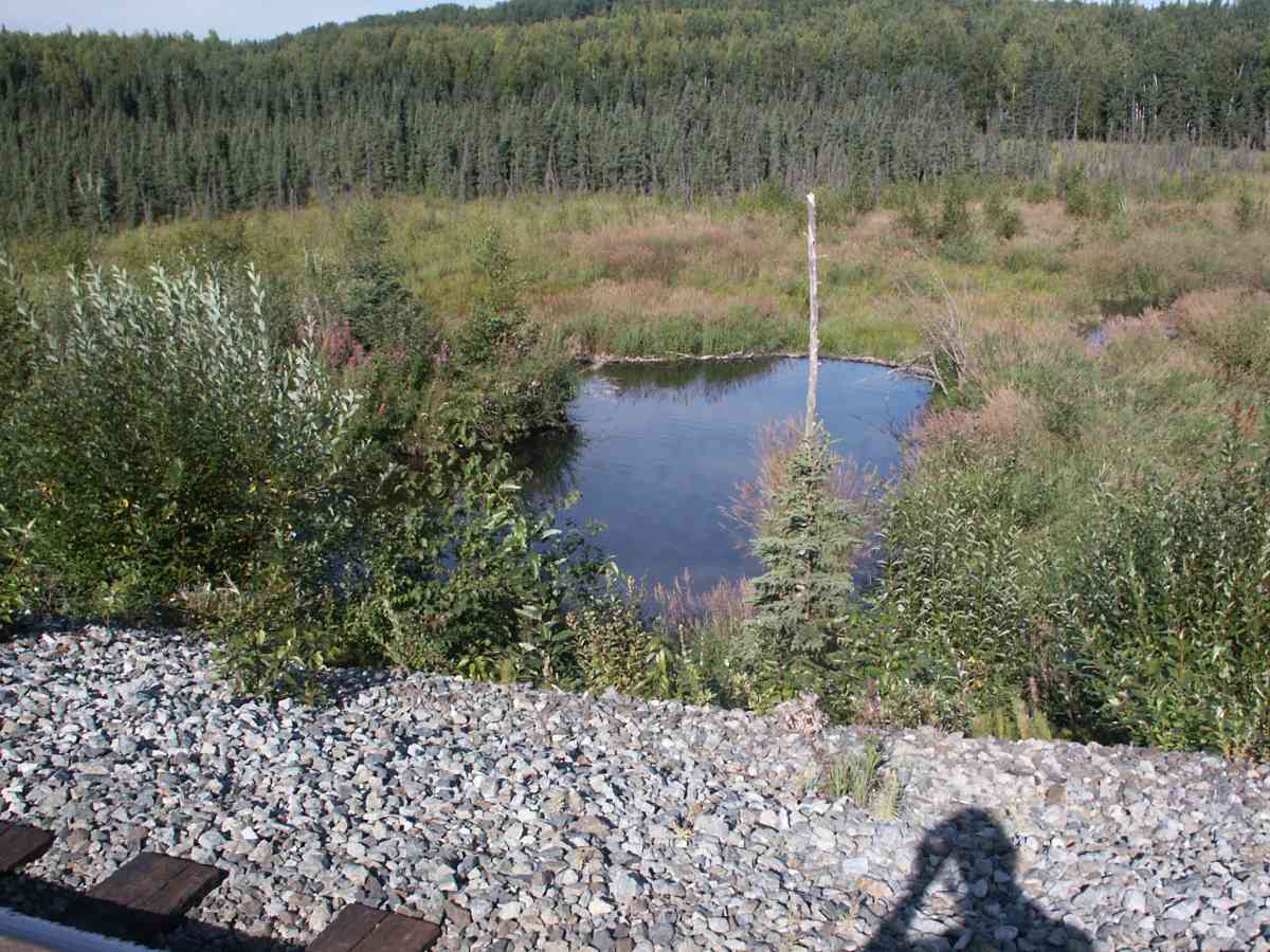
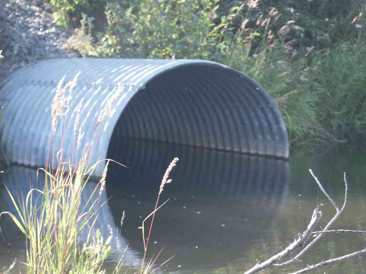
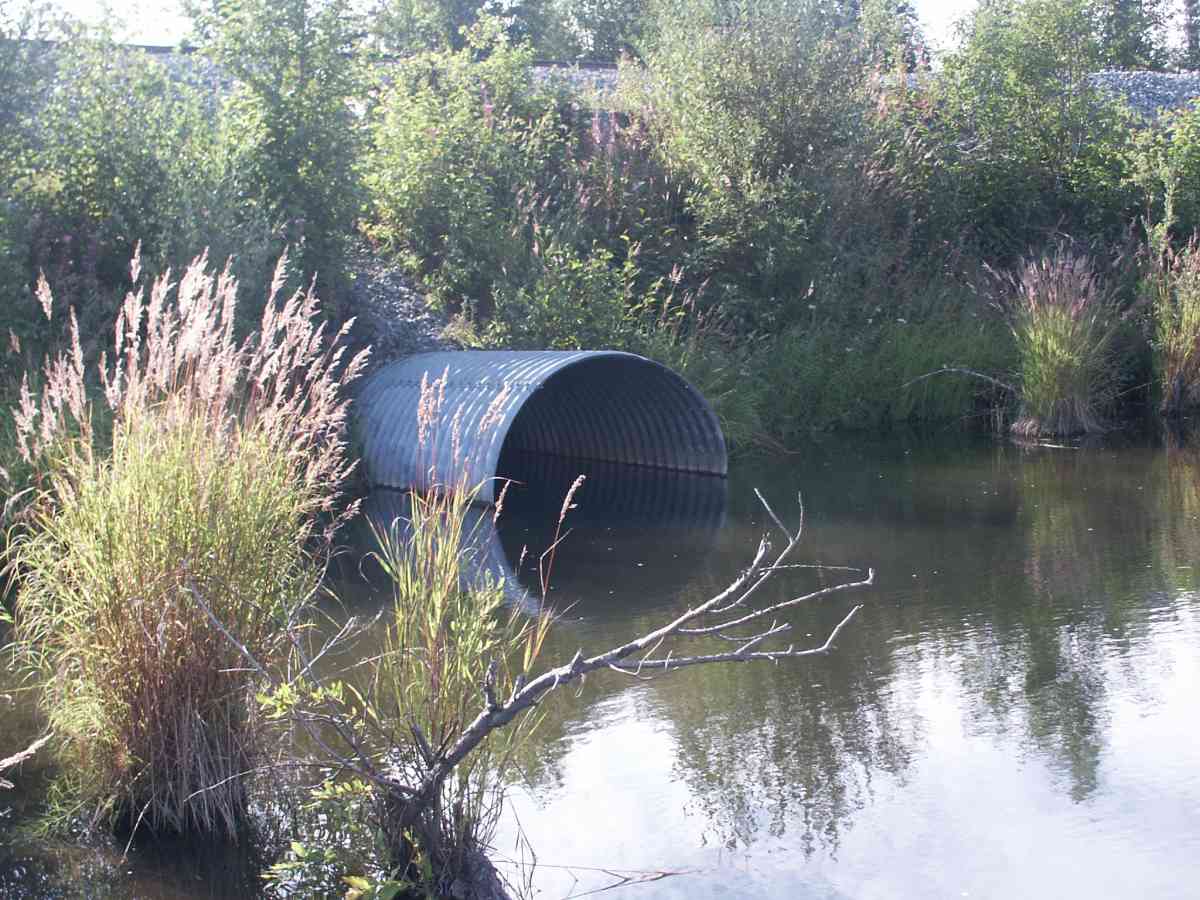
Site Comments: At end of EKLUTNA PARK RD. RAILROAD TRACK CULVERT,
arrow to the right of the survey date below to choose a different report for this site.
Survey ANC04-1A013
Observers: Dean Beers, Joe Miller
Overall Fish Passage Rating:
Tidal: No
Backwatered: No
Step Pools:
Construction Year:
Comments: UNKNOWN FISH BELOW OUTLET, RAILROAD TRACK CULVERT, FIRE CREEK WATERSHED
Culvert Measurements
| ID: 1 | Structure Type: Circular pipe (Corrugated Metal) | Fish Passage Rating: | |||||||||||||||||||||||||||||||||||||||||
|
|
|
|||||||||||||||||||||||||||||||||||||||||
Stream Measurements
|
|
| Stream Width Type | Distance From Crossing (ft) |
Stream Width (ft) |
|---|---|---|
| Upstream bank full | 75.0 | 42.60 |
| Upstream bank full | 100.0 | 34.50 |
| Upstream bed width | 75.0 | 7.50 |
| Upstream bed width | 100.0 | 4.70 |
| Upstream ordinary high water | 75.0 | 40.00 |
| Upstream ordinary high water | 100.0 | 32.00 |
Elevations
| Locator ID | Culvert Number |
River Distance (ft)1 |
Distance From Crossing (ft)2 |
Relative Elevation (ft) |
|---|---|---|---|---|
| D/S Thalweg | 78.17 | |||
| Max Pool Depth | 78.77 | |||
| U/S Thalweg | 1 | 82.13 | ||
| D/S Tailcrest or 1st Thalweg | 83.73 | |||
| OHW Left Bank | 83.82 | |||
| OHW Left Bank | 83.95 | |||
| Outlet Invert | 1 | 0.00 | 0.0 | 80.38 |
| Road Elev | 40.00 | 99.64 | ||
| Inlet Culvert Invert | 1 | 80.00 | 0.0 | 81.65 |
Notes:
- River distance is measured continuously throughout the survey reach along the thalweg of the stream.
- Measured from each end of the crossing along the thalweg of the stream.
Fish Sampling Efforts
| Gear Type: Visual Observation, Ground (A) | ||
Fish Observations
No fish observations occurred during this survey.
Photos
Questions or comments about this report can be directed to dfg.dsf.webmaster@alaska.gov