Fish Passage Site 20400010
Coordinates (dec. deg.): 61.38402°, -149.54511°
Legal Description: S015N002W13
Region: South Central
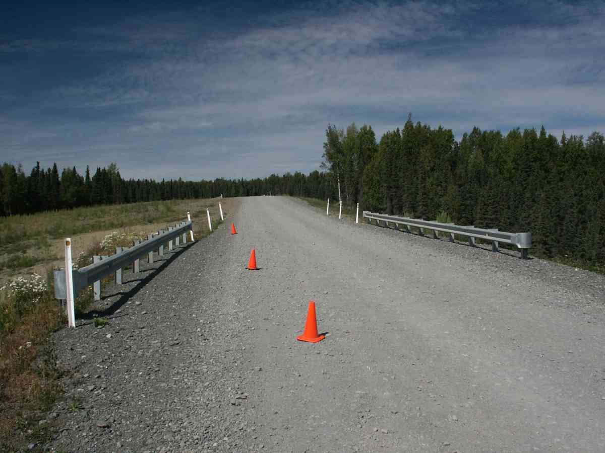
Road Name: Beach Lake Road
Datum: NAD83
Quad Name / ITM: Anchorage B-7
AWC Stream #: 247-50-10150
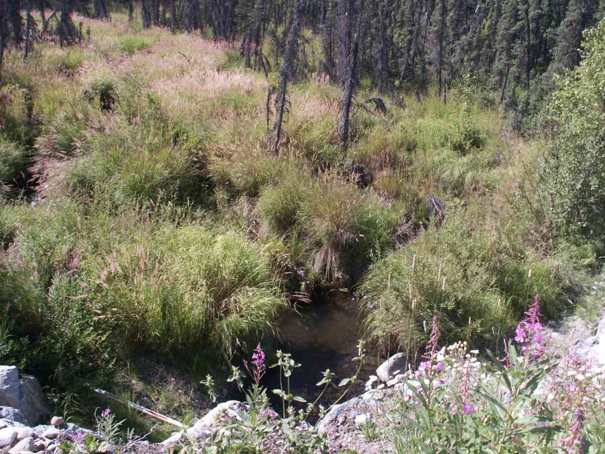
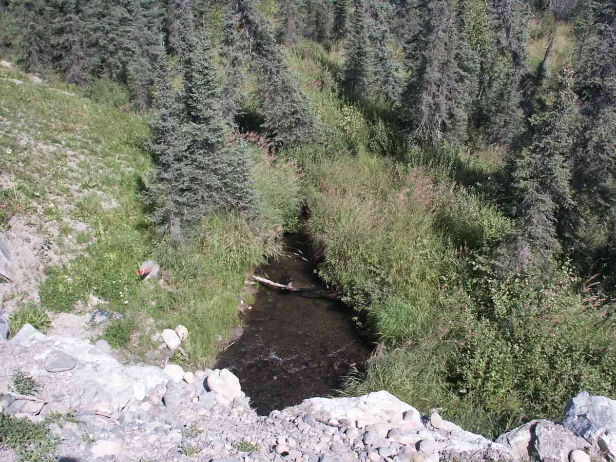
Stream Name: Fire Creek
Elevation:
Site Comments: FIRE CREEK WATERSHED
Survey ANC04-1A010
Observers: Dean Beers, Joe Miller
Overall Fish Passage Rating:
Tidal: No
Backwatered: No
Step Pools:
Construction Year:
Comments: FIRE CREEK WATERSHED, JUV COHO ABOVE INLET
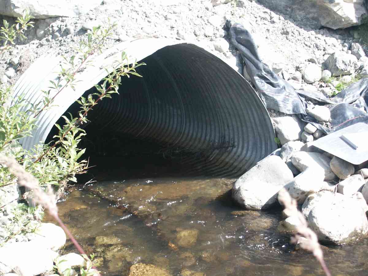
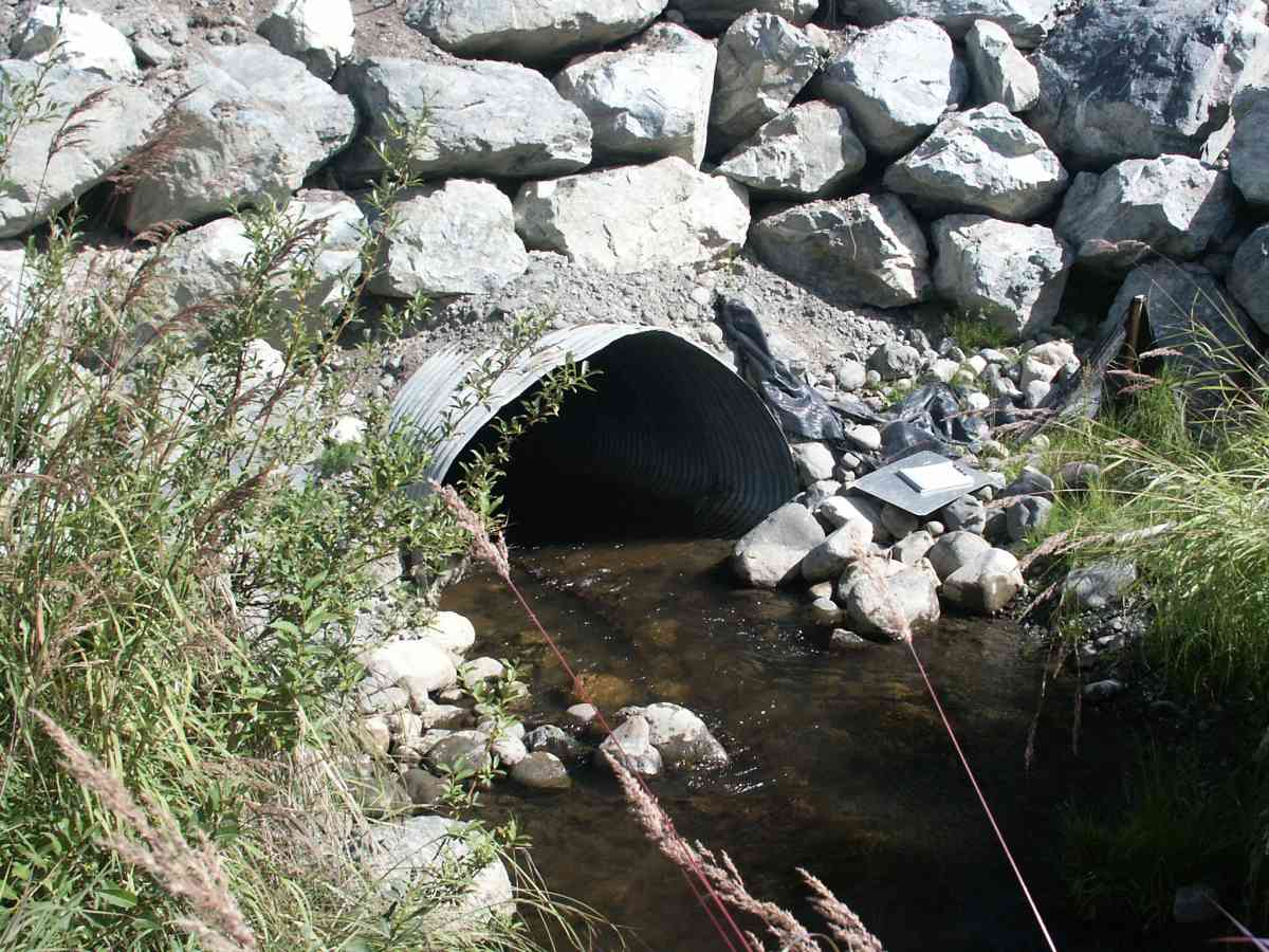
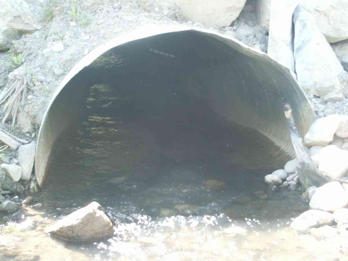
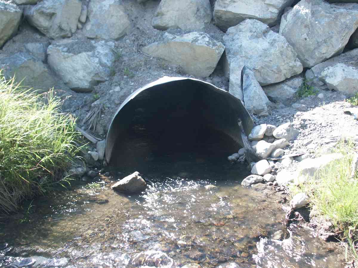
Culvert Measurements
| ID: 1 | Structure Type: Pipe-arch (Corrugated Metal) | Fish Passage Rating: | |||||||||||||||||||||||||||||||||||||||||
|
|
|
|||||||||||||||||||||||||||||||||||||||||
Stream Measurements
|
|
| Stream Width Type | Distance From Crossing (ft) |
Stream Width (ft) |
|---|---|---|
| Upstream bank full | 75.0 | 28.50 |
| Upstream bed width | 75.0 | 7.90 |
| Upstream bed width | 100.0 | 6.60 |
| Upstream bed width | 125.0 | 5.20 |
| Upstream bed width | 150.0 | 5.30 |
| Upstream ordinary high water | 75.0 | 8.30 |
| Upstream ordinary high water | 100.0 | 7.40 |
| Upstream ordinary high water | 125.0 | 6.80 |
| Upstream ordinary high water | 150.0 | 7.00 |
Elevations
| Locator ID | Culvert Number |
River Distance (ft)1 |
Distance From Crossing (ft)2 |
Relative Elevation (ft) |
|---|---|---|---|---|
| D/S Thalweg | 93.86 | |||
| Max Pool Depth | 93.93 | |||
| D/S Tailcrest or 1st Thalweg | 94.16 | |||
| U/S Thalweg | 1 | 94.20 | ||
| OHW Left Bank | 94.57 | |||
| OHW Left Bank | 94.62 | |||
| Outlet Invert | 1 | 0.00 | 0.0 | 93.76 |
| Road Elev | 41.50 | 110.96 | ||
| Inlet Culvert Invert | 1 | 83.00 | 0.0 | 95.15 |
Notes:
- River distance is measured continuously throughout the survey reach along the thalweg of the stream.
- Measured from each end of the crossing along the thalweg of the stream.
Fish Sampling Efforts
| Gear Type: Visual Observation, Ground (A) | ||
Fish Observations
No fish observations occurred during this survey.
Photos
Questions or comments about this report can be directed to dfg.dsf.webmaster@alaska.gov