Fish Passage Site 20400006
Coordinates (dec. deg.): 61.34479°, -149.56254°
Legal Description: S015N002W36
Region: South Central
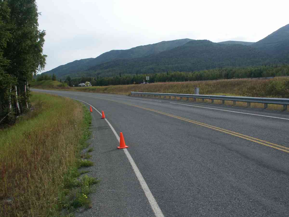
Road Name: Terrace Lane
Datum: NAD83
Quad Name / ITM: Anchorage B-7
AWC Stream #: 247-50-10150
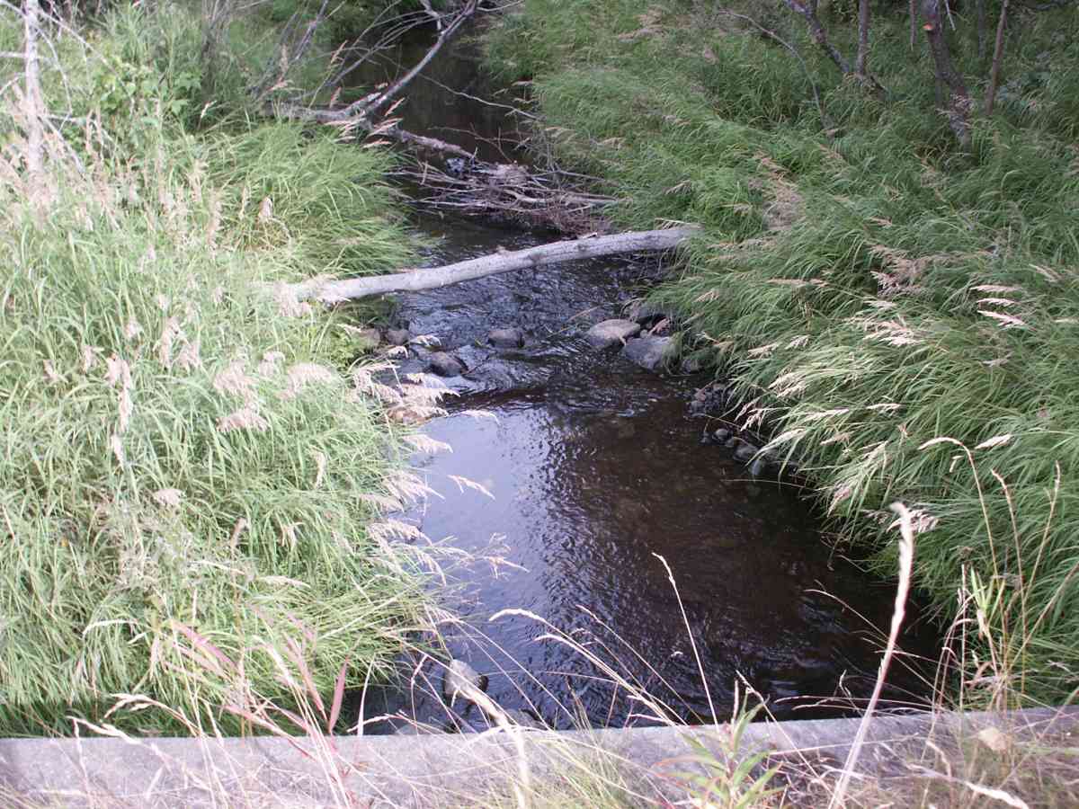
Stream Name: Fire Creek
Elevation:
Site Comments: Fire Ck. Watershed. V-notch rock weirs installed downstream in 1991.
Survey ANC04-1A006
Observers: Dean Beers, Joe Miller
Overall Fish Passage Rating:
Tidal: No
Backwatered: No
Step Pools:
Construction Year:
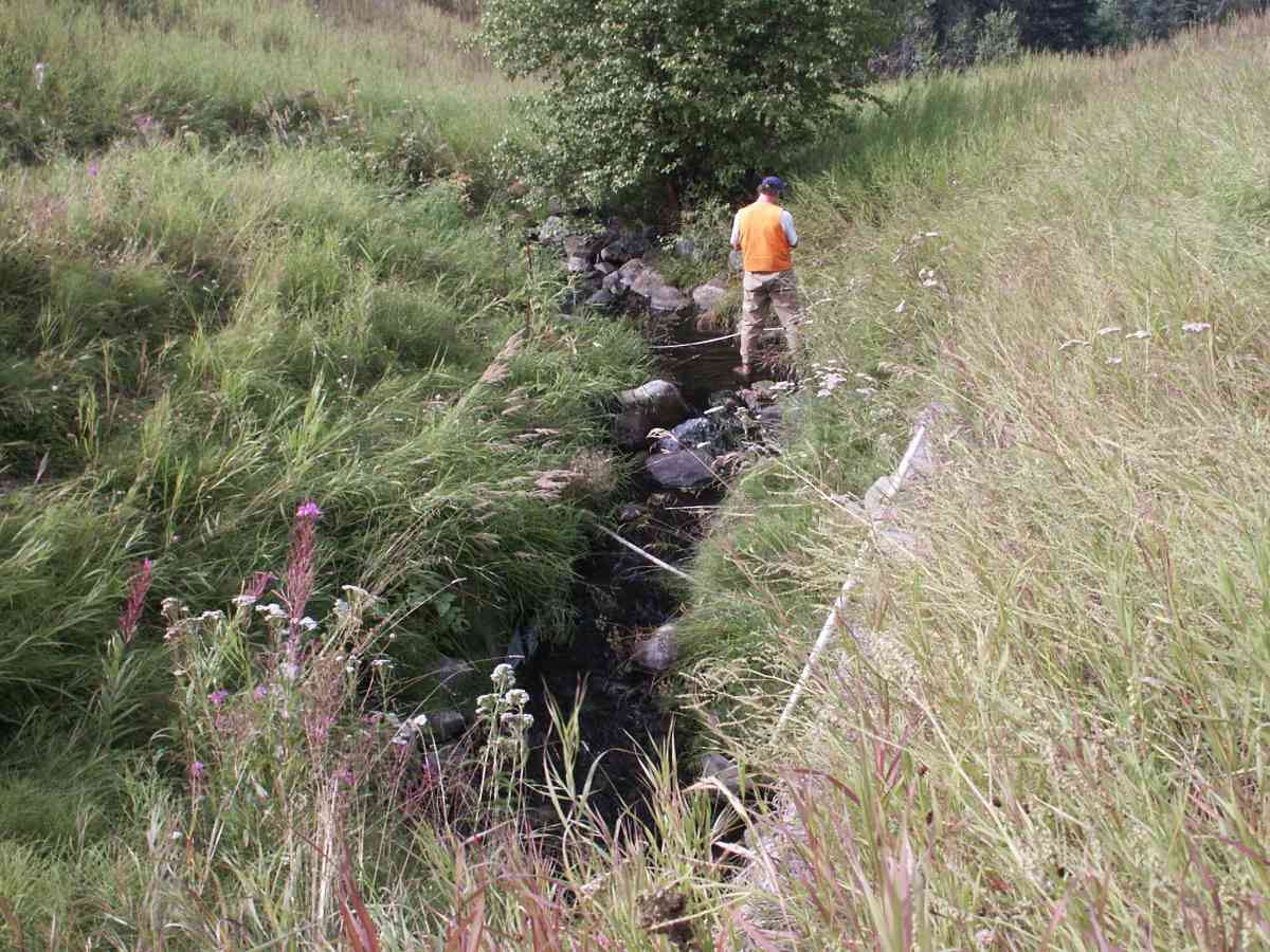
Comments: Fire Ck. Watershed. Burbot was trapped downstream of outlet. Stream measurements above 100 ft were not taken due to Glenn Highway being above that point.
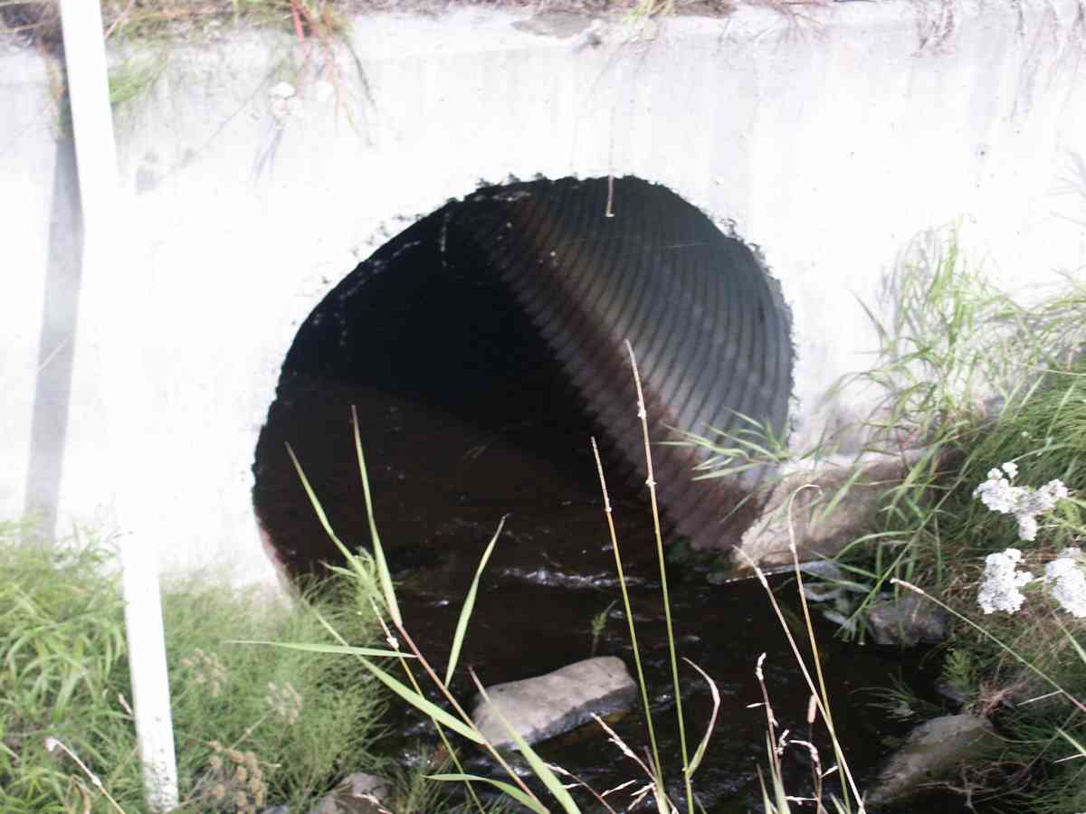
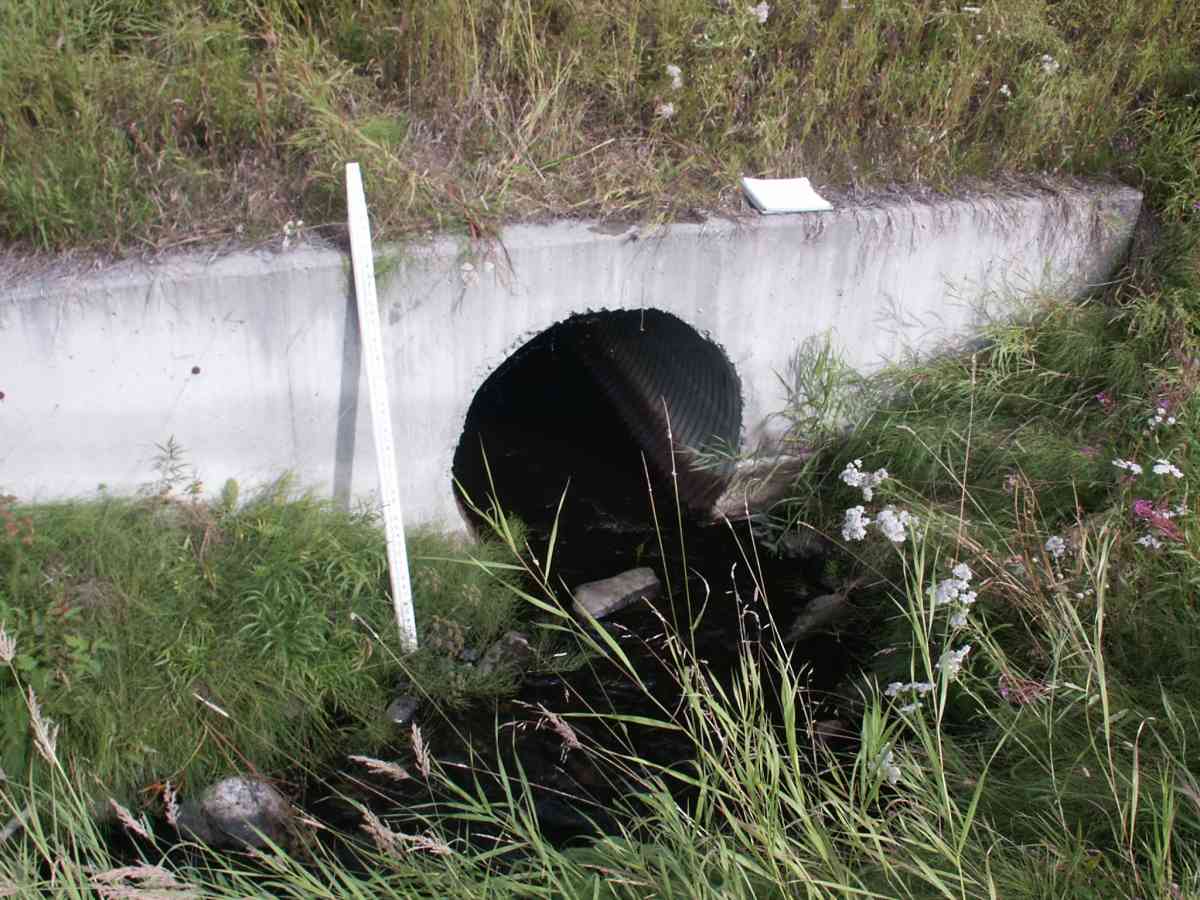
Culvert Measurements
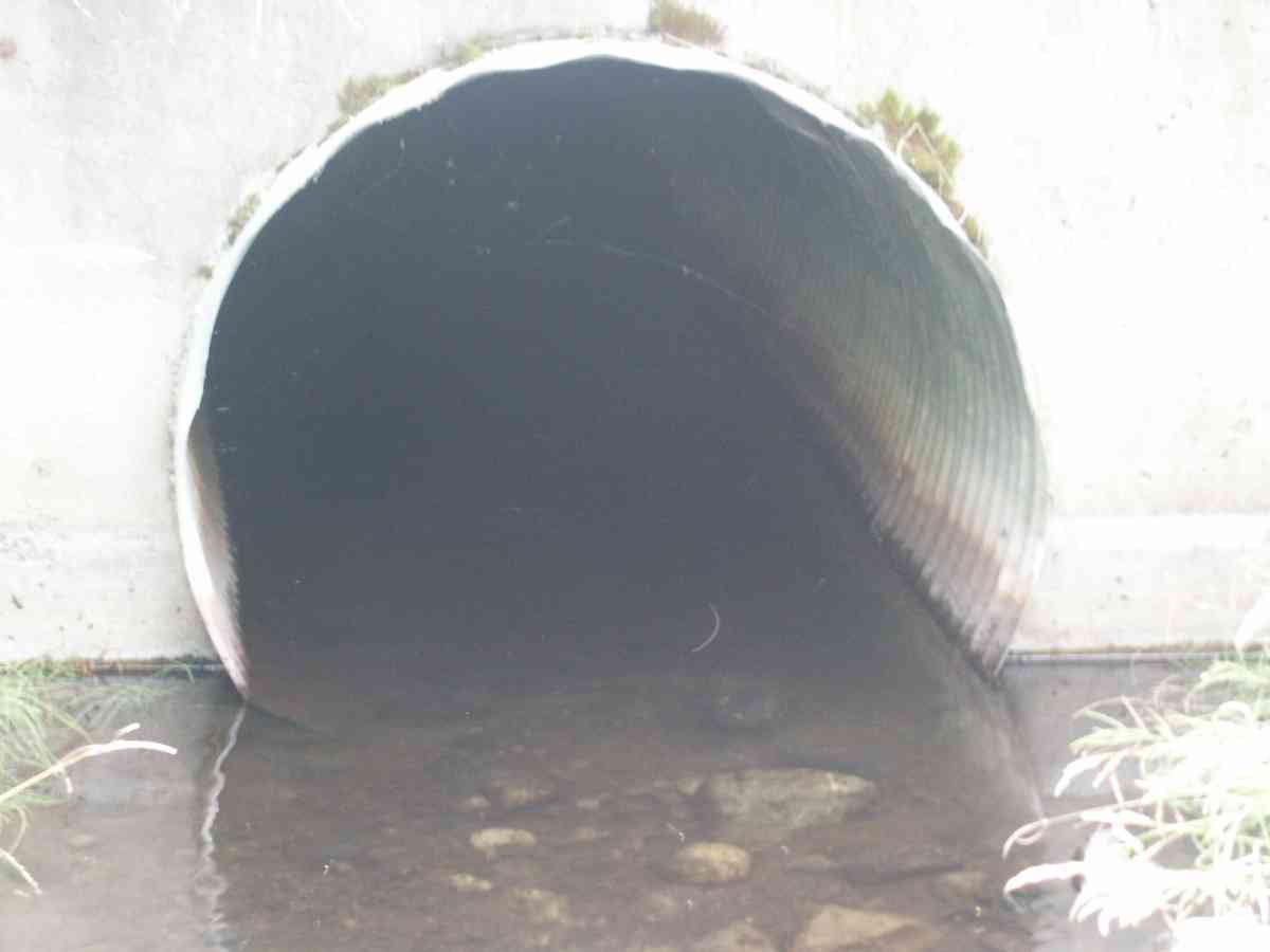
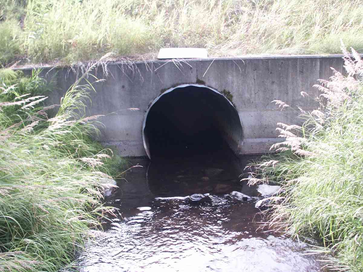
| ID: 1 | Structure Type: Circular pipe (Corrugated Metal) | Fish Passage Rating: | |||||||||||||||||||||||||||||||||||||||||
|
|
|
|||||||||||||||||||||||||||||||||||||||||
Stream Measurements
|
|
| Stream Width Type | Distance From Crossing (ft) |
Stream Width (ft) |
|---|---|---|
| Upstream bed width | 75.0 | 6.90 |
| Upstream bed width | 100.0 | 3.10 |
| Upstream ordinary high water | 75.0 | 8.80 |
| Upstream ordinary high water | 100.0 | 5.00 |
Elevations
| Locator ID | Culvert Number |
River Distance (ft)1 |
Distance From Crossing (ft)2 |
Relative Elevation (ft) |
|---|---|---|---|---|
| D/S Thalweg | 94.39 | |||
| Max Pool Depth | 94.46 | |||
| D/S Tailcrest or 1st Thalweg | 94.76 | |||
| OHW Left Bank | 95.02 | |||
| OHW Left Bank | 95.13 | |||
| U/S Thalweg | 1 | 95.58 | ||
| Outlet Invert | 1 | 0.00 | 0.0 | 94.28 |
| Road Elev | 51.00 | 112.30 | ||
| Inlet Culvert Invert | 1 | 102.00 | 0.0 | 95.14 |
Notes:
- River distance is measured continuously throughout the survey reach along the thalweg of the stream.
- Measured from each end of the crossing along the thalweg of the stream.
Fish Sampling Efforts
| Gear Type: Minnow Trap (A) | Trap Duration(h): 21.0 | |
Fish Observations
No fish observations occurred during this survey.
Photos
Questions or comments about this report can be directed to dfg.dsf.webmaster@alaska.gov