Fish Passage Site 20300216
Coordinates (dec. deg.): 60.99613°, -149.50347°
Legal Description: S011N001W32
Region: South Central
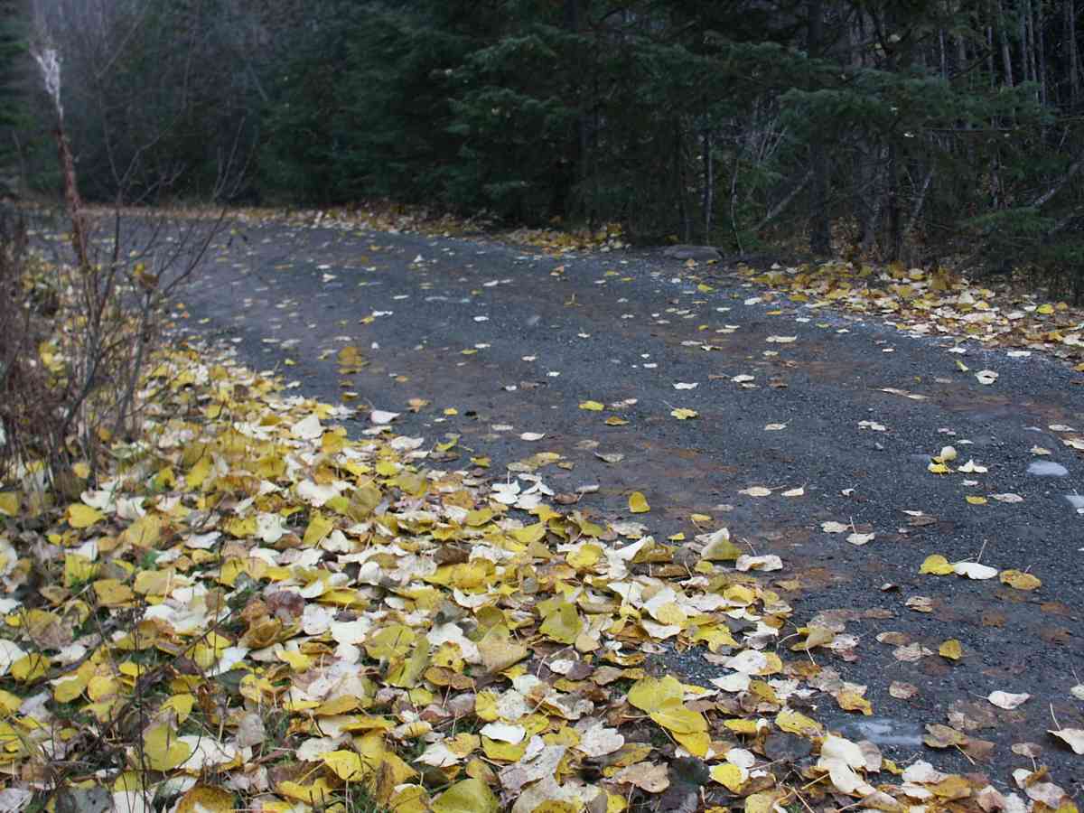
Road Name: Indian River Road
Datum: NAD83
Quad Name / ITM: Seward D-7
AWC Stream #: 247-60-10290
Stream Name: Indian River tributary
Elevation:
Site Comments: INDIAN RIVER WATERSHED, SITE IS IN CHUGACH STATE PARK.
Survey ANC04-4A216
Observers: Dean Beers, Vic Stanculescu
Overall Fish Passage Rating:
Tidal: No
Backwatered: No
Step Pools:
Construction Year:
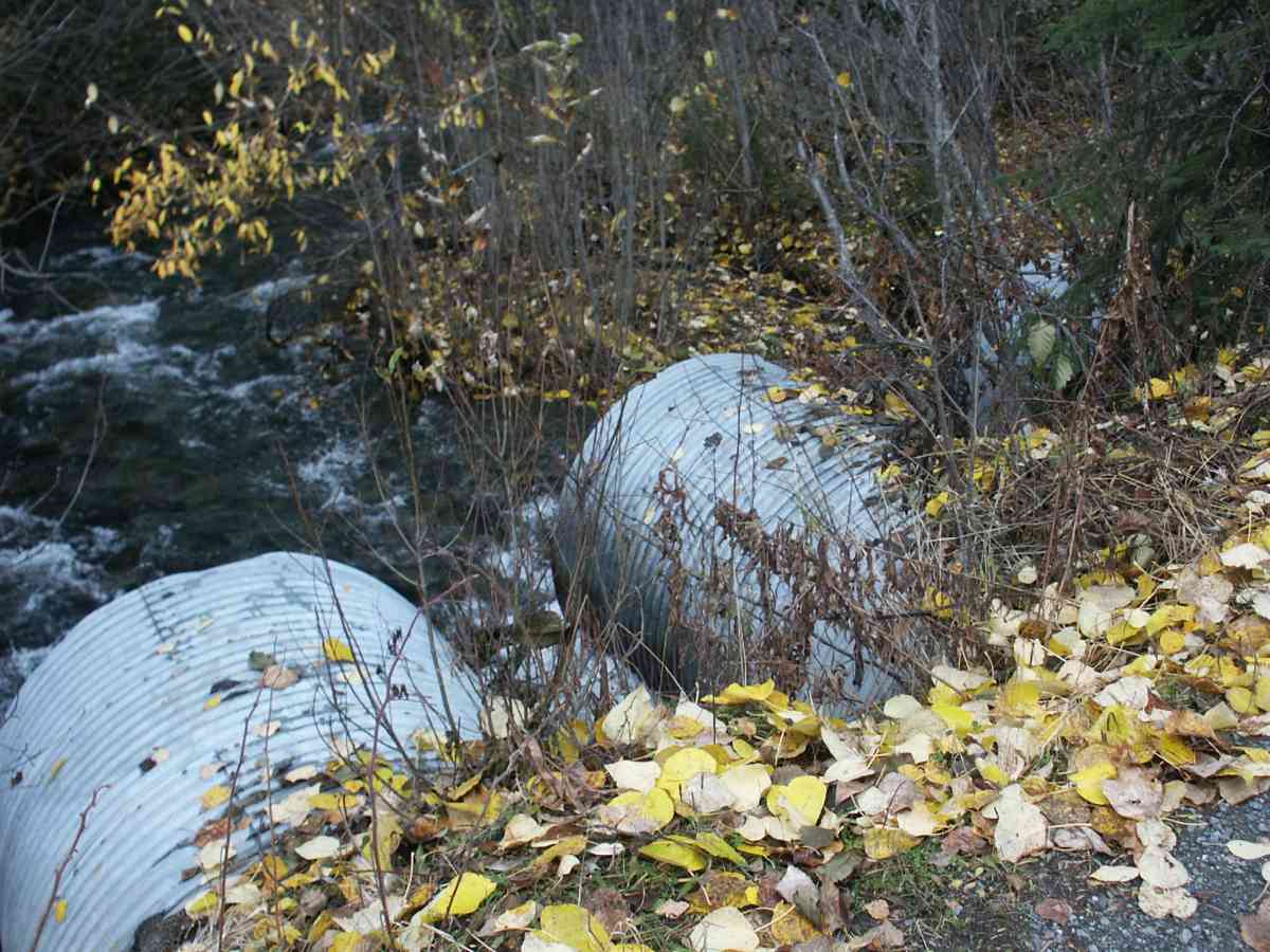
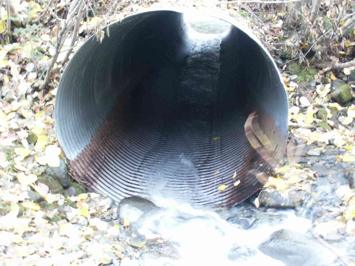
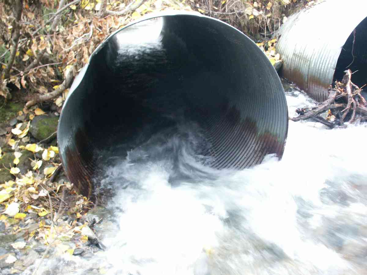
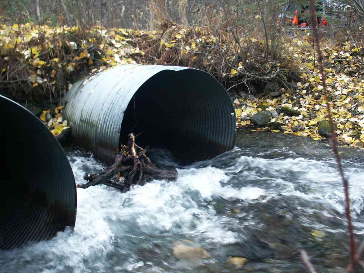
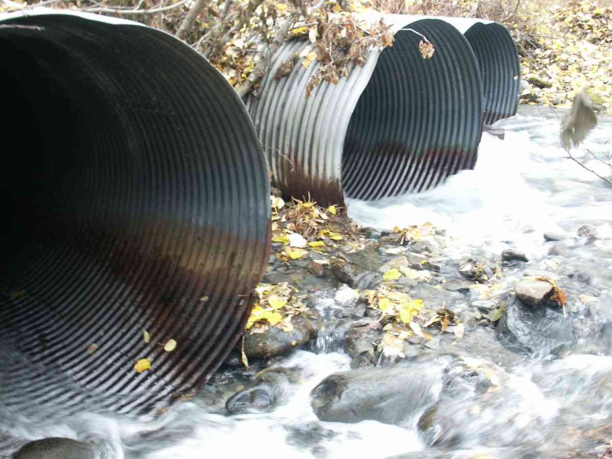
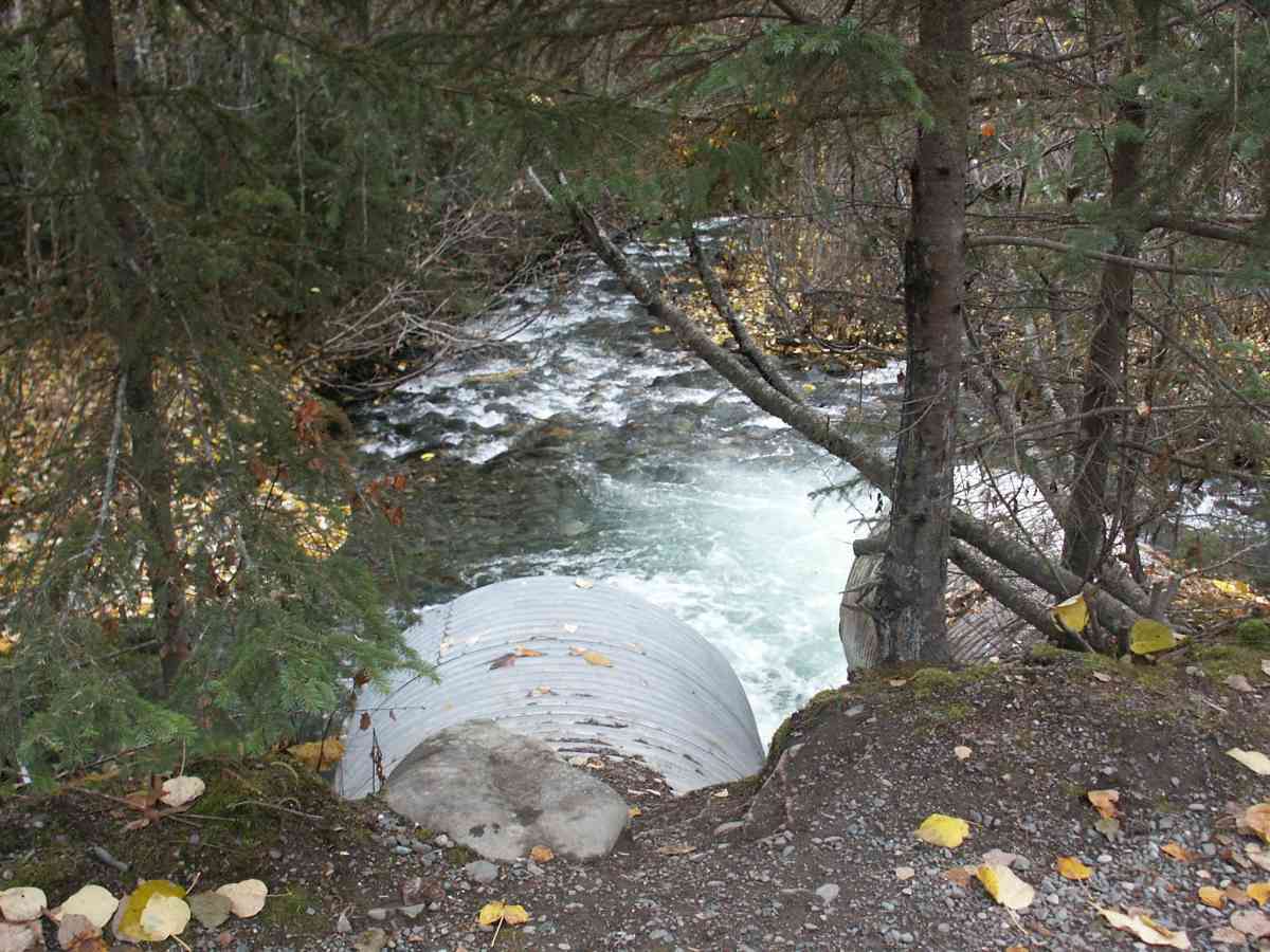
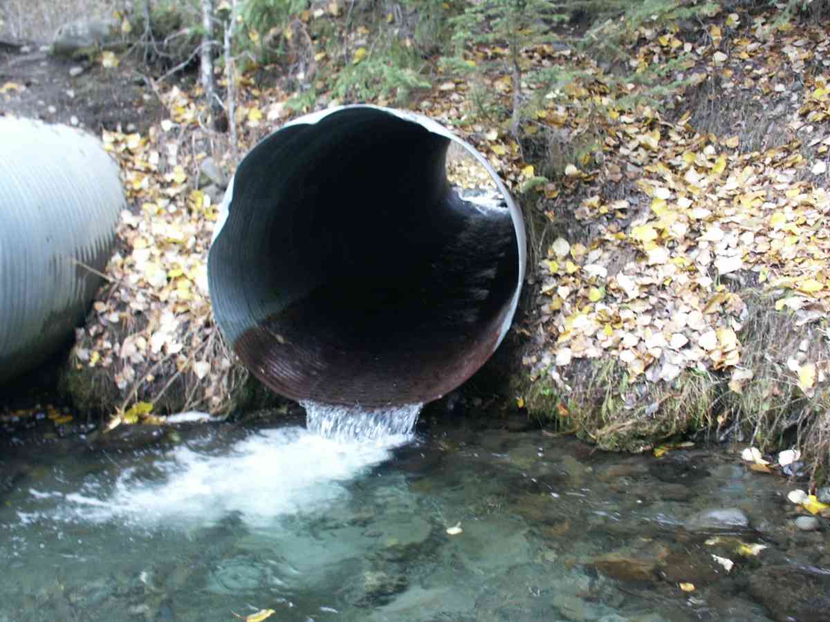
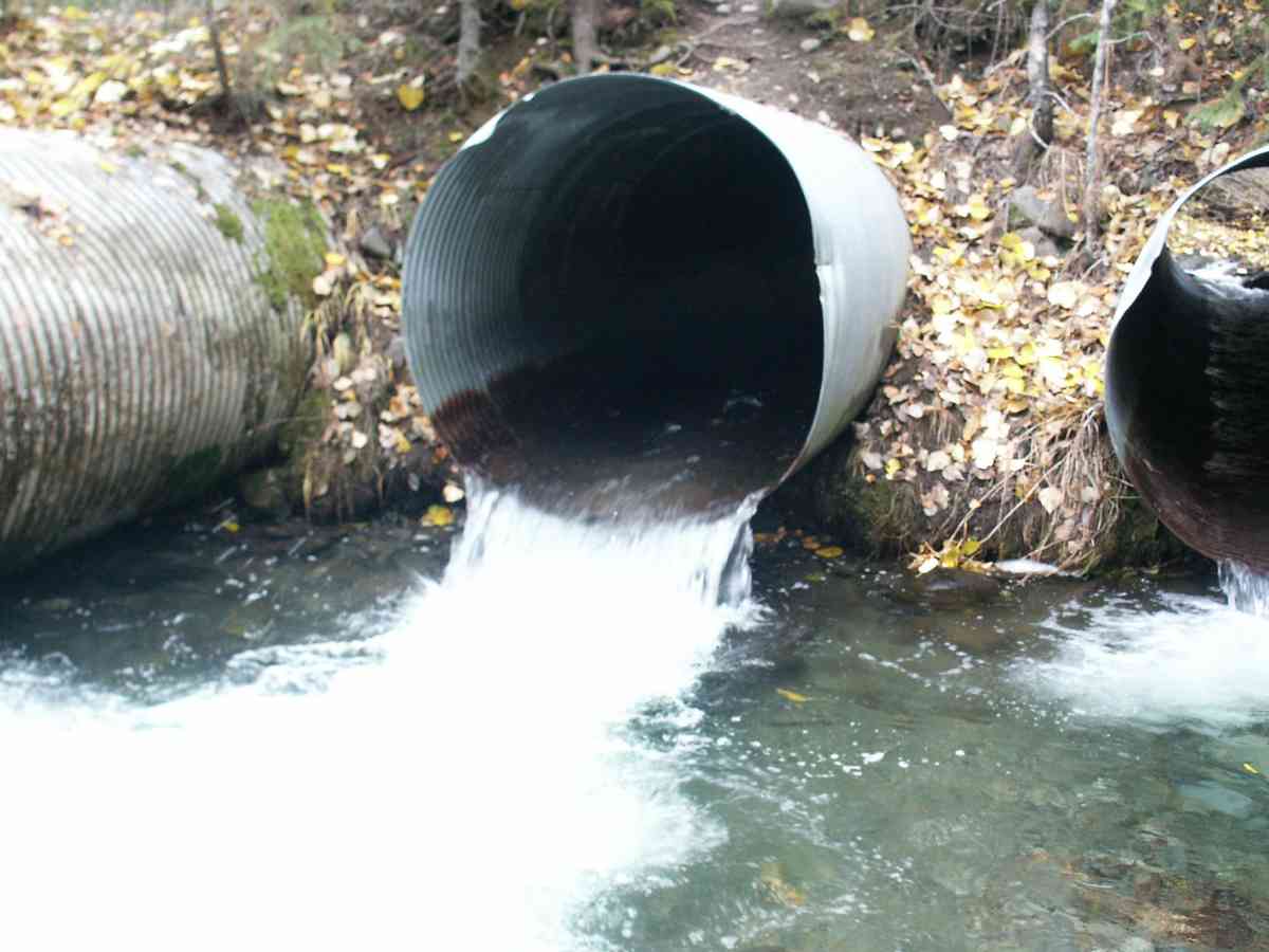
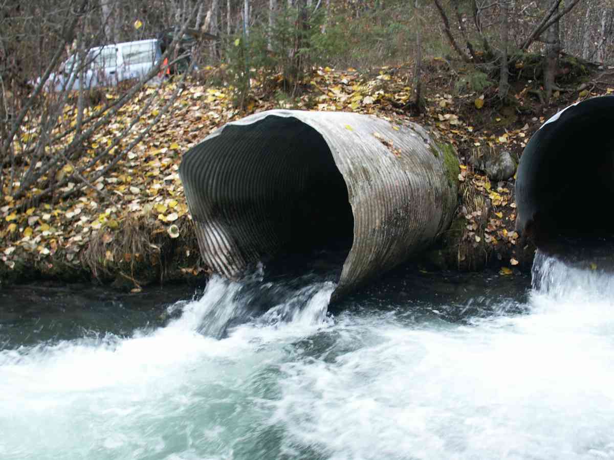
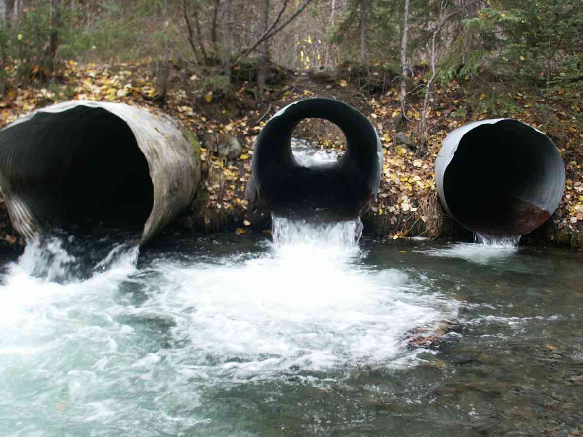
Comments: INDIAN RIVER WATERSHED, SITE IS IN CHUGACH STATE PARK, ADULT COHO BELOW CULVERT OUTLETS
Culvert Measurements
| ID: 1 | Structure Type: Circular pipe (Corrugated Metal) | Fish Passage Rating: | |||||||||||||||||||||||||||||||||||||||||
|
|
|
|||||||||||||||||||||||||||||||||||||||||
| ID: 2 | Structure Type: Circular pipe (Corrugated Metal) | Fish Passage Rating: | |||||||||||||||||||||||||||||||||||||||||
|
|
|
|||||||||||||||||||||||||||||||||||||||||
| ID: 3 | Structure Type: Circular pipe (Corrugated Metal) | Fish Passage Rating: | |||||||||||||||||||||||||||||||||||||||||
|
|
|
|||||||||||||||||||||||||||||||||||||||||
Stream Measurements
|
|
| Stream Width Type | Distance From Crossing (ft) |
Stream Width (ft) |
|---|---|---|
| Upstream bank full | 75.0 | 24.60 |
| Upstream bank full | 100.0 | 23.00 |
| Upstream bank full | 125.0 | 25.50 |
| Upstream bank full | 150.0 | 25.00 |
| Upstream bed width | 75.0 | 21.00 |
| Upstream bed width | 100.0 | 19.20 |
| Upstream bed width | 125.0 | 17.60 |
| Upstream bed width | 150.0 | 18.00 |
| Upstream ordinary high water | 75.0 | 21.50 |
| Upstream ordinary high water | 100.0 | 19.60 |
| Upstream ordinary high water | 125.0 | 22.00 |
| Upstream ordinary high water | 150.0 | 21.90 |
Elevations
| Locator ID | Culvert Number |
River Distance (ft)1 |
Distance From Crossing (ft)2 |
Relative Elevation (ft) |
|---|---|---|---|---|
| D/S Thalweg | 90.13 | |||
| Max Pool Depth | 90.14 | |||
| D/S Tailcrest or 1st Thalweg | 91.58 | |||
| OHW Left Bank | 92.43 | |||
| OHW Left Bank | 92.71 | |||
| U/S Thalweg | 2 | 95.35 | ||
| U/S Thalweg | 1 | 95.55 | ||
| U/S Thalweg | 3 | 95.55 | ||
| Outlet Invert | 1 | 0.00 | 0.0 | 92.73 |
| Outlet Invert | 3 | 0.00 | 0.0 | 93.01 |
| Outlet Invert | 2 | 0.00 | 0.0 | 92.06 |
| Road Elev | 21.00 | 101.31 | ||
| Inlet Culvert Invert | 2 | 42.00 | 0.0 | 93.54 |
| Inlet Culvert Invert | 3 | 42.00 | 0.0 | 93.89 |
| Inlet Culvert Invert | 1 | 42.00 | 0.0 | 94.25 |
Notes:
- River distance is measured continuously throughout the survey reach along the thalweg of the stream.
- Measured from each end of the crossing along the thalweg of the stream.
Fish Sampling Efforts
| Gear Type: Visual Observation, Ground (A) | ||
Fish Observations
No fish observations occurred during this survey.
Photos
Questions or comments about this report can be directed to dfg.dsf.webmaster@alaska.gov