Fish Passage Site 20300207
Coordinates (dec. deg.): 60.95651°, -149.11531°
Legal Description: S010N002E16
Region: South Central
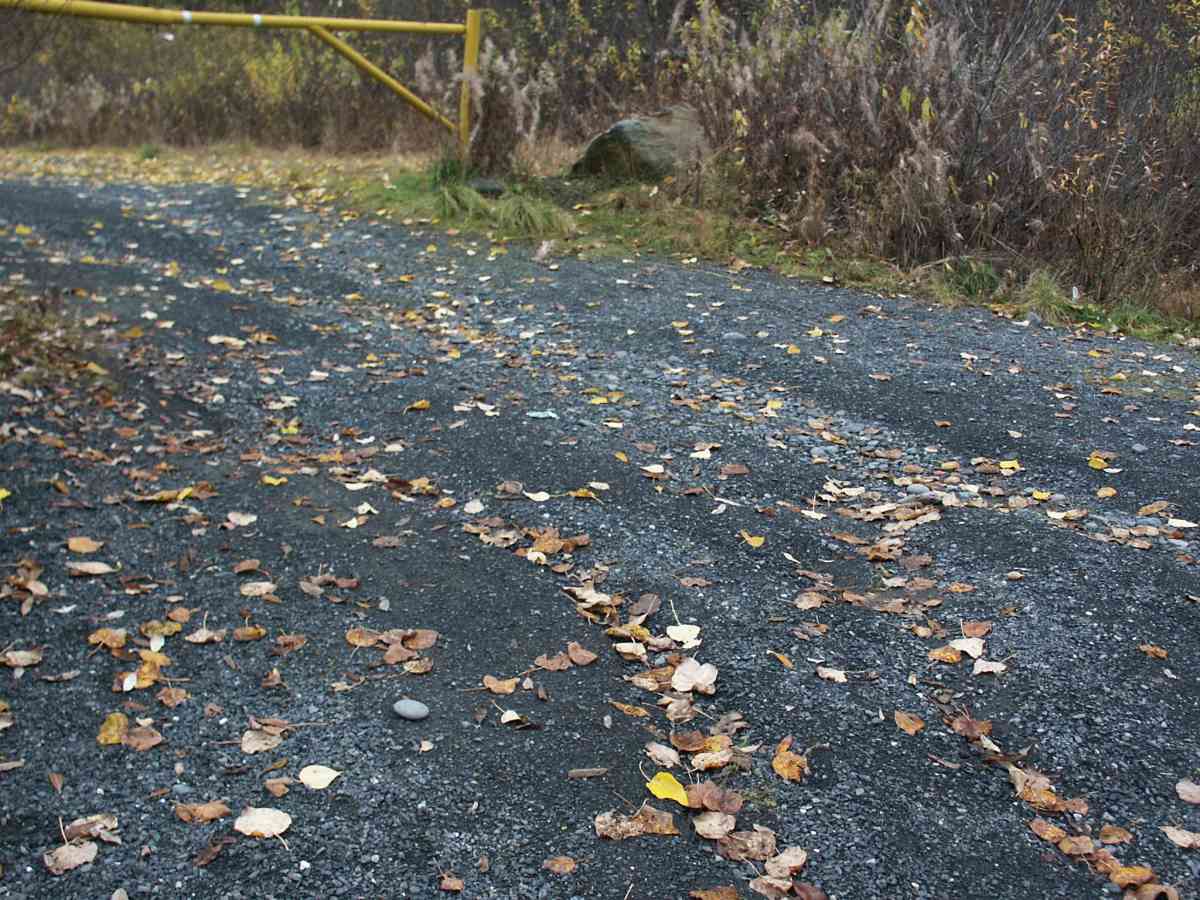
Road Name: Driveway off Alyeska Avenue
Datum: NAD83
Quad Name / ITM: Seward D-6
AWC Stream #:
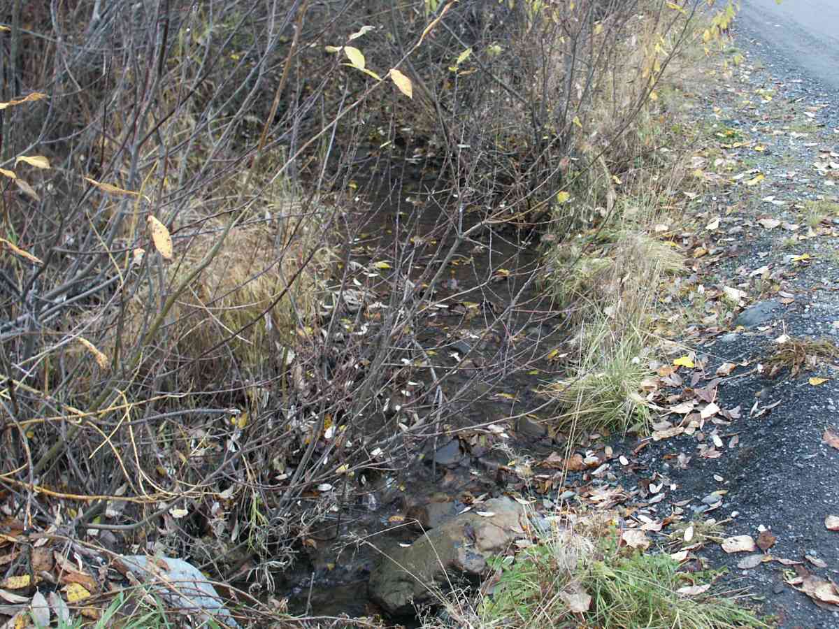
Stream Name: Glacier Creek tributary
Elevation:
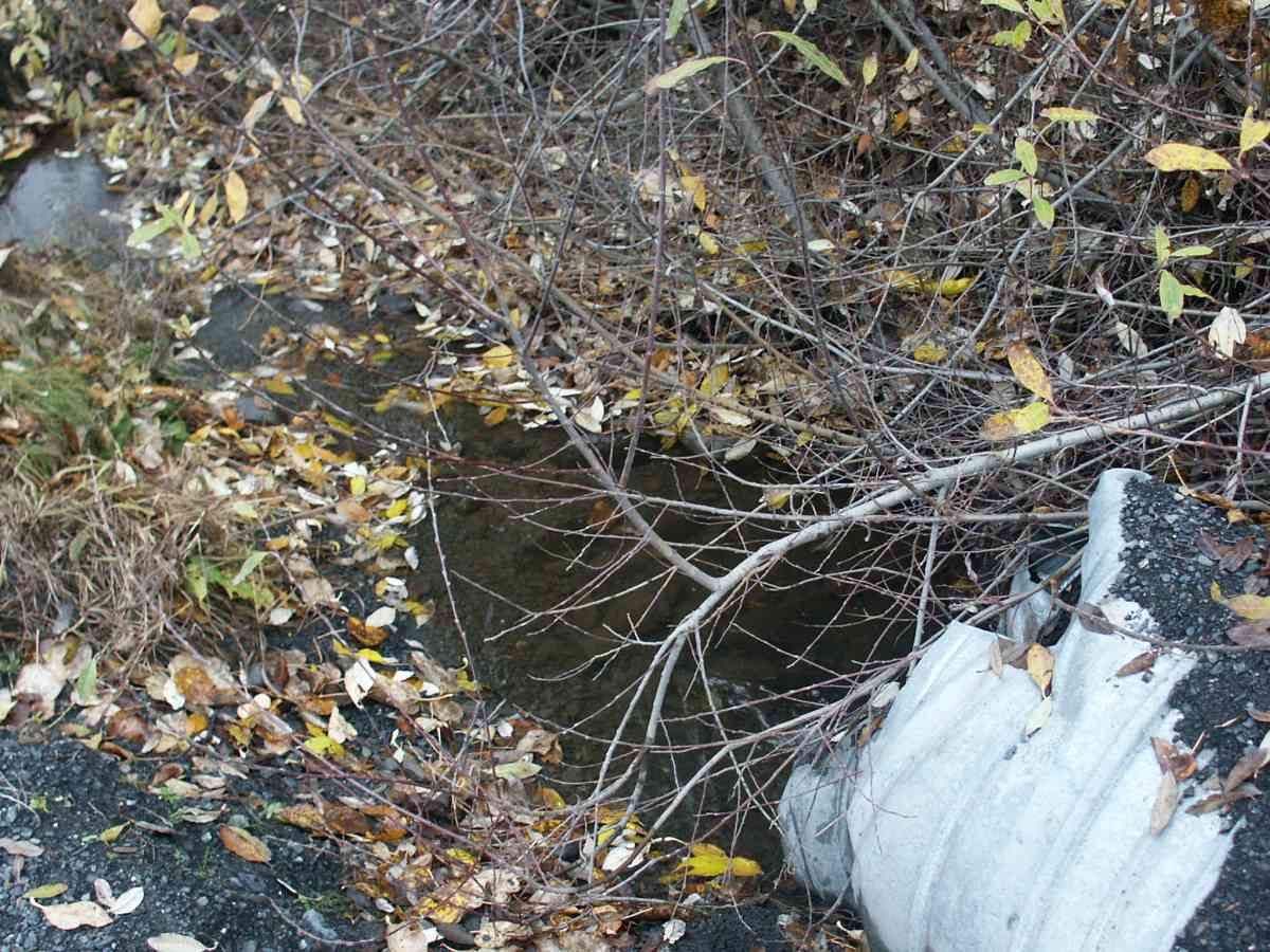
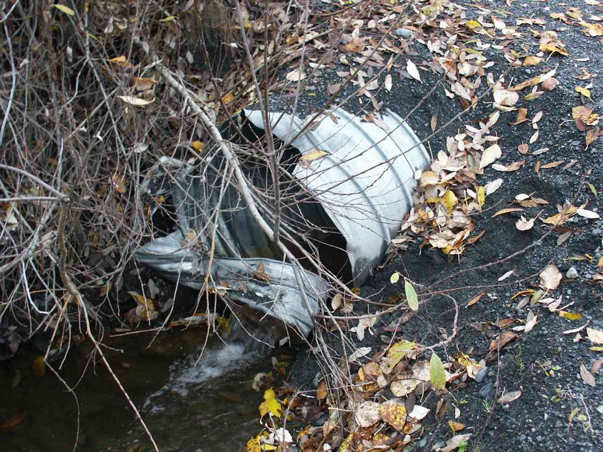
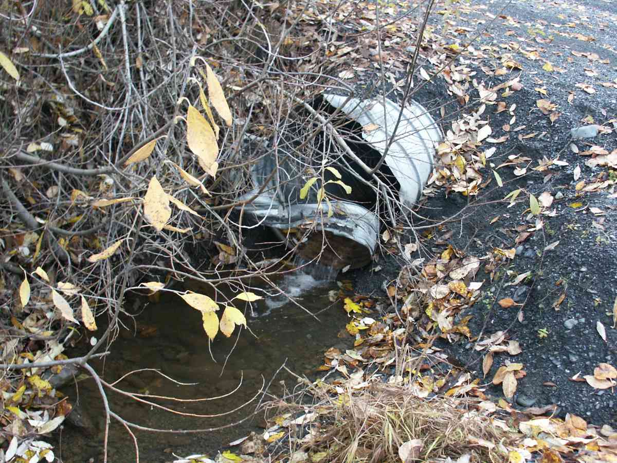
Site Comments: GLACIER CREEK WATERSHED
arrow to the right of the survey date below to choose a different report for this site.
Survey ANC04-4A207
Observers: Dean Beers, Vic Stanculescu
Overall Fish Passage Rating:
Tidal: No
Backwatered: No
Step Pools:
Construction Year:
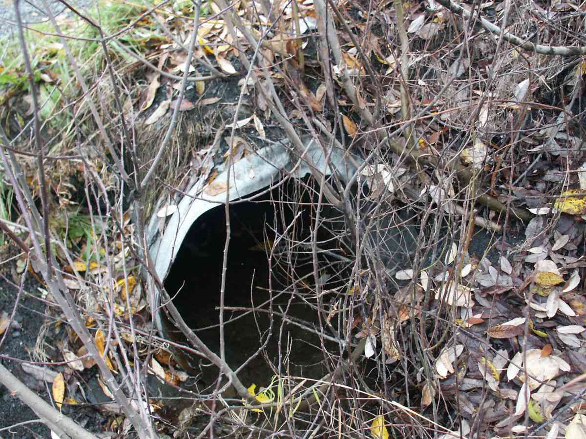
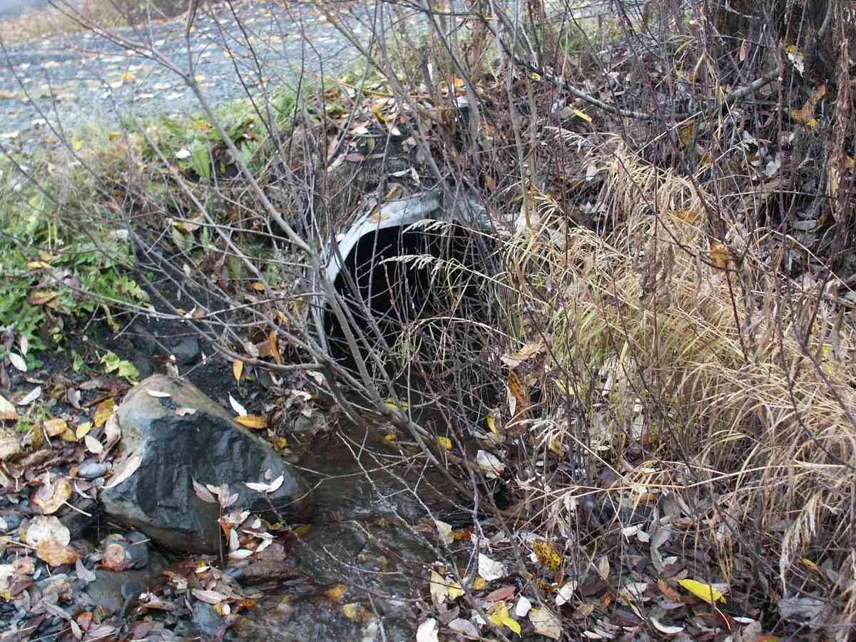
Comments: GLACIER CREEK WATERSHED, CULVERT IS DAMAGED (major collapse).
Culvert Measurements
No measurement data available.
Stream Measurements
|
|
| Stream Width Type | Distance From Crossing (ft) |
Stream Width (ft) |
|---|---|---|
| Upstream bank full | 75.0 | 7.10 |
| Upstream bank full | 100.0 | 7.00 |
| Upstream bank full | 125.0 | 6.90 |
| Upstream bed width | 75.0 | 3.60 |
| Upstream bed width | 100.0 | 2.50 |
| Upstream bed width | 125.0 | 2.60 |
| Upstream ordinary high water | 75.0 | 4.00 |
| Upstream ordinary high water | 100.0 | 4.00 |
| Upstream ordinary high water | 125.0 | 3.90 |
Elevations
| Locator ID | Culvert Number |
River Distance (ft)1 |
Distance From Crossing (ft)2 |
Relative Elevation (ft) |
|---|---|---|---|---|
| Max Pool Depth | 104.44 | |||
| D/S Thalweg | 104.44 | |||
| D/S Tailcrest or 1st Thalweg | 105.15 | |||
| OHW Left Bank | 105.35 | |||
| OHW Left Bank | 105.84 | |||
| U/S Thalweg | 1 | 106.92 | ||
| Outlet Invert | 1 | 0.00 | 0.0 | 105.50 |
| Road Elev | 18.00 | 109.39 | ||
| Inlet Culvert Invert | 1 | 36.00 | 0.0 | 106.54 |
Notes:
- River distance is measured continuously throughout the survey reach along the thalweg of the stream.
- Measured from each end of the crossing along the thalweg of the stream.
Fish Sampling Efforts
| Gear Type: Visual Observation, Ground (A) | ||
Fish Observations
No fish observations occurred during this survey.
Photos
Questions or comments about this report can be directed to dfg.dsf.webmaster@alaska.gov