Fish Passage Site 10103603
Coordinates (dec. deg.): 55.71682°, -132.92233°
Legal Description: C071S081E13
Region: Southeast
Road Name: North Prince of Wales Road
Datum: NAD83
Quad Name / ITM: Craig C-3
AWC Stream #:
Stream Name: Unnamed
Elevation:
Site Comments: None
Survey SEA17-NPW37
Observers: Elizabeth Flory, Kelly Petty
Overall Fish Passage Rating:
Tidal: No
Backwatered: No
Step Pools: No
Construction Year:
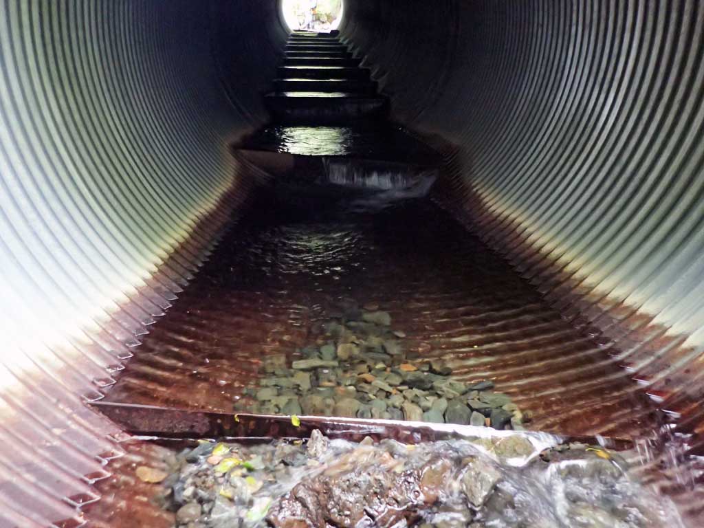
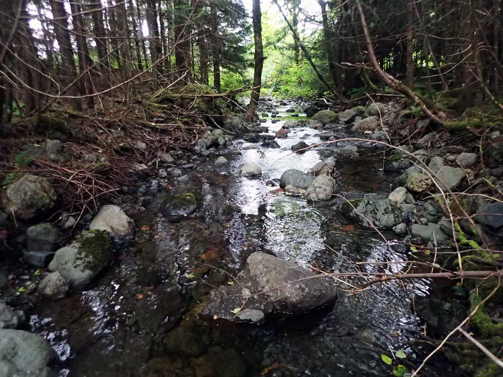
Comments: Steep cascades upstream, first resting at inlet. Downstream has nice low gradient riffle and glides. 4ft high large woody debris step about 80ft downstream.
Culvert Measurements
| ID: 1 | Structure Type: Circular pipe (Corrugated steel) | Fish Passage Rating: | |||||||||||||||||||||||||||||||||||||||||
|
|
|
|||||||||||||||||||||||||||||||||||||||||
Comments: Through pipe gradient given, measured on pipe. Top of culvert length 74'. Some scattered substrate at inverts. |
|||||||||||||||||||||||||||||||||||||||||||
Stream Measurements
|
|
| Stream Width Type | Distance From Crossing (ft) |
Stream Width (ft) |
|---|---|---|
| Upstream ordinary high water | 30.0 | 4.50 |
| Upstream ordinary high water | 60.0 | 4.00 |
| Upstream ordinary high water | 90.0 | 3.50 |
Elevations
| Locator ID | Culvert Number |
River Distance (ft)1 |
Distance From Crossing (ft)2 |
Relative Elevation (ft) |
|---|---|---|---|---|
| Road Elev | 104.86 | |||
| D/S Grade Ctrl (Thalweg) | 0.00 | 83.42 | ||
| D/S Water Surface Elev | 0.00 | 83.85 | ||
| D/S Water Surface Elev | 17.00 | 84.01 | ||
| D/S Grade Ctrl (Thalweg) (trap pool) | 17.00 | 82.85 | ||
| D/S Tailcrest or 1st Thalweg (boulders) | 39.00 | 85.81 | ||
| D/S Water Surface Elev | 39.00 | 86.04 | ||
| D/S Water Surface Elev | 48.00 | 86.03 | ||
| Outlet Invert (on pipe) | 48.00 | 85.18 | ||
| Outlet Culvert Top | 53.00 | 93.15 | ||
| Inlet Culvert Top | 127.00 | 99.87 | ||
| U/S Water Surface Elev | 135.00 | 93.28 | ||
| Inlet Culvert Invert (on pipe) | 135.00 | 92.99 | ||
| U/S Grade Ctrl (Thalweg) (First resting) | 144.00 | 94.09 | ||
| U/S Water Surface Elev | 144.00 | 94.98 | ||
| U/S Grade Ctrl (Thalweg) | 173.00 | 95.62 | ||
| U/S Water Surface Elev | 173.00 | 95.84 | ||
| U/S Grade Ctrl (Thalweg) | 190.00 | 98.97 | ||
| U/S Water Surface Elev | 190.00 | 99.19 |
Notes:
- River distance is measured continuously throughout the survey reach along the thalweg of the stream.
- Measured from each end of the crossing along the thalweg of the stream.
Fish Sampling Efforts
| Gear Type: Minnow Trap (A) | Trap Duration(h): 1.5 | |
| Comments: no fish | ||
| Gear Type: Minnow Trap (B) | Trap Duration(h): 1.5 | |
| Comments: no fish | ||
Fish Observations
No fish observations occurred during this survey.
Photos


Questions or comments about this report can be directed to dfg.dsf.webmaster@alaska.gov

