Fish Passage Site 10103593
Coordinates (dec. deg.): 55.73513°, -132.96695°
Legal Description: C071S081E03
Region: Southeast
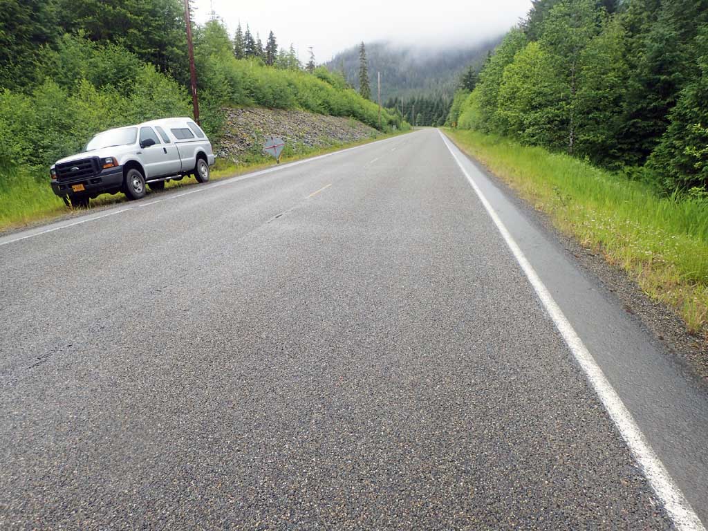
Road Name: North Prince of Wales Road
Datum: NAD83
Quad Name / ITM: Craig C-3
AWC Stream #:
Stream Name: Unnamed
Elevation:
Site Comments: Near Milepost 22
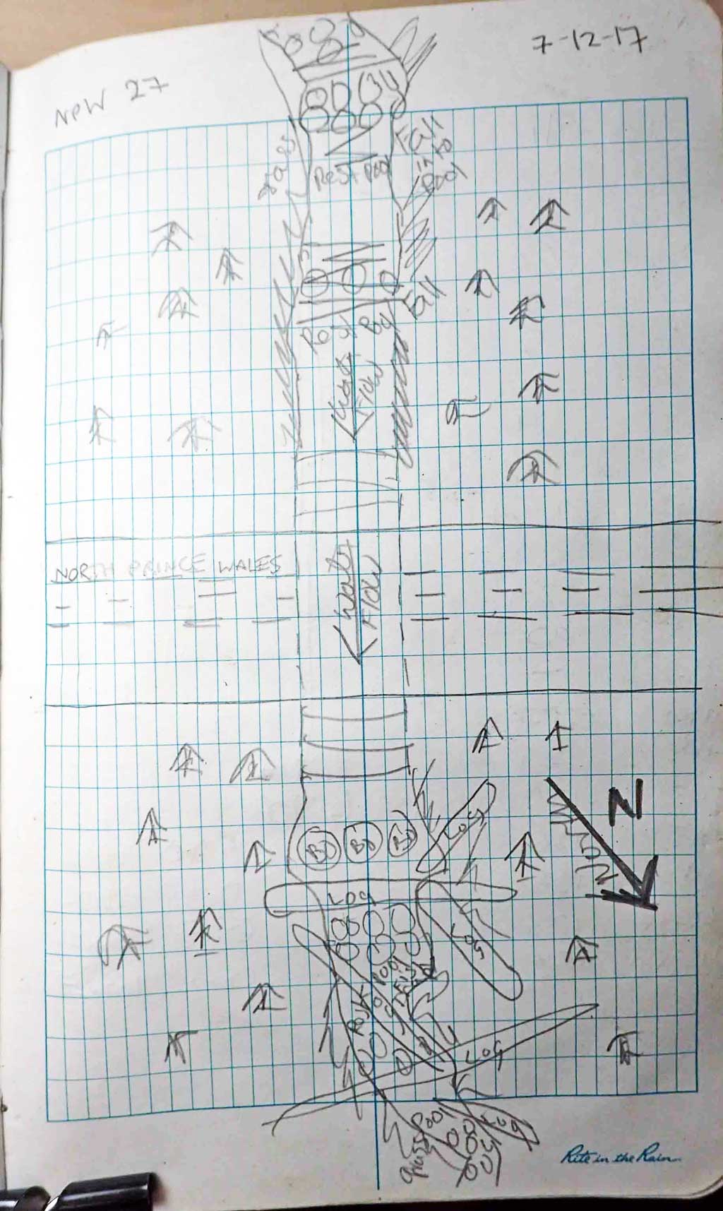
Survey SEA17-NPW27
Observers: Elizabeth Flory, Kelly Petty
Overall Fish Passage Rating:
Tidal: No
Backwatered: No
Step Pools: No
Construction Year:
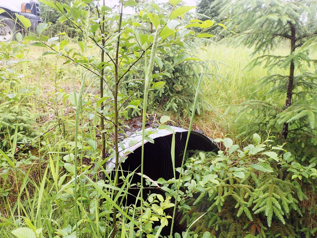
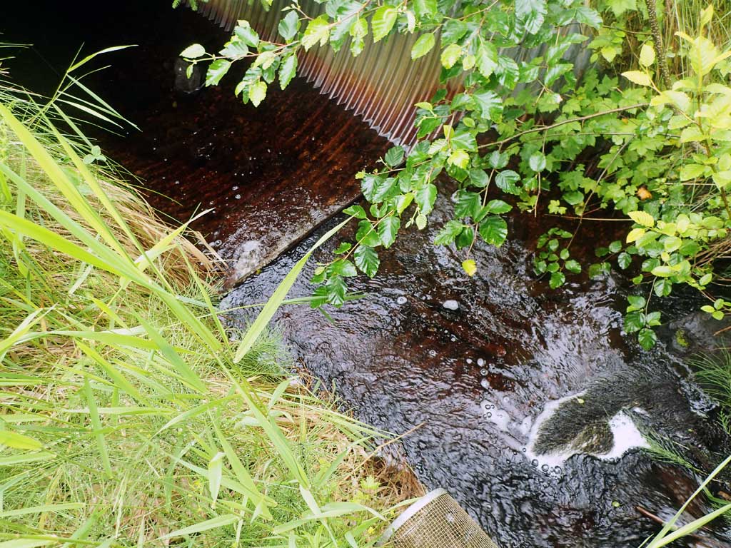
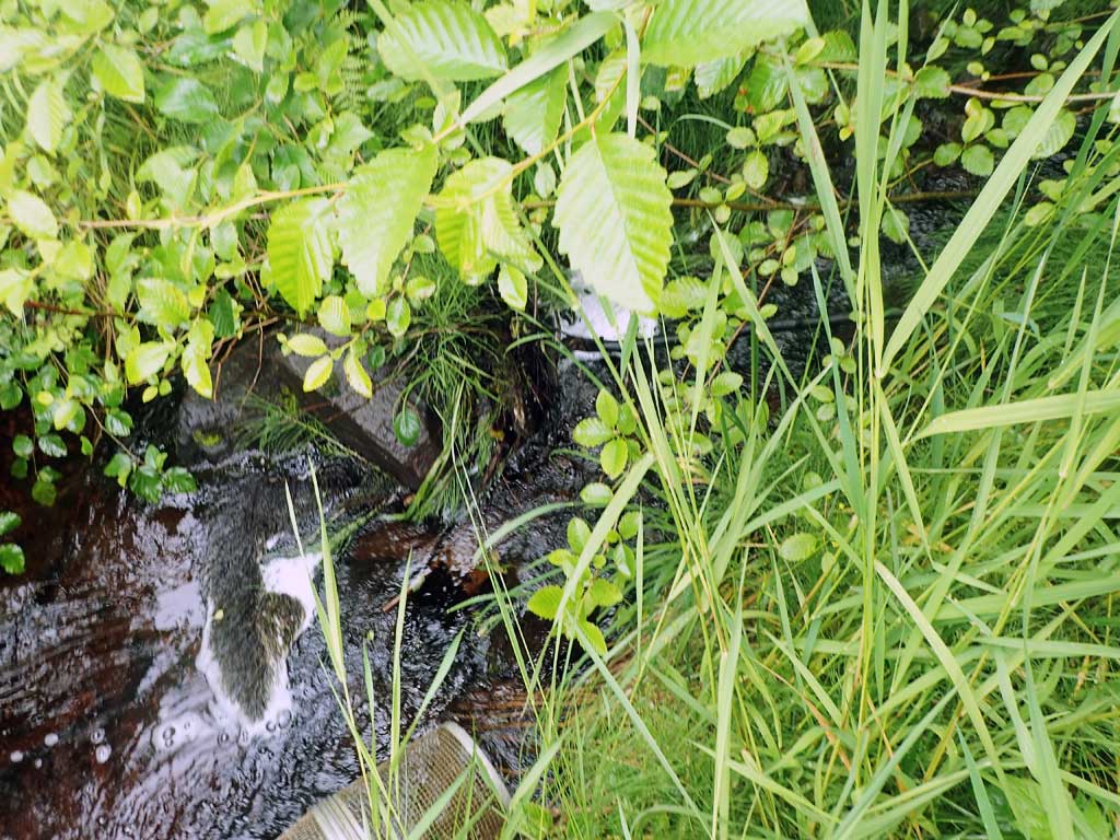
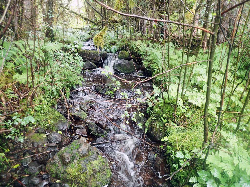
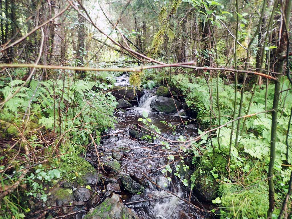
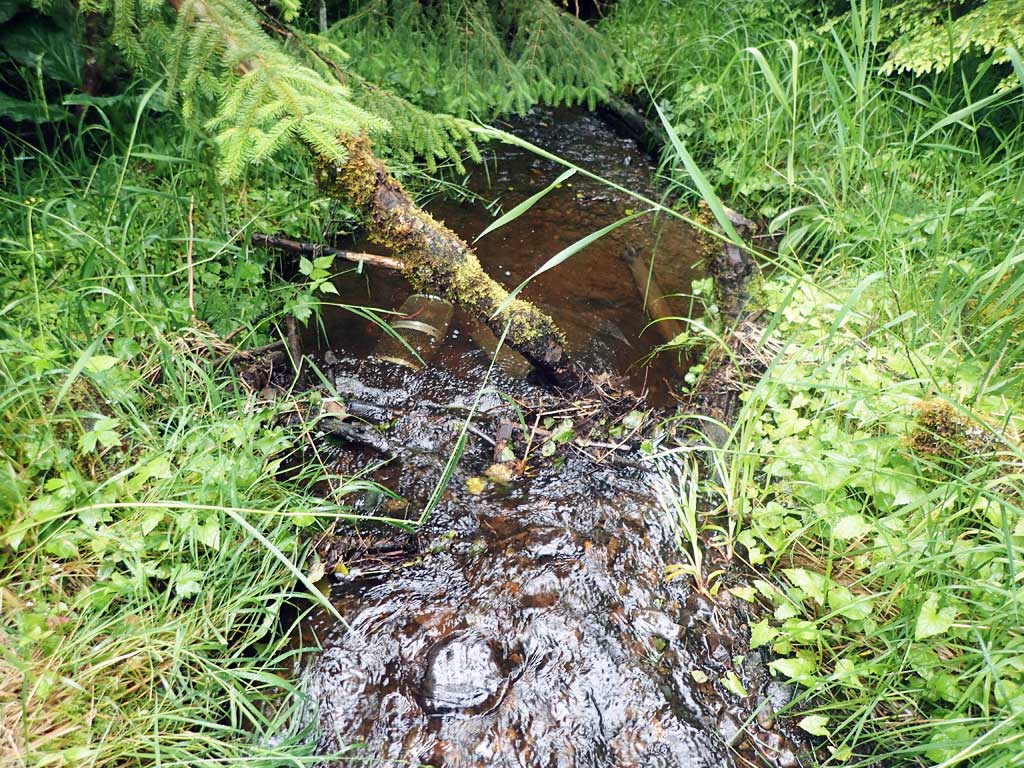
Comments: Upstream gravel riffles, not too steep, a few small pools, not much woody debris, some steps further up. Downstream low gradient riffle, not much woody debris. Some open canopy and meadow further down. Sign of beaver cutting trees downstream.
Culvert Measurements
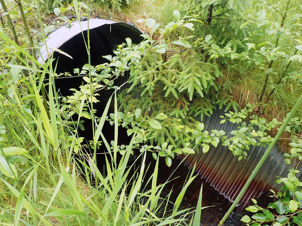
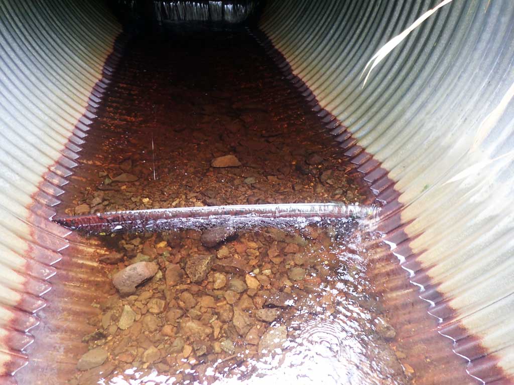
| ID: 1 | Structure Type: Circular pipe (Corrugated steel) | Fish Passage Rating: | |||||||||||||||||||||||||||||||||||||||||
|
|
|
|||||||||||||||||||||||||||||||||||||||||
Comments: Rusty pipe. Top of culvert length 80'. Baffles present. |
|||||||||||||||||||||||||||||||||||||||||||
Stream Measurements
|
|
| Stream Width Type | Distance From Crossing (ft) |
Stream Width (ft) |
|---|---|---|
| Downstream ordinary high water | 30.0 | 3.80 |
| Downstream ordinary high water | 40.0 | 4.25 |
| Downstream ordinary high water | 60.0 | 5.00 |
| Upstream ordinary high water | 30.0 | 4.25 |
| Upstream ordinary high water | 50.0 | 3.60 |
| Upstream ordinary high water | 70.0 | 3.50 |
Elevations
| Locator ID | Culvert Number |
River Distance (ft)1 |
Distance From Crossing (ft)2 |
Relative Elevation (ft) |
|---|---|---|---|---|
| Road Elev | 104.68 | |||
| D/S Grade Ctrl (Thalweg) | 0.00 | 87.39 | ||
| D/S Water Surface Elev | 0.00 | 87.50 | ||
| Max Pool Depth | 5.00 | 86.33 | ||
| D/S Water Surface Elev | 5.00 | 86.84 | ||
| D/S Tailcrest or 1st Thalweg | 9.00 | 88.07 | ||
| D/S Water Surface Elev | 9.00 | 88.23 | ||
| D/S Water Surface Elev | 16.00 | 88.32 | ||
| Max Pool Depth | 16.00 | 87.72 | ||
| Outlet Invert (estimated end of mitre) | 24.00 | 88.55 | ||
| D/S Water Surface Elev | 24.00 | 88.80 | ||
| Outlet Culvert Top | 37.00 | 95.27 | ||
| Inlet Culvert Top | 117.00 | 100.00 | ||
| Inlet Culvert Invert (estimated end of mitre) | 129.00 | 93.88 | ||
| U/S Water Surface Elev | 129.00 | 94.13 | ||
| U/S Grade Ctrl (Thalweg) | 136.00 | 94.98 | ||
| U/S Water Surface Elev | 136.00 | 95.24 | ||
| U/S Grade Ctrl (Thalweg) | 183.00 | 100.04 | ||
| U/S Water Surface Elev | 183.00 | 100.28 |
Notes:
- River distance is measured continuously throughout the survey reach along the thalweg of the stream.
- Measured from each end of the crossing along the thalweg of the stream.
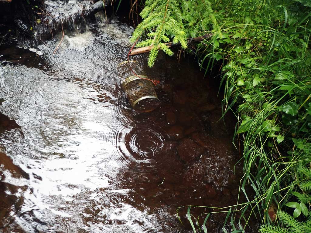
Fish Sampling Efforts
| Gear Type: Minnow Trap (A) | Trap Duration(h): 1.3 | |
| Comments: 20ft upstream, no fish | ||
| Gear Type: Minnow Trap (B) | Trap Duration(h): 1.2 | |
| Comments: 20ft downstream, no fish | ||
Fish Observations
No fish observations occurred during this survey.
Photos


Questions or comments about this report can be directed to dfg.dsf.webmaster@alaska.gov