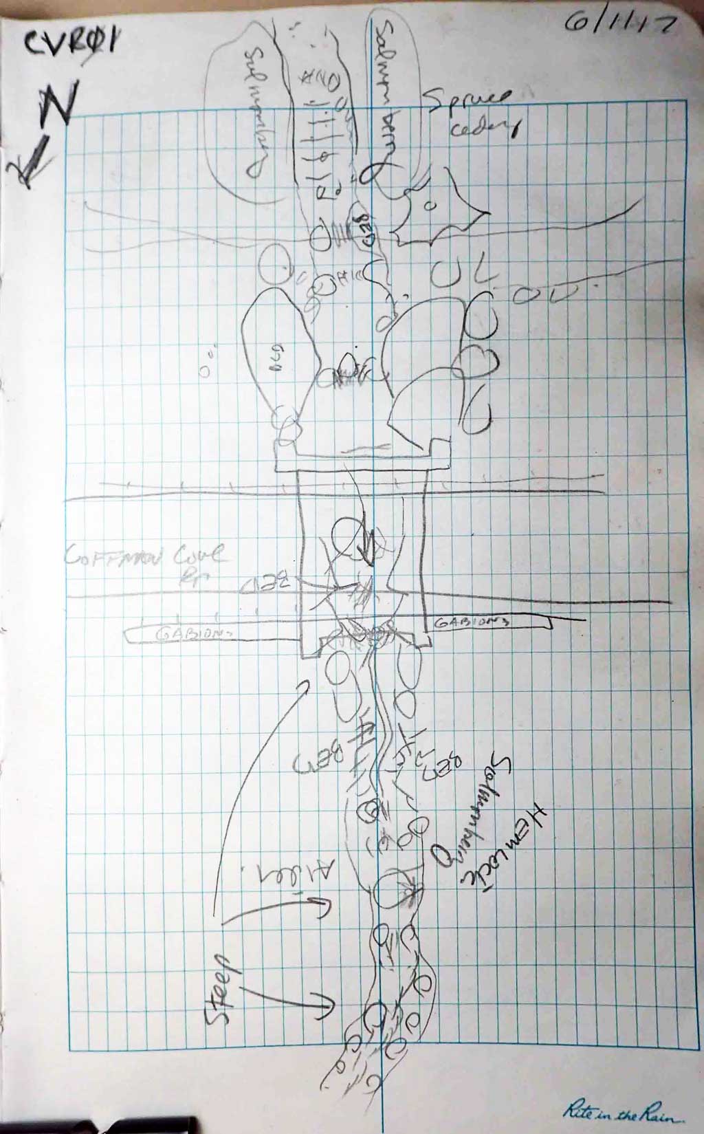
Fish Passage Site 10103550
Coordinates (dec. deg.): 55.91636°, -132.99113°
Legal Description: C069S081E04
Region: Southeast
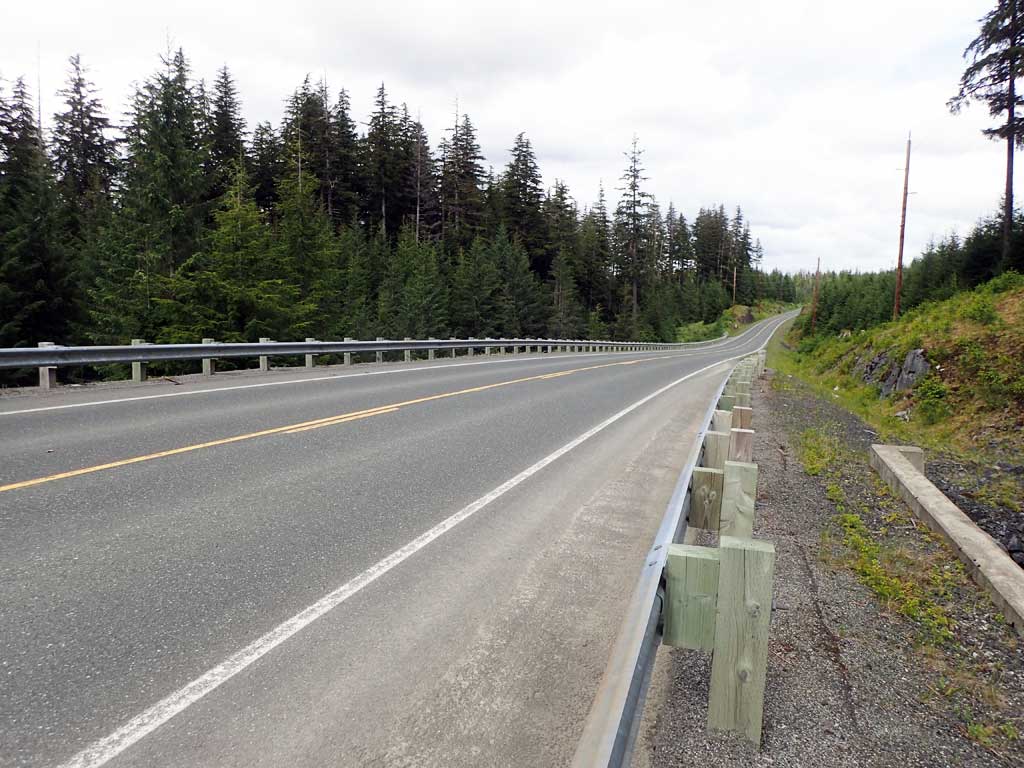
Road Name: Coffman Cove Road
Datum: NAD83
Quad Name / ITM: Craig D-3
AWC Stream #:
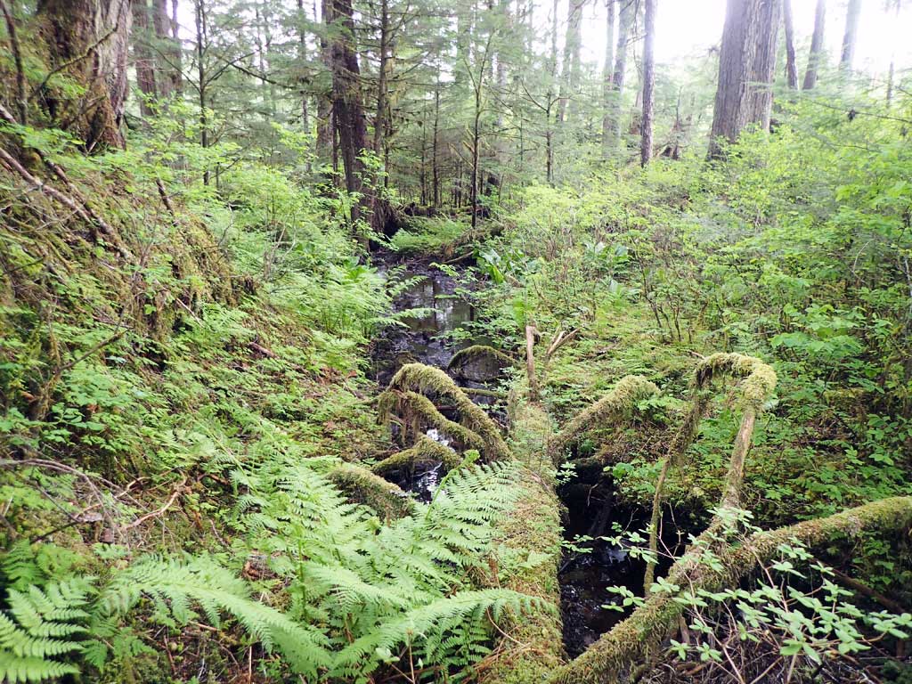
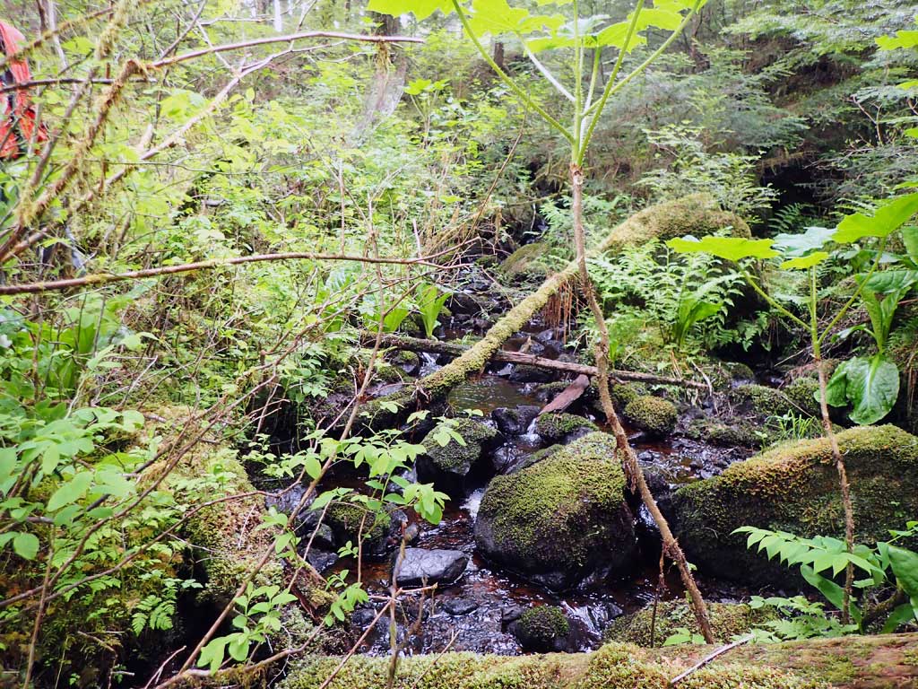
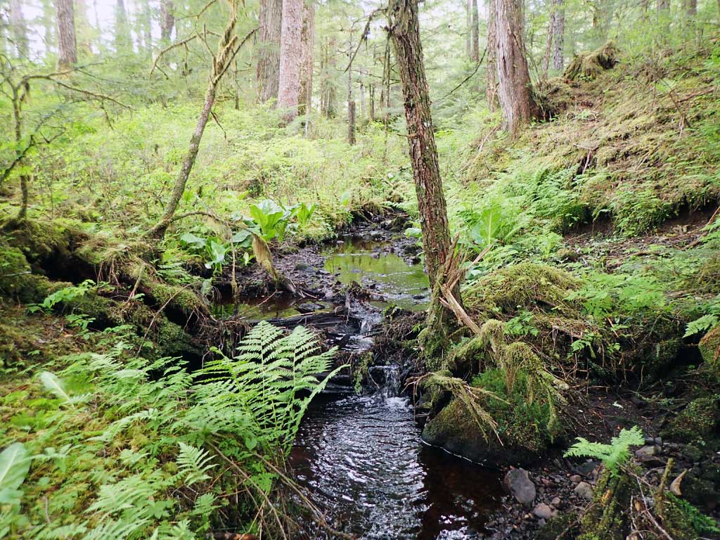
Stream Name: Unnamed
Elevation:
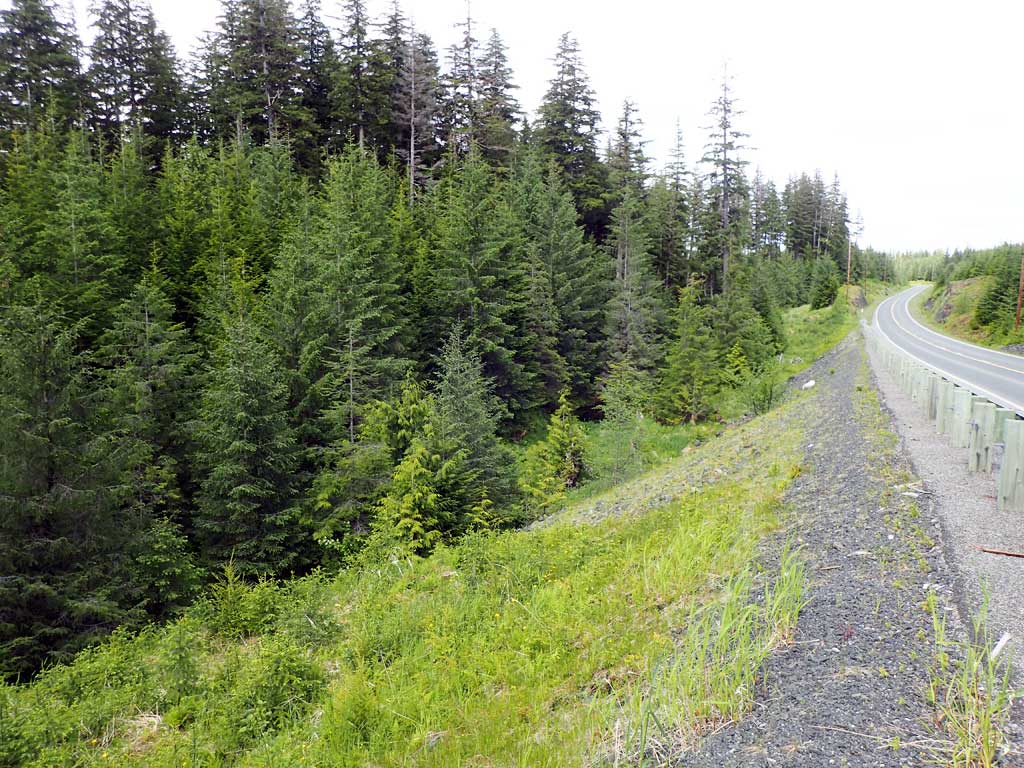
Site Comments: Site between milepost 14 and 15.
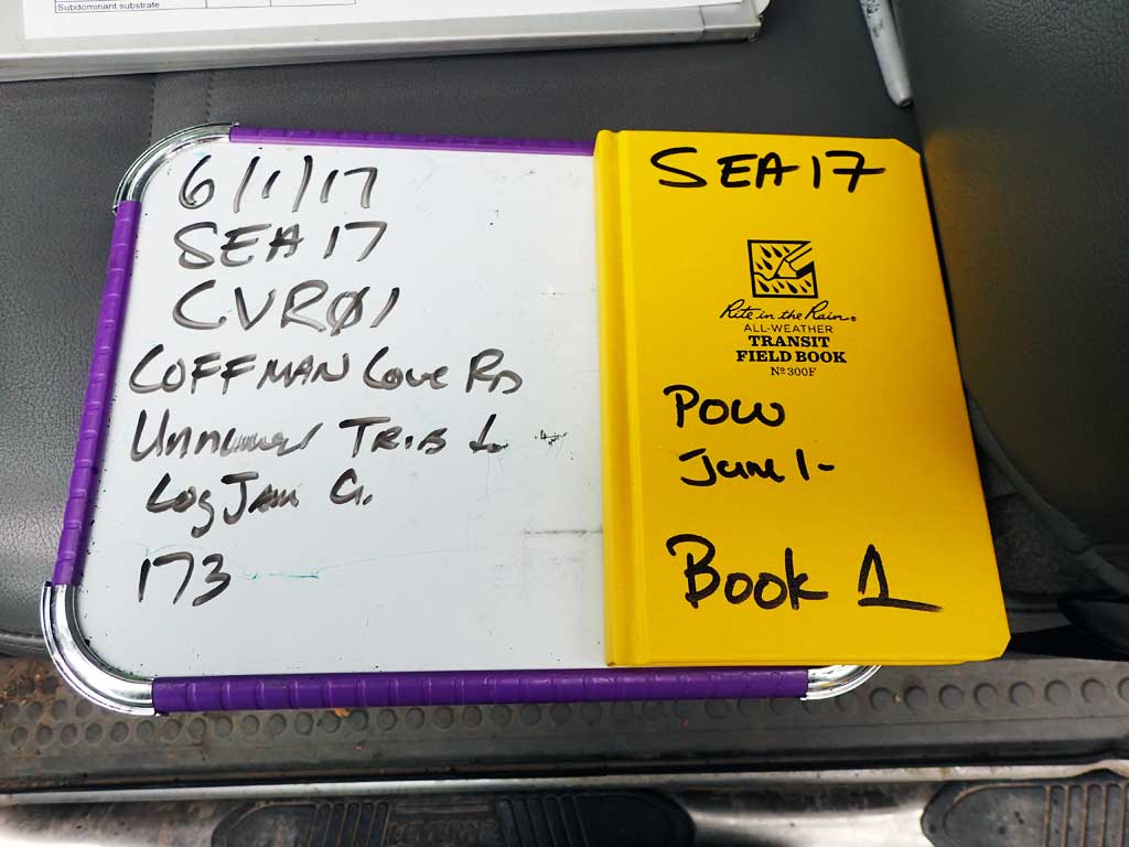
Survey SEA17-CVR01
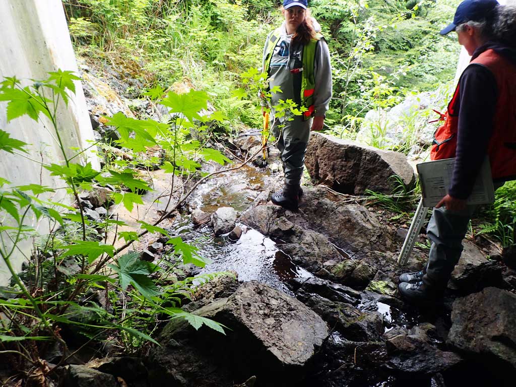
Observers: Mark Eisenman, Elizabeth Flory, Kelly Petty
Overall Fish Passage Rating:
Tidal: No
Backwatered: No
Step Pools: No
Construction Year:
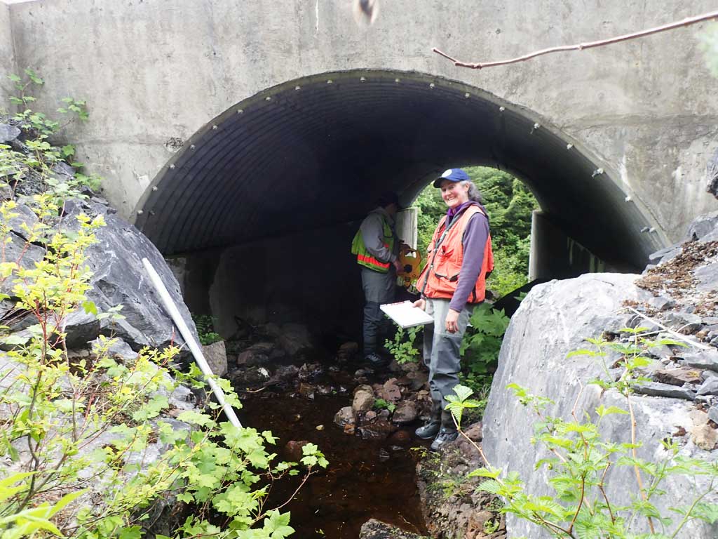
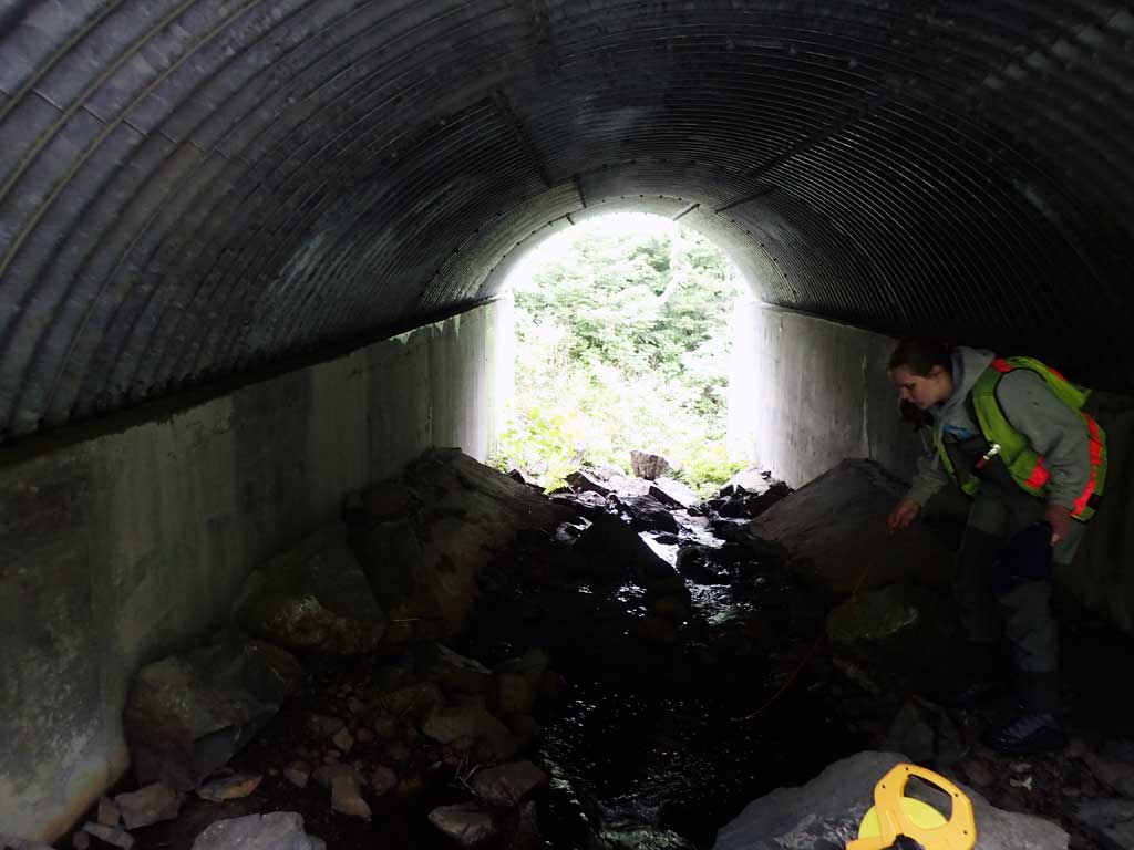
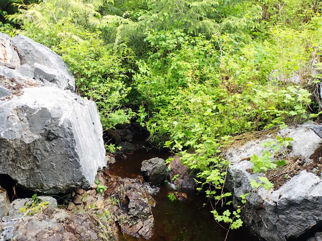
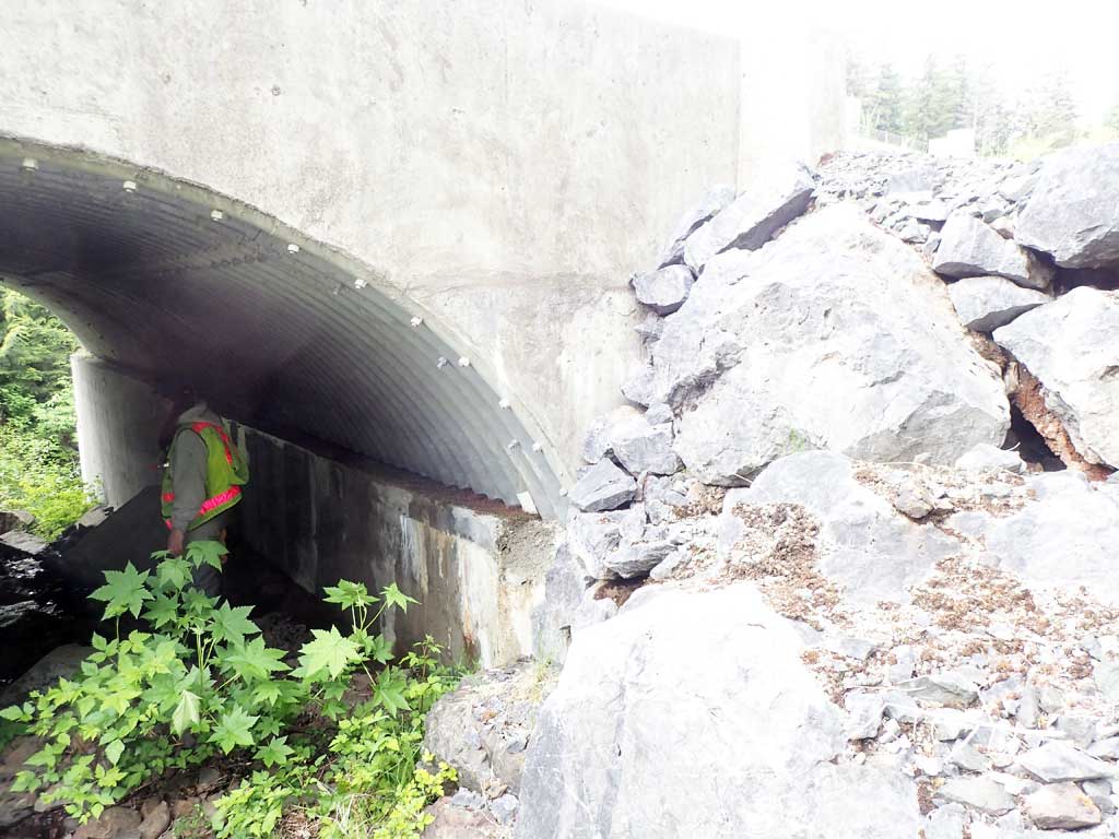
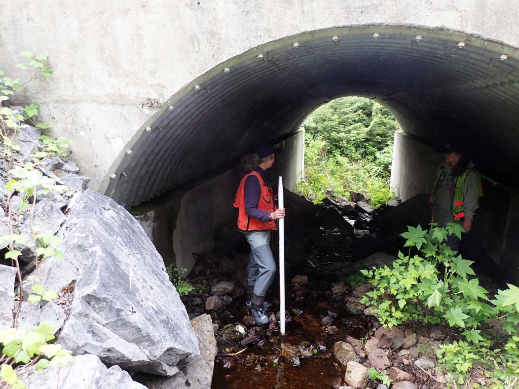
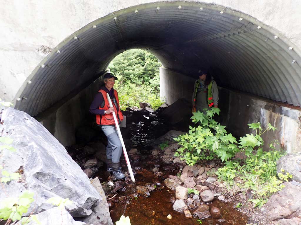
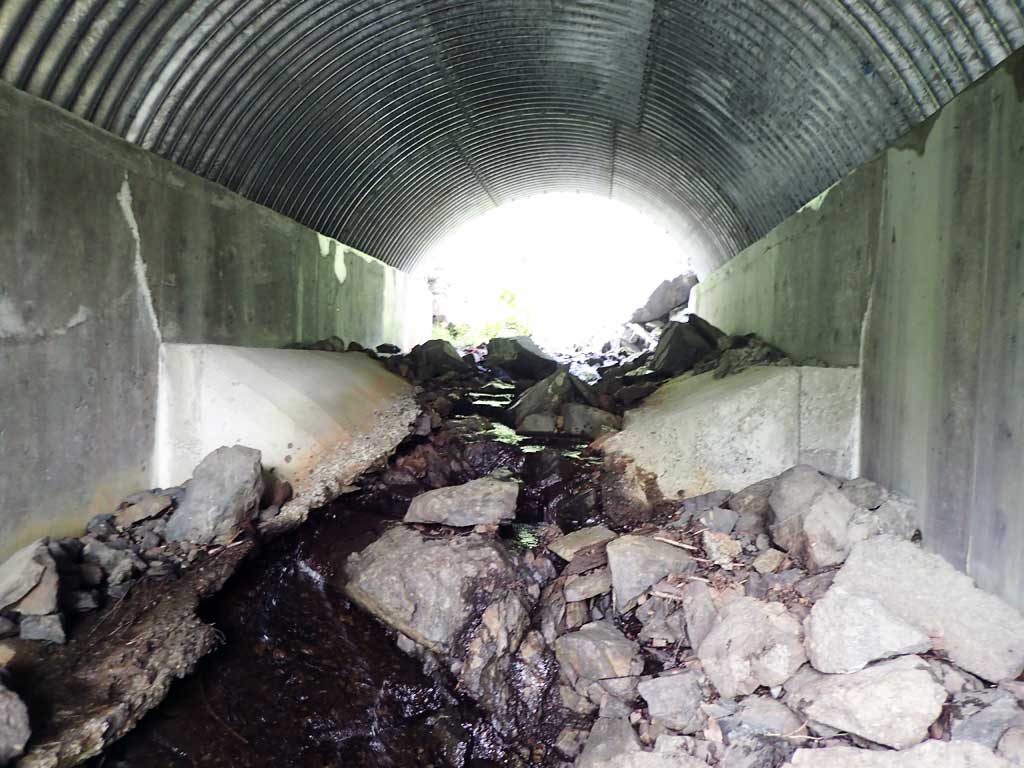
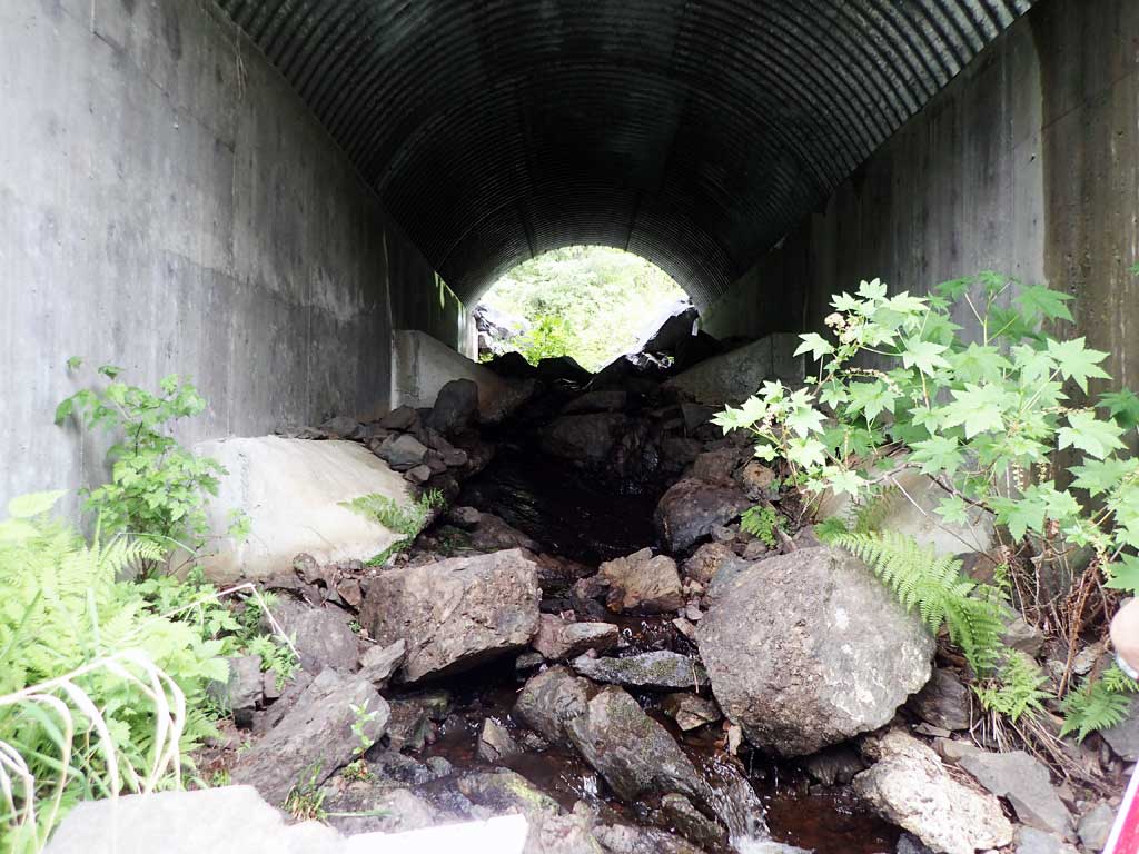
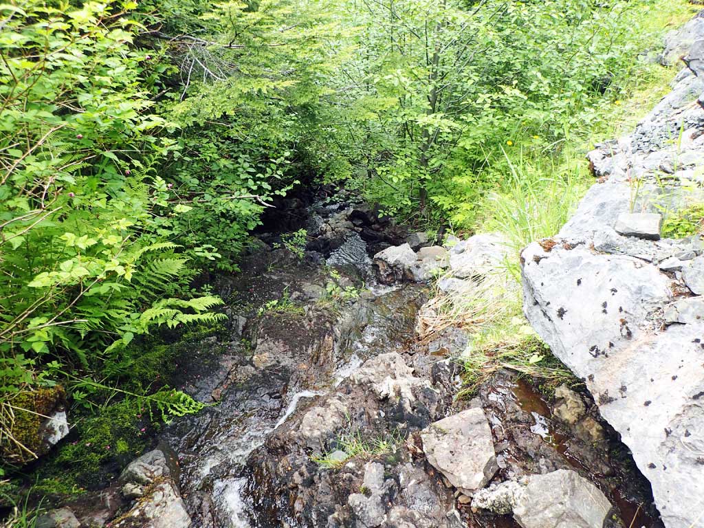
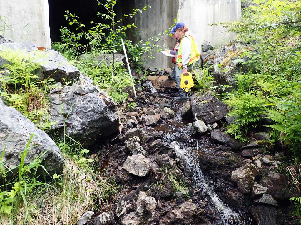
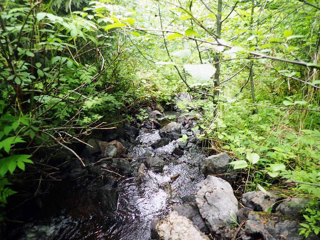
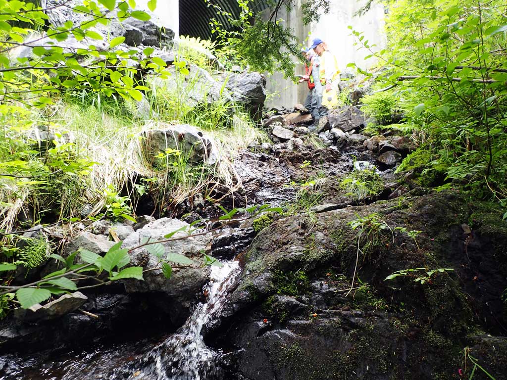
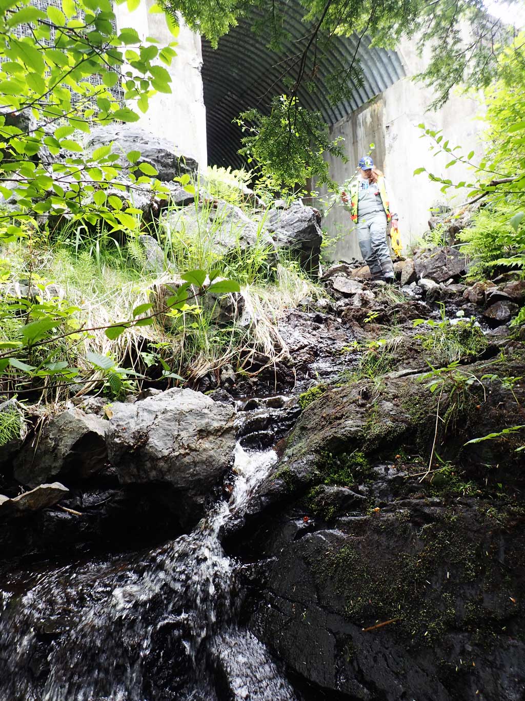
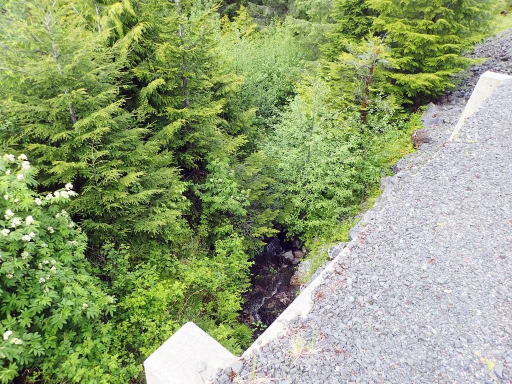
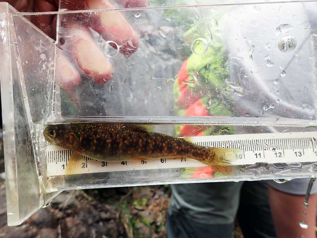
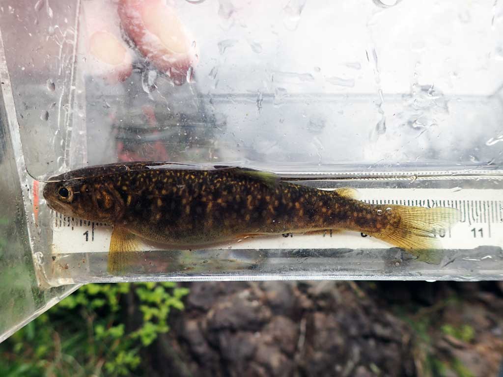
Comments: Open bottom arch, more of a bridge. Upstream and downstream gradient levels out after 100ft. Dolly Varden char captured upstream and downstream of crossing.
Culvert Measurements
| ID: 1 | Structure Type: Open-bottom arch (Structural steel plate) | Fish Passage Rating: | |||||||||||||||||||||||||||||||||||||||||
|
|
|
|||||||||||||||||||||||||||||||||||||||||
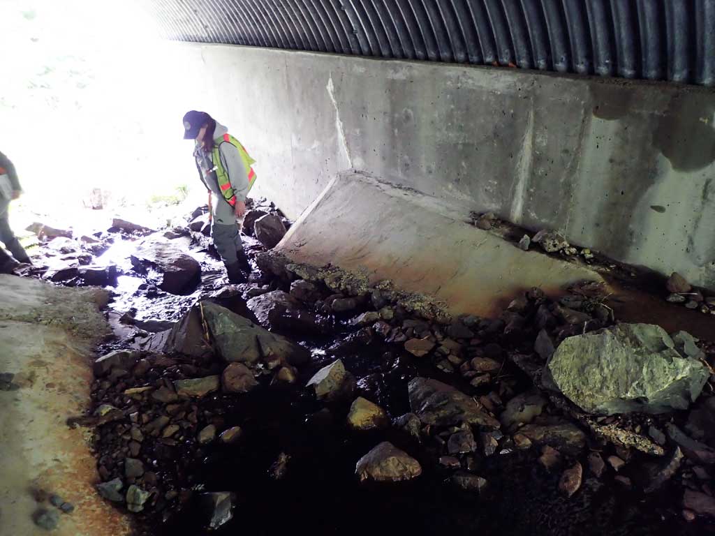
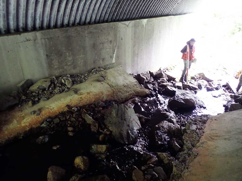
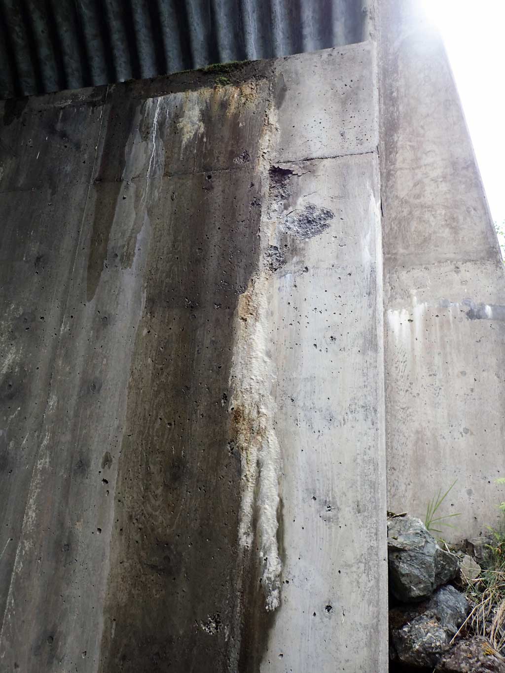
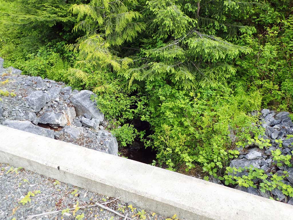
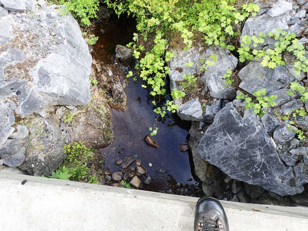
Comments: Outlet at bedrock control grade, bedrock chute. Open bottom crossing, culvert is basically a bridge on concrete abuttments. Some deterioration of concrete noticed through out crossing. Concrete chutes inside crossing. Effective gradient through crossing is over 18% gradient . |
|||||||||||||||||||||||||||||||||||||||||||
Stream Measurements
|
|
| Stream Width Type | Distance From Crossing (ft) |
Stream Width (ft) |
|---|---|---|
| Upstream ordinary high water | 40.0 | 4.10 |
| Upstream ordinary high water | 200.0 | 5.20 |
| Upstream ordinary high water | 300.0 | 4.80 |
Elevations
| Locator ID | Culvert Number |
River Distance (ft)1 |
Distance From Crossing (ft)2 |
Relative Elevation (ft) |
|---|---|---|---|---|
| Road Elev | 116.46 | |||
| D/S Grade Ctrl (Thalweg) (End of downstream steep gradient) | 0.00 | 80.46 | ||
| D/S Water Surface Elev | 0.00 | 80.51 | ||
| D/S Water Surface Elev | 37.00 | 88.60 | ||
| D/S Grade Ctrl (Thalweg) (pool at outlet to bedrock chute) | 37.00 | 88.71 | ||
| Outlet Invert | 68.00 | 96.49 | ||
| D/S Water Surface Elev | 68.00 | 96.61 | ||
| Outlet Culvert Top (Invert embedded, elevation only relative to ITOP used for gradient) | 68.00 | 107.19 | ||
| Inlet Culvert Top (Invert embedded, elevation taken inverted only relative to OTOP) | 116.20 | 107.24 | ||
| Inlet Culvert Invert (1st resting) | 116.20 | 105.18 | ||
| U/S Water Surface Elev | 116.20 | 105.34 | ||
| U/S Grade Ctrl (Thalweg) | 133.00 | 106.73 | ||
| U/S Water Surface Elev | 133.00 | 106.96 |
Notes:
- River distance is measured continuously throughout the survey reach along the thalweg of the stream.
- Measured from each end of the crossing along the thalweg of the stream.
Fish Sampling Efforts
| Gear Type: Minnow Trap (A) | Trap Duration(h): 2.3 | |
| Comments: 50ft upstream, dolly captured | ||
| Gear Type: Minnow Trap (B) | Trap Duration(h): 2.3 | |
| Comments: set inside pipe, dolly captured | ||
Fish Observations
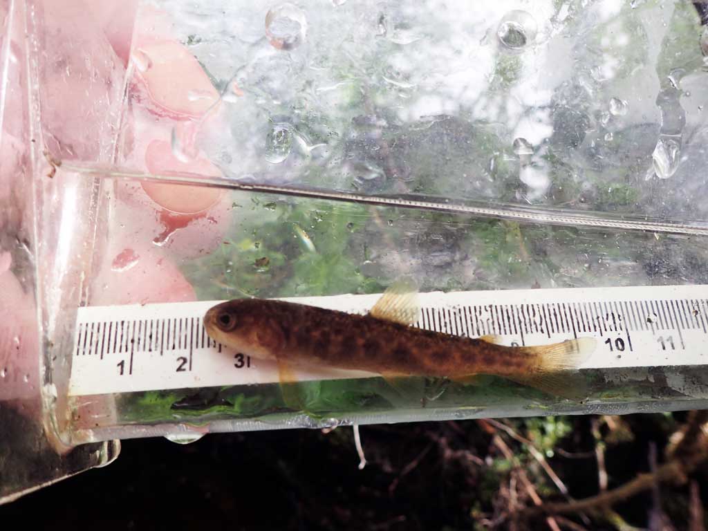
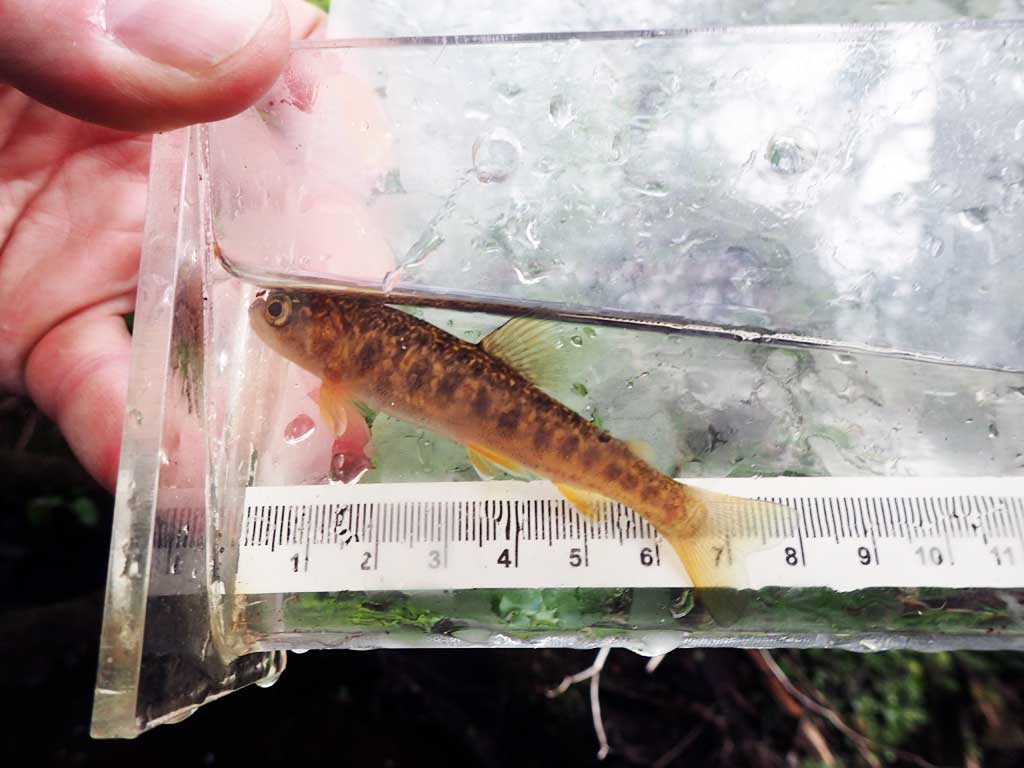
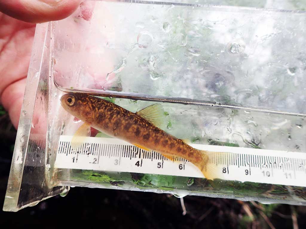
| Species: juvenile Dolly Varden | Life History: | ||
| Total Fish Observed: 3 | Fish Measured: 3 | Fork Lengths (mm) Min: 66 Max: 93 Mean: 79 | |
| Collected/Observed by Gear Type: Downstream Minnow Trap (1) Upstream Minnow Trap (2) | |||
Photos
Questions or comments about this report can be directed to dfg.dsf.webmaster@alaska.gov