Fish Passage Site 10103549
Coordinates (dec. deg.): 55.56147°, -133.07762°
Legal Description: C073S081E10
Region: Southeast
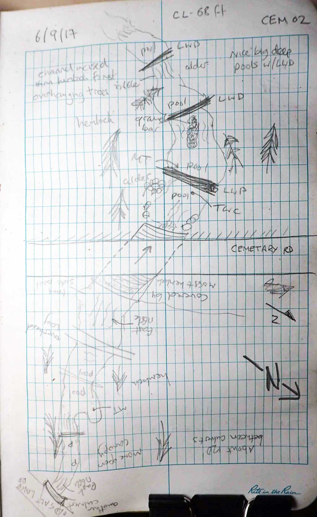
Road Name: Cemetery Road
Datum: NAD83
Quad Name / ITM: Craig C-4
AWC Stream #: 103-60-10450
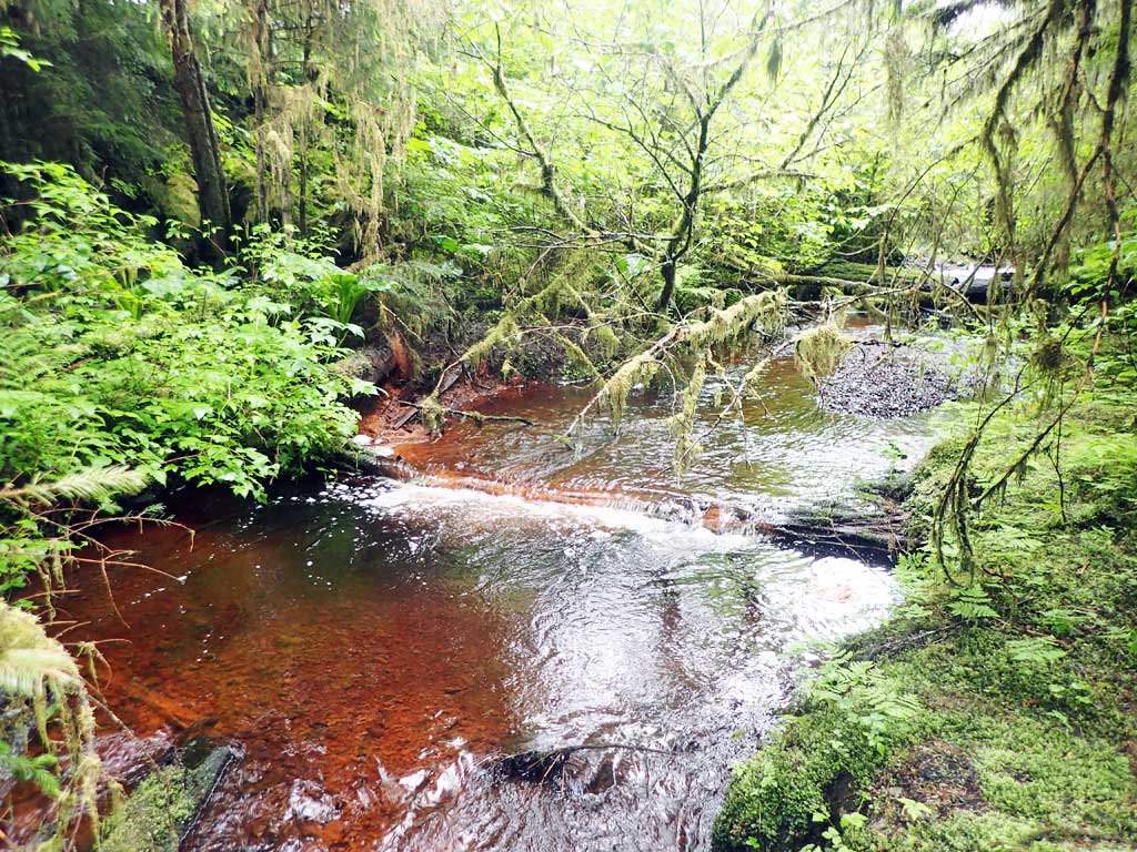
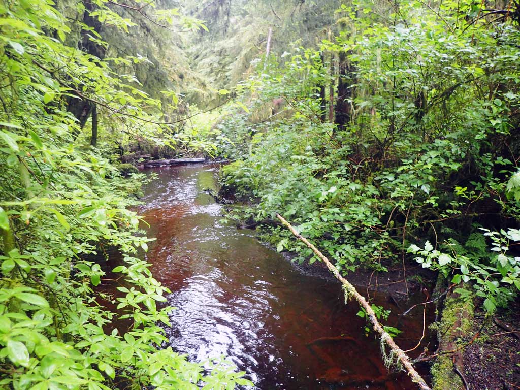
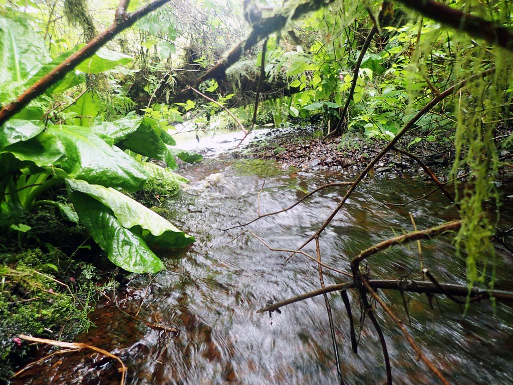
Stream Name: Trevor Creek
Elevation:
Site Comments: None
Survey SEA17-CEM02
Observers: Mark Eisenman, Elizabeth Flory
Overall Fish Passage Rating:
Tidal: No
Backwatered: No
Step Pools: No
Construction Year:
Site Observations:
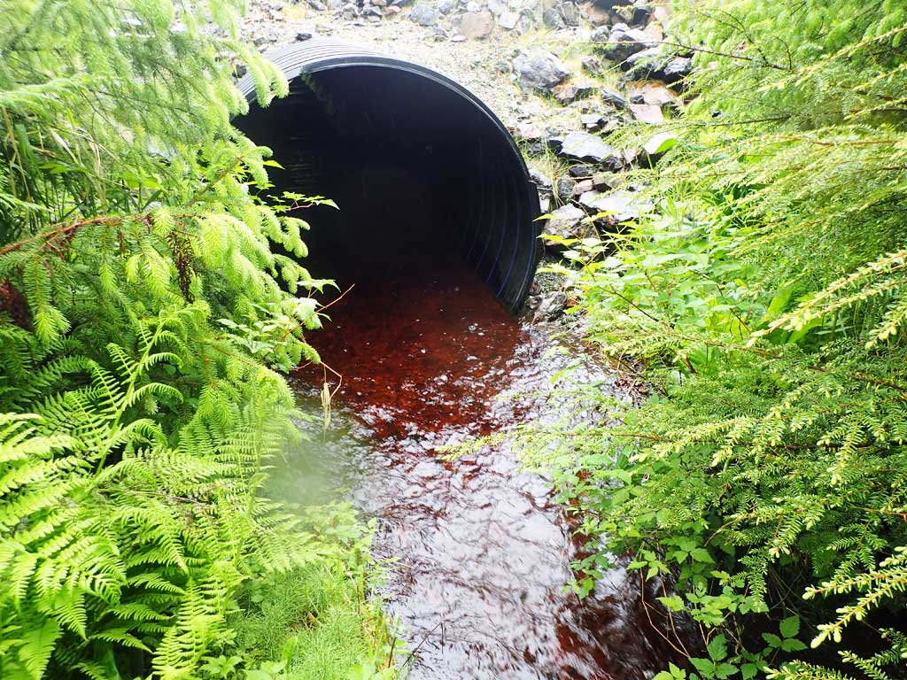
- Inlet perch
- Outfall height red
- Constriction ratio red
- Culvert gradient gray
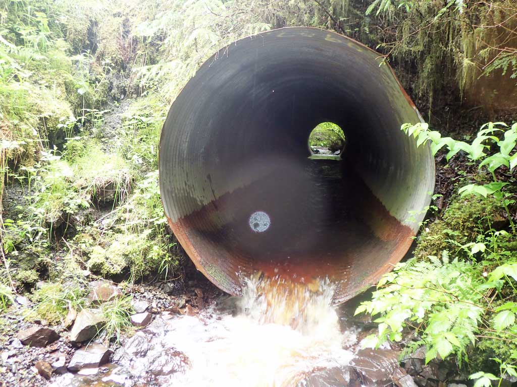
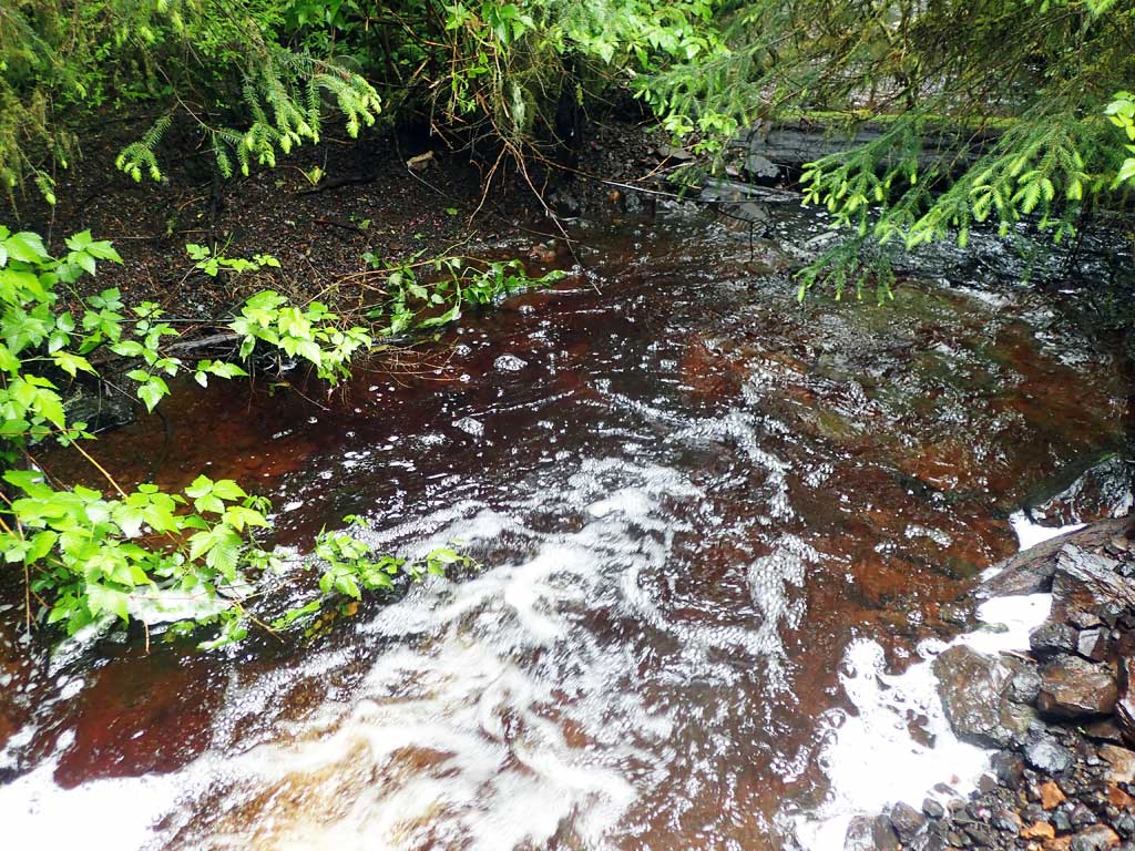
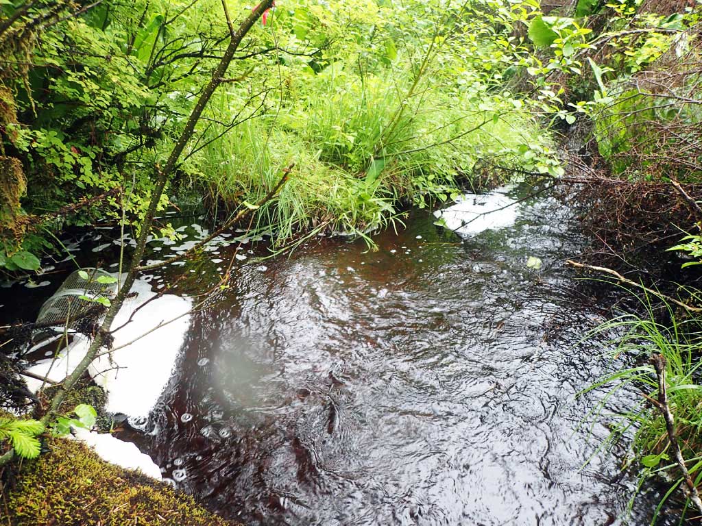
Comments: 200 feet upstream to highway culvert. Dense vegetation around culvert. TWC log controlled. Confluence with CEM01 Creek about 700 ft downstream.
Culvert Measurements
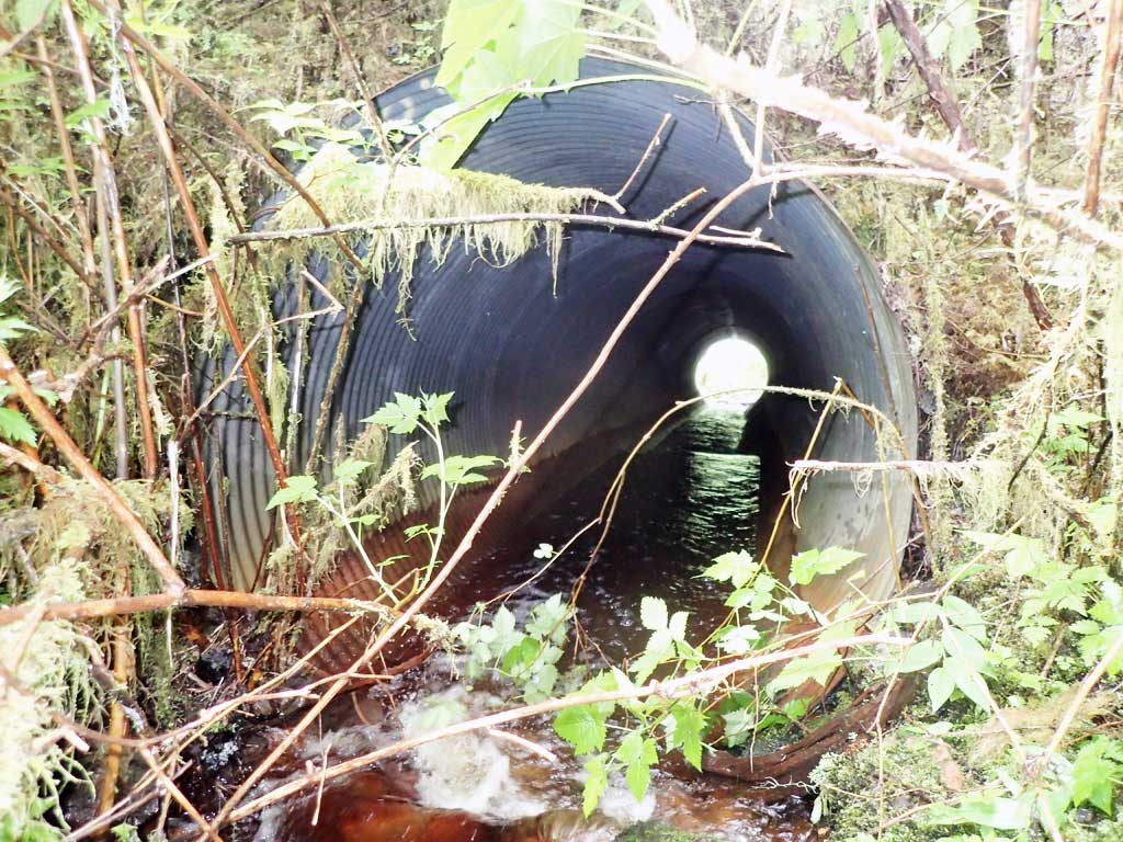
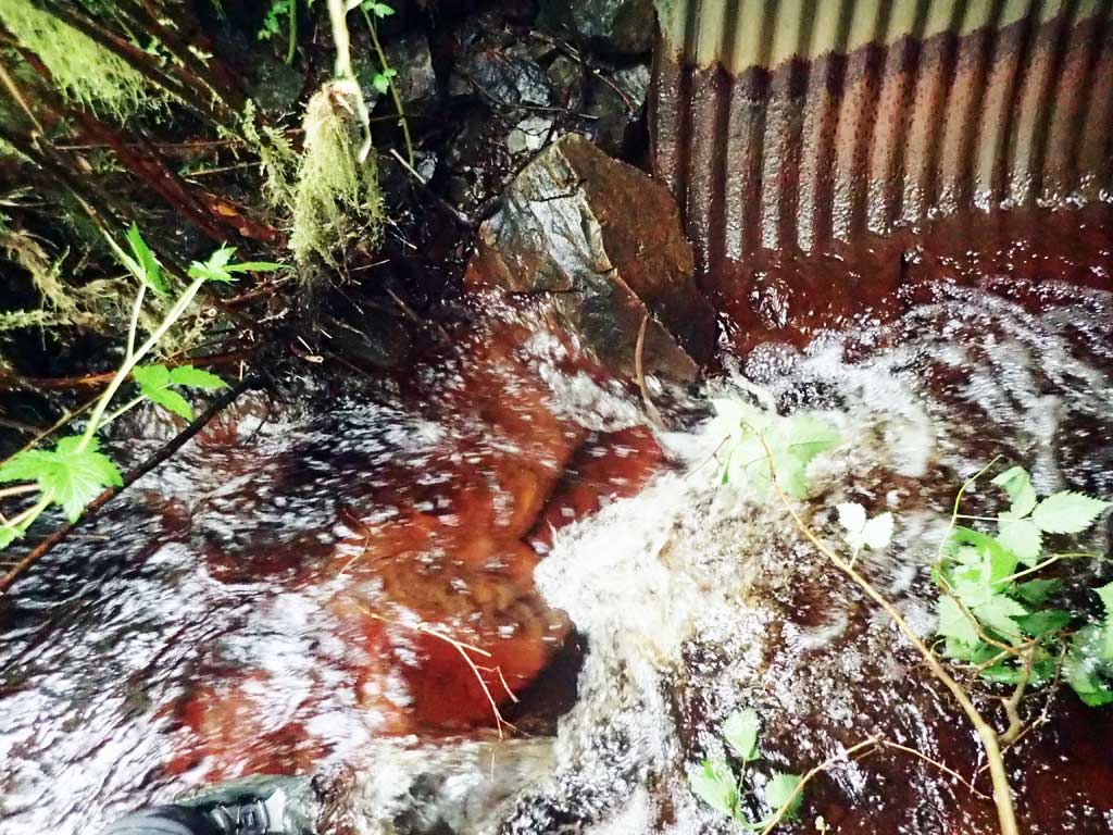
| ID: 1 | Structure Type: Circular pipe (Corrugated steel) | Fish Passage Rating: | |||||||||||||||||||||||||||||||||||||||||
|
|
|
|||||||||||||||||||||||||||||||||||||||||
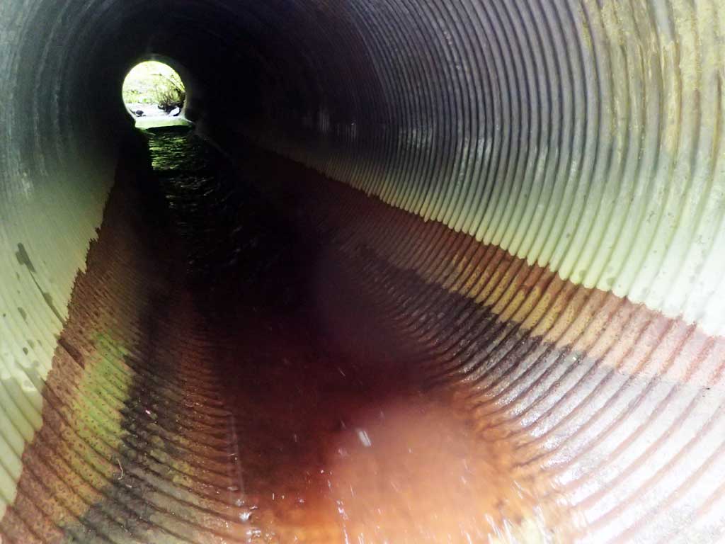
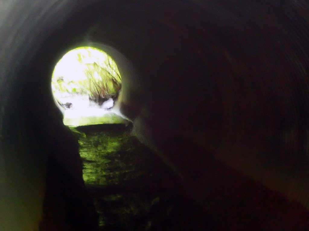
Comments: Portions of culvert outlet have rusted away.Culvert bottom has ruted out in places. Inlet perch. Large rock in centre of culvert creating gradient break (not stable) |
|||||||||||||||||||||||||||||||||||||||||||
Culvert Observations:
|
|||||||||||||||||||||||||||||||||||||||||||
Stream Measurements
|
|
| Stream Width Type | Distance From Crossing (ft) |
Stream Width (ft) |
|---|---|---|
| Downstream ordinary high water | 200.0 | 13.00 |
| Downstream ordinary high water | 500.0 | 17.50 |
| Downstream ordinary high water | 700.0 | 16.00 |
Elevations
| Locator ID | Culvert Number |
River Distance (ft)1 |
Distance From Crossing (ft)2 |
Relative Elevation (ft) |
|---|---|---|---|---|
| Road Elev | 97.67 | |||
| D/S Grade Ctrl (Thalweg) (Plunge pool) | 0.00 | 80.31 | ||
| D/S Water Surface Elev | 0.00 | 80.66 | ||
| D/S Thalweg (Plunge pool max depth) | 6.50 | 79.00 | ||
| D/S Water Surface Elev | 6.50 | 80.65 | ||
| D/S Grade Ctrl (Thalweg) (Log control) | 10.50 | 81.40 | ||
| D/S Water Surface Elev | 10.50 | 81.63 | ||
| D/S Water Surface Elev | 16.50 | 81.69 | ||
| D/S Tailcrest or 1st Thalweg | 16.50 | 81.16 | ||
| Max Pool Depth | 21.50 | 80.61 | ||
| D/S Water Surface Elev | 21.50 | 81.73 | ||
| Outlet Invert (On pipe) | 26.00 | 82.41 | ||
| D/S Water Surface Elev | 26.00 | 82.76 | ||
| Outlet Culvert Top | 29.00 | 88.48 | ||
| Inlet Culvert Top | 97.00 | 89.51 | ||
| Inlet Culvert Invert | 97.00 | 83.38 | ||
| U/S Water Surface Elev | 97.00 | 84.04 | ||
| U/S Water Surface Elev | 101.00 | 84.49 | ||
| U/S Grade Ctrl (Thalweg) (Inlet perch) | 101.00 | 85.11 |
Notes:
- River distance is measured continuously throughout the survey reach along the thalweg of the stream.
- Measured from each end of the crossing along the thalweg of the stream.
Fish Sampling Efforts
| Gear Type: Minnow Trap (A) | Trap Duration(h): 2.5 | |
| Comments: 50ft upstream | ||
| Gear Type: Minnow Trap (B) | Trap Duration(h): 2.5 | |
| Comments: 20 ft downstream | ||
Fish Observations
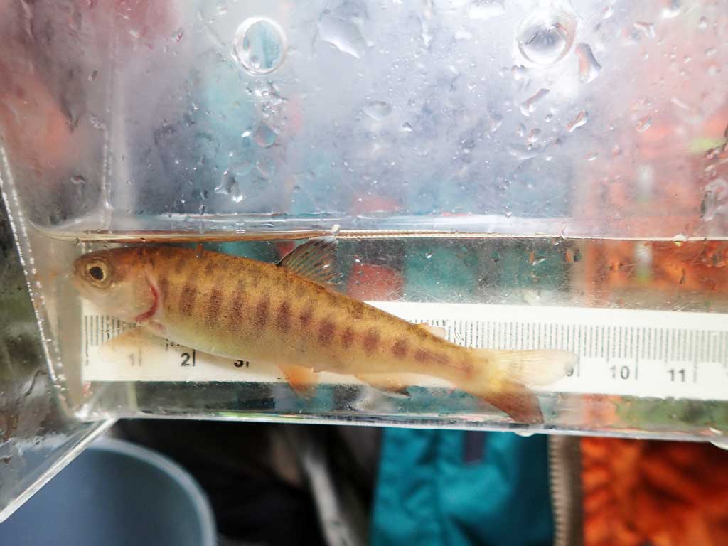
| Species: juvenile coho salmon | Life History: Anadromous | ||
| Total Fish Observed: 2 | Fish Measured: 2 | Fork Lengths (mm) Min: 69 Max: 81 Mean: 75 | |
| Collected/Observed by Gear Type: Downstream Minnow Trap (2) | |||
Photos


Questions or comments about this report can be directed to dfg.dsf.webmaster@alaska.gov